Property Record
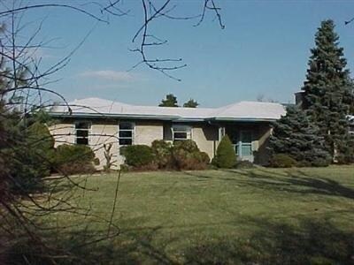
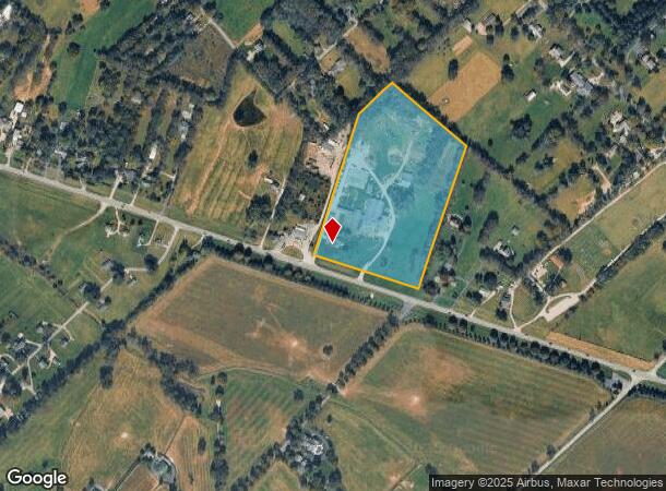
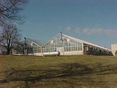
3913 Winchester Rd, Lexington, KY 40509
NEARBY LISTINGS FOR SALE OR LEASE
-
-
View all Lexington listings for lease on LoopNet.com
Property Detail
3913 Winchester Rd
Lexington-Fayette, KY
Goodwin Acres
20540900
E-578&586 GOODWIN ACRES LOT 21-23; BOOK: 3214 PAGE: 282
Farms
Fayette
X
Kentucky
21049C0025D
21-23
2025
14.23 AC
2025
East Lexington/Fayette
003918
Lexington/Fayette
2,188 SF
DEMOGRAPHICS near 3913 Winchester Rd
1 Mile
3 Mile
5 Mile
2024 Total Population
653
13,135
57,127
2029 Population
656
13,111
57,101
Pop Growth 2024-2029
+ 0.46%
(0.18%)
(0.05%)
Average Age
45
39
39
2024 Total Households
250
5,094
23,972
HH Growth 2024-2029
+ 0.40%
(0.14%)
(0.07%)
Median Household Inc
$124,404
$105,963
$72,407
Avg Household Size
2.50
2.50
2.30
2024 Avg HH Vehicles
2.00
2.00
2.00
Median Home Value
$530,000
$323,711
$283,131
Median Year Built
1991
2004
1997
Nearby Places
Map Layers
Map Styles
 Street
 Aerial
- Restaurants
- Banks
- Shops
- Fitness
- Groceries
PUBLIC TRANSPORTATION
AIRPORT
Blue Grass
DRIVE
WALK
Distance
Blue Grass
27 min
15.9 mi
Freight Ports
Port of Toledo
DRIVE
WALK
Distance
Port of Toledo
336 min
291.4 mi
SALE & LEASE HISTORY
LISTING DATE
SALE/LEASE

Sep 25, 2016
For Lease
Nearby Properties
Address
Land Use
TOTAL SIZE
Lot Size
Zoning
Address
Land Use
TOTAL SIZE
Lot Size
Zoning
7,640 SF
9.04 AC
EAR-3
Address
Land Use
TOTAL SIZE
Lot Size
Zoning
64,617 SF
41.63 AC
B-6P
Address
Land Use
TOTAL SIZE
Lot Size
Zoning
57,974 SF
15.22 AC
B-6P
Address
Land Use
TOTAL SIZE
Lot Size
Zoning
41.55 AC
ED
Address
Land Use
TOTAL SIZE
Lot Size
Zoning
42,642 SF
10.35 AC
B-6P
Address
Land Use
TOTAL SIZE
Lot Size
Zoning
123,132 SF
6.81 AC
R-4
Address
Land Use
TOTAL SIZE
Lot Size
Zoning
147,967 SF
17.03 AC
CC
Address
Land Use
TOTAL SIZE
Lot Size
Zoning
20,267 SF
877.22 AC
A-R
Address
Land Use
TOTAL SIZE
Lot Size
Zoning
25,032 SF
12.25 AC
B-6P
Address
Land Use
TOTAL SIZE
Lot Size
Zoning
Address
Land Use
TOTAL SIZE
Lot Size
Zoning
235,969 SF
27.81 AC
B-6P
Address
Land Use
TOTAL SIZE
Lot Size
Zoning
219,455 SF
21.38 AC
B-6P
Address
Land Use
TOTAL SIZE
Lot Size
Zoning
14,400 SF
11.44 AC
EAR-2
Address
Land Use
TOTAL SIZE
Lot Size
Zoning
124,010 SF
5 AC
EAR-3
Address
Land Use
TOTAL SIZE
Lot Size
Zoning
74,212 SF
15 AC
EAR-2
Address
Land Use
TOTAL SIZE
Lot Size
Zoning
92,250 SF
2 AC
B-5P
Address
Land Use
TOTAL SIZE
Lot Size
Zoning
7.09 AC
EAR-1
Address
Land Use
TOTAL SIZE
Lot Size
Zoning
123,126 SF
12.14 AC
B-6P
Address
Land Use
TOTAL SIZE
Lot Size
Zoning
74,415 SF
2.73 AC
B-5P
Address
Land Use
TOTAL SIZE
Lot Size
Zoning
113,760 SF
2 AC
I-1
Address
Land Use
TOTAL SIZE
Lot Size
Zoning
73,140 SF
14.64 AC
CC
Address
Land Use
TOTAL SIZE
Lot Size
Zoning
29,706 SF
7.29 AC
EAR-2
Address
Land Use
TOTAL SIZE
Lot Size
Zoning
135,759 SF
14.18 AC
B-6P
Address
Land Use
TOTAL SIZE
Lot Size
Zoning
63,600 SF
2.37 AC
B-6P
Address
Land Use
TOTAL SIZE
Lot Size
Zoning
53,491 SF
2.68 AC
B-5P
Address
Land Use
TOTAL SIZE
Lot Size
Zoning
85,510 SF
6.22 AC
B-6P
Address
Land Use
TOTAL SIZE
Lot Size
Zoning
74,648 SF
2.75 AC
B-5P
Address
Land Use
TOTAL SIZE
Lot Size
Zoning
1,170 SF
2.28 AC
B-3
Address
Land Use
TOTAL SIZE
Lot Size
Zoning
101,488 SF
7.10 AC
I-1
Address
Land Use
TOTAL SIZE
Lot Size
Zoning
31.58 AC
EAR-2
The World's #1 Commercial Real Estate Marketplace
Connect with us
© 2025 CoStar Group
The information above has been obtained from sources believed reliable. While we do not doubt its accuracy we have not verified it and make no guarantee, warranty or representation about it. It is your responsibility to independently confirm its accuracy and completeness. Any projections, opinions, assumptions, or estimates used are for example only and do not represent the current or future performance of the property. The value of this transaction to you depends on tax and other factors which should be evaluated by your tax, financial, and legal advisors. You and your advisors should conduct a careful, independent investigation of the property to determine to your satisfaction the suitability of the property for your needs.