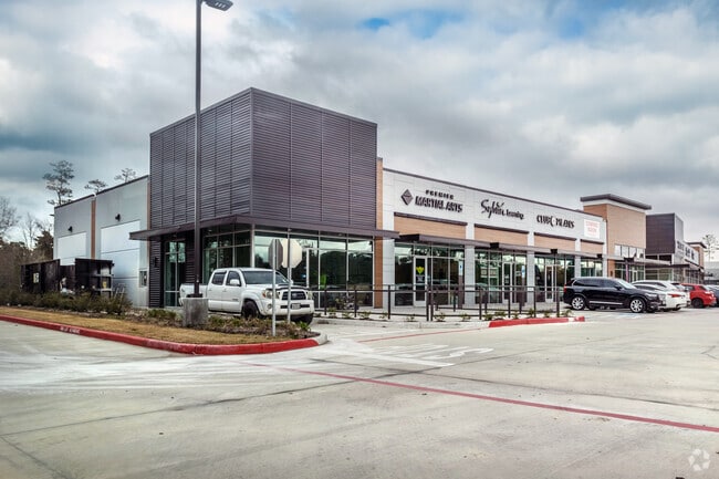
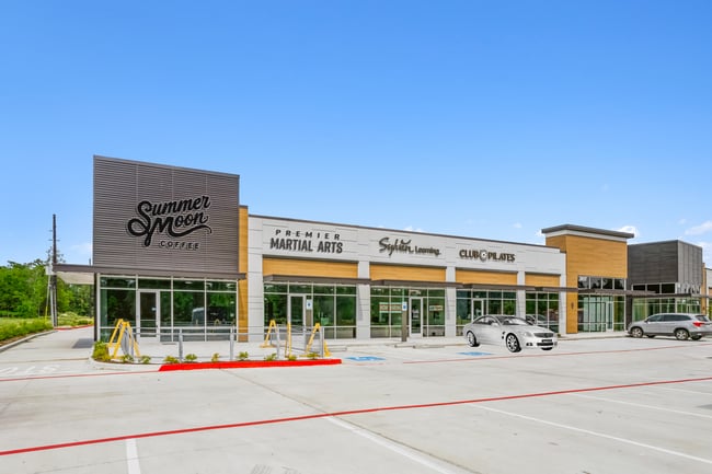
Property Record
3917 Woodsons Reserve Pkwy, Spring, TX 77386
NEARBY LISTINGS FOR SALE OR LEASE
Property Detail
3917 Woodsons Reserve Pkwy
Houston-The Woodlands-Sugar Land, TX
Woodsons Reserve Retail Pad 3
9737-93-00100
A0350 MONTG CO SCH LAND, TR 14-F, 2.5610 ACRES
Commercialnec
Montgomery
2024
Texas
2025
1.19 AC
692010
Montgomery County
9,875 SF
Houston
DEMOGRAPHICS near 3917 Woodsons Reserve Pkwy
1 Mile
3 Mile
5 Mile
2024 Total Population
7,015
60,296
126,340
2029 Population
8,632
73,574
148,059
Pop Growth 2024-2029
+ 23.05%
+ 22.02%
+ 17.19%
Average Age
32
34
35
2024 Total Households
2,195
19,060
41,512
HH Growth 2024-2029
+ 23.14%
+ 22.11%
+ 17.09%
Median Household Inc
$135,349
$130,511
$103,464
Avg Household Size
3.20
3.10
3.00
2024 Avg HH Vehicles
2.00
2.00
2.00
Median Home Value
$335,847
$308,732
$264,904
Median Year Built
2009
2009
2005
Nearby Places
Map Layers
Map Styles
 Street
 Aerial
- Restaurants
- Banks
- Shops
- Fitness
- Groceries
PUBLIC TRANSPORTATION
AIRPORT
George Bush Intcntl/Houston
DRIVE
WALK
Distance
George Bush Intcntl/Houston
27 min
19.8 mi
Freight Ports
Port of Houston
DRIVE
WALK
Distance
Port of Houston
50 min
35.6 mi
SALE & LEASE HISTORY
LISTING DATE
SALE/LEASE

Oct 11, 2022
For Sale
Nearby Properties
Address
Land Use
TOTAL SIZE
Lot Size
Zoning
Address
Land Use
TOTAL SIZE
Lot Size
Zoning
354,981 SF
72.09 AC
Address
Land Use
TOTAL SIZE
Lot Size
Zoning
970,101 SF
48.05 AC
Address
Land Use
TOTAL SIZE
Lot Size
Zoning
153,729 SF
17.94 AC
Address
Land Use
TOTAL SIZE
Lot Size
Zoning
331,264 SF
12.92 AC
Address
Land Use
TOTAL SIZE
Lot Size
Zoning
321,024 SF
8.73 AC
6
Address
Land Use
TOTAL SIZE
Lot Size
Zoning
215,741 SF
14 AC
Address
Land Use
TOTAL SIZE
Lot Size
Zoning
179,426 SF
5.70 AC
Address
Land Use
TOTAL SIZE
Lot Size
Zoning
89,090 SF
10.93 AC
Address
Land Use
TOTAL SIZE
Lot Size
Zoning
184,338 SF
17.13 AC
Address
Land Use
TOTAL SIZE
Lot Size
Zoning
122,925 SF
16.68 AC
Address
Land Use
TOTAL SIZE
Lot Size
Zoning
138,536 SF
15.99 AC
Address
Land Use
TOTAL SIZE
Lot Size
Zoning
120,807 SF
12.62 AC
Address
Land Use
TOTAL SIZE
Lot Size
Zoning
126,509 SF
15.59 AC
Address
Land Use
TOTAL SIZE
Lot Size
Zoning
133,188 SF
2.26 AC
6
Address
Land Use
TOTAL SIZE
Lot Size
Zoning
135,960 SF
1.77 AC
Address
Land Use
TOTAL SIZE
Lot Size
Zoning
66,000 SF
16 AC
6
Address
Land Use
TOTAL SIZE
Lot Size
Zoning
32,962 SF
9.86 AC
Address
Land Use
TOTAL SIZE
Lot Size
Zoning
121,422 SF
14.75 AC
Address
Land Use
TOTAL SIZE
Lot Size
Zoning
37,360 SF
4.61 AC
Address
Land Use
TOTAL SIZE
Lot Size
Zoning
137,156 SF
15.14 AC
Address
Land Use
TOTAL SIZE
Lot Size
Zoning
Address
Land Use
TOTAL SIZE
Lot Size
Zoning
115,834 SF
17.11 AC
Address
Land Use
TOTAL SIZE
Lot Size
Zoning
80,952 SF
9.21 AC
Address
Land Use
TOTAL SIZE
Lot Size
Zoning
52,607 SF
4.08 AC
Address
Land Use
TOTAL SIZE
Lot Size
Zoning
112,000 SF
14.87 AC
Address
Land Use
TOTAL SIZE
Lot Size
Zoning
34,091 SF
3.89 AC
Address
Land Use
TOTAL SIZE
Lot Size
Zoning
81,400 SF
3.39 AC
Address
Land Use
TOTAL SIZE
Lot Size
Zoning
92,216 SF
5.62 AC
Address
Land Use
TOTAL SIZE
Lot Size
Zoning
12,859 SF
2.39 AC
6
Address
Land Use
TOTAL SIZE
Lot Size
Zoning
18,524 SF
1.73 AC
The World's #1 Commercial Real Estate Marketplace
Connect with us
© 2026 CoStar Group
The information above has been obtained from sources believed reliable. While we do not doubt its accuracy we have not verified it and make no guarantee, warranty or representation about it. It is your responsibility to independently confirm its accuracy and completeness. Any projections, opinions, assumptions, or estimates used are for example only and do not represent the current or future performance of the property. The value of this transaction to you depends on tax and other factors which should be evaluated by your tax, financial, and legal advisors. You and your advisors should conduct a careful, independent investigation of the property to determine to your satisfaction the suitability of the property for your needs.