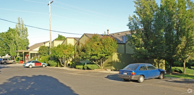
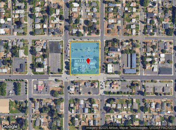
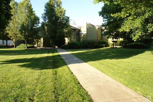
Property Record
3919 N Maple St, Spokane, WA 99205
NEARBY LISTINGS FOR SALE OR LEASE
Property Detail
3919 N Maple St
Spokane-Spokane Valley, WA
Greenes Add
25011.3911
GREENES ADD: LOTS 1 - 12 BLK 39 INC VAC 16 FT STRIP
Commercialnec
Spokane
X
Washington
53063C0533D
1-12
0
1.86 AC
2025
SW North Metro
001200
Spokane
12,881 SF
DEMOGRAPHICS near 3919 N Maple St
1 Mile
3 Mile
5 Mile
2024 Total Population
17,722
128,866
223,720
2029 Population
18,755
136,863
237,920
Pop Growth 2024-2029
+ 5.83%
+ 6.21%
+ 6.35%
Average Age
38
39
39
2024 Total Households
7,242
52,954
91,901
HH Growth 2024-2029
+ 5.99%
+ 6.54%
+ 6.65%
Median Household Inc
$64,102
$52,893
$58,124
Avg Household Size
2.40
2.30
2.30
2024 Avg HH Vehicles
2.00
2.00
2.00
Median Home Value
$275,306
$269,860
$304,086
Median Year Built
1948
1955
1961
Nearby Places
Map Layers
Map Styles
 Street
 Aerial
- Restaurants
- Banks
- Shops
- Fitness
- Groceries
PUBLIC TRANSPORTATION
COMMUTER RAIL
Spokane (Empire Builder - Amtrak)
DRIVE
WALK
Distance
Spokane (Empire Builder - Amtrak)
9 min
3.6 mi
AIRPORT
Spokane International
DRIVE
WALK
Distance
Spokane International
16 min
8.3 mi
Freight Ports
Port of Everett
DRIVE
WALK
Distance
Port of Everett
344 min
303.9 mi
Nearby Properties
Address
Land Use
TOTAL SIZE
Lot Size
Zoning
Address
Land Use
TOTAL SIZE
Lot Size
Zoning
831,429 SF
119.79 AC
Address
Land Use
TOTAL SIZE
Lot Size
Zoning
481,348 SF
17.09 AC
DTU
Address
Land Use
TOTAL SIZE
Lot Size
Zoning
629,722 SF
26.28 AC
RHD
Address
Land Use
TOTAL SIZE
Lot Size
Zoning
157,882 SF
42.70 AC
DTG
Address
Land Use
TOTAL SIZE
Lot Size
Zoning
123,047 SF
3.95 AC
DTG
Address
Land Use
TOTAL SIZE
Lot Size
Zoning
241,106 SF
3.92 AC
CB
Address
Land Use
TOTAL SIZE
Lot Size
Zoning
536,438 SF
1.70 AC
DTC
Address
Land Use
TOTAL SIZE
Lot Size
Zoning
531,295 SF
17.11 AC
CC2
Address
Land Use
TOTAL SIZE
Lot Size
Zoning
171,479 SF
67.30 AC
RSF
Address
Land Use
TOTAL SIZE
Lot Size
Zoning
154,800 SF
20.06 AC
DTG
Address
Land Use
TOTAL SIZE
Lot Size
Zoning
386,885 SF
22.81 AC
RSF
Address
Land Use
TOTAL SIZE
Lot Size
Zoning
310,606 SF
27.56 AC
RMF
Address
Land Use
TOTAL SIZE
Lot Size
Zoning
180,822 SF
16.11 AC
CC1
Address
Land Use
TOTAL SIZE
Lot Size
Zoning
139,485 SF
16.74 AC
RSF
Address
Land Use
TOTAL SIZE
Lot Size
Zoning
107,800 SF
3.20 AC
CB
Address
Land Use
TOTAL SIZE
Lot Size
Zoning
379,678 SF
20.64 AC
LI
Address
Land Use
TOTAL SIZE
Lot Size
Zoning
91,882 SF
2.07 AC
OR
Address
Land Use
TOTAL SIZE
Lot Size
Zoning
314,149 SF
1.07 AC
DTC
Address
Land Use
TOTAL SIZE
Lot Size
Zoning
151,667 SF
7.45 AC
DTG
Address
Land Use
TOTAL SIZE
Lot Size
Zoning
289,705 SF
3.36 AC
OR
Address
Land Use
TOTAL SIZE
Lot Size
Zoning
112,634 SF
3.87 AC
OR
Address
Land Use
TOTAL SIZE
Lot Size
Zoning
50,869 SF
0.61 AC
DTC
Address
Land Use
TOTAL SIZE
Lot Size
Zoning
137,503 SF
17.31 AC
GC
Address
Land Use
TOTAL SIZE
Lot Size
Zoning
1,555,116 SF
23.12 AC
GC
Address
Land Use
TOTAL SIZE
Lot Size
Zoning
228,981 SF
5.32 AC
RHD
Address
Land Use
TOTAL SIZE
Lot Size
Zoning
290,380 SF
2.11 AC
CA3
Address
Land Use
TOTAL SIZE
Lot Size
Zoning
182,088 SF
0.37 AC
DTC
Address
Land Use
TOTAL SIZE
Lot Size
Zoning
107,240 SF
1.54 AC
CC1
Address
Land Use
TOTAL SIZE
Lot Size
Zoning
56,600 SF
4.98 AC
GC
Address
Land Use
TOTAL SIZE
Lot Size
Zoning
53,748 SF
1.26 AC
DTC
The World's #1 Commercial Real Estate Marketplace
Connect with us
© 2025 CoStar Group
The information above has been obtained from sources believed reliable. While we do not doubt its accuracy we have not verified it and make no guarantee, warranty or representation about it. It is your responsibility to independently confirm its accuracy and completeness. Any projections, opinions, assumptions, or estimates used are for example only and do not represent the current or future performance of the property. The value of this transaction to you depends on tax and other factors which should be evaluated by your tax, financial, and legal advisors. You and your advisors should conduct a careful, independent investigation of the property to determine to your satisfaction the suitability of the property for your needs.