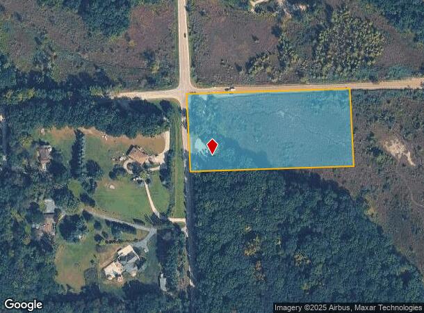
Property Record
3920 Fenton Rd, Hartland, MI 48353
NEARBY LISTINGS FOR SALE OR LEASE
Property Detail
3920 Fenton Rd
Detroit-Warren-Dearborn, MI
Livingston
08-13-100-004
Michigan
Sfr
5 AC
X
Livingston County
26093C0237D
Detroit
1,316 SF
DEMOGRAPHICS near 3920 Fenton Rd
1 Mile
3 Mile
5 Mile
2024 Total Population
1,857
12,126
34,991
2029 Population
1,910
12,365
35,601
Pop Growth 2024-2029
+ 2.85%
+ 1.97%
+ 1.74%
Average Age
43
44
42
2024 Total Households
710
4,510
12,786
HH Growth 2024-2029
+ 2.82%
+ 1.91%
+ 1.68%
Median Household Inc
$63,836
$95,007
$103,070
Avg Household Size
2.60
2.60
2.70
2024 Avg HH Vehicles
2.00
2.00
2.00
Median Home Value
$254,166
$336,494
$348,921
Median Year Built
1994
1991
1990
Nearby Places
- Restaurants
- Banks
- Shops
- Fitness
- Groceries
PUBLIC TRANSPORTATION
AIRPORT
Bishop International
DRIVE
WALK
Distance
Bishop International
44 min
26.5 mi
Freight Ports
Port of Toledo
DRIVE
WALK
Distance
Port of Toledo
111 min
89.9 mi
SALE & LEASE HISTORY
LISTING DATE
SALE/LEASE

Sep 24, 2016
For Sale
Nearby Properties
Address
Land Use
TOTAL SIZE
Lot Size
Zoning
Address
Land Use
TOTAL SIZE
Lot Size
Zoning
75,102 SF
27.14 AC
CA
Address
Land Use
TOTAL SIZE
Lot Size
Zoning
154.38 AC
MR
Address
Land Use
TOTAL SIZE
Lot Size
Zoning
55,117 SF
7.50 AC
PD
Address
Land Use
TOTAL SIZE
Lot Size
Zoning
163,707 SF
17.93 AC
CA
Address
Land Use
TOTAL SIZE
Lot Size
Zoning
188,508 SF
18.32 AC
PD
Address
Land Use
TOTAL SIZE
Lot Size
Zoning
83,159 SF
34.44 AC
Address
Land Use
TOTAL SIZE
Lot Size
Zoning
42,134 SF
6.80 AC
CA
Address
Land Use
TOTAL SIZE
Lot Size
Zoning
18.68 AC
PD
Address
Land Use
TOTAL SIZE
Lot Size
Zoning
93,084 SF
9.11 AC
GC
Address
Land Use
TOTAL SIZE
Lot Size
Zoning
34,075 SF
14.06 AC
BI
Address
Land Use
TOTAL SIZE
Lot Size
Zoning
9,257 SF
79.69 AC
CA
Address
Land Use
TOTAL SIZE
Lot Size
Zoning
7,360 SF
4.95 AC
GC
Address
Land Use
TOTAL SIZE
Lot Size
Zoning
8,045 SF
1.73 AC
PD
Address
Land Use
TOTAL SIZE
Lot Size
Zoning
4,870 SF
399.43 AC
RV
Address
Land Use
TOTAL SIZE
Lot Size
Zoning
3,871 SF
352.69 AC
CA
Address
Land Use
TOTAL SIZE
Lot Size
Zoning
12,636 SF
2.32 AC
OS
Address
Land Use
TOTAL SIZE
Lot Size
Zoning
1.40 AC
PD
Address
Land Use
TOTAL SIZE
Lot Size
Zoning
15,320 SF
1.74 AC
GC
Address
Land Use
TOTAL SIZE
Lot Size
Zoning
21,000 SF
3.12 AC
BI
Address
Land Use
TOTAL SIZE
Lot Size
Zoning
14,271 SF
3.20 AC
GC
Address
Land Use
TOTAL SIZE
Lot Size
Zoning
15,105 SF
140 AC
CA
Address
Land Use
TOTAL SIZE
Lot Size
Zoning
10,065 SF
1.28 AC
PD
Address
Land Use
TOTAL SIZE
Lot Size
Zoning
6,623 SF
6.16 AC
OS
Address
Land Use
TOTAL SIZE
Lot Size
Zoning
4,046 SF
1.26 AC
PD
Address
Land Use
TOTAL SIZE
Lot Size
Zoning
11,024 SF
2.05 AC
GC
Address
Land Use
TOTAL SIZE
Lot Size
Zoning
6,798 SF
15.63 AC
OS
Address
Land Use
TOTAL SIZE
Lot Size
Zoning
4,550 SF
1.25 AC
GC
Address
Land Use
TOTAL SIZE
Lot Size
Zoning
15,066 SF
6.39 AC
OS
Address
Land Use
TOTAL SIZE
Lot Size
Zoning
7,800 SF
2.15 AC
GC
Address
Land Use
TOTAL SIZE
Lot Size
Zoning
2,172 SF
0.82 AC
PD
The World's #1 Commercial Real Estate Marketplace
Connect with us
© 2025 CoStar Group
The information above has been obtained from sources believed reliable. While we do not doubt its accuracy we have not verified it and make no guarantee, warranty or representation about it. It is your responsibility to independently confirm its accuracy and completeness. Any projections, opinions, assumptions, or estimates used are for example only and do not represent the current or future performance of the property. The value of this transaction to you depends on tax and other factors which should be evaluated by your tax, financial, and legal advisors. You and your advisors should conduct a careful, independent investigation of the property to determine to your satisfaction the suitability of the property for your needs.