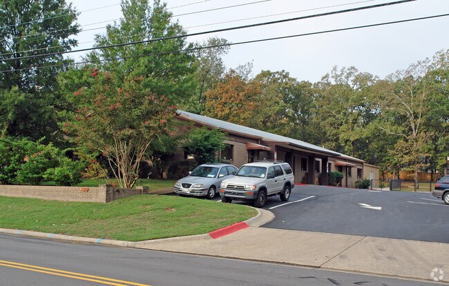
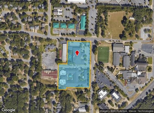
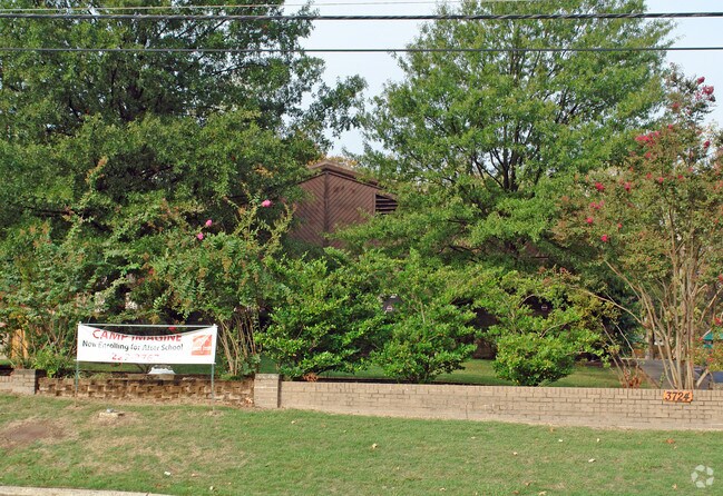
Property Record
3920 Woodland Heights Rd, Little Rock, AR 72212
NEARBY LISTINGS FOR SALE OR LEASE
Property Detail
3920 Woodland Heights Rd
43L-022-00-017-00
E1/2 NE SE SW & S1/2 E110 OF W1/2 NE SE SW EXC BEG NW COR E1/2 SE SE SW N19 4 E307 39 S TO SLN E1/2 NE SE SW TH W TO POB 21-2N-13W
Hospitalprivate
Pulaski
X
Arkansas
05119C0317G
4.84 AC
2025
West
2025
Little Rock/N Little Rock
004215
Little Rock-North Little Rock-Conway, AR
60,000 SF
DEMOGRAPHICS near 3920 Woodland Heights Rd
1 Mile
3 Mile
5 Mile
2024 Total Population
5,985
48,993
118,158
2029 Population
5,861
48,471
117,417
Pop Growth 2024-2029
(2.07%)
(1.07%)
(0.63%)
Average Age
40
40
40
2024 Total Households
2,595
22,141
53,358
HH Growth 2024-2029
(2.08%)
(1.07%)
(0.65%)
Median Household Inc
$78,113
$69,983
$71,810
Avg Household Size
2.30
2.20
2.20
2024 Avg HH Vehicles
2.00
2.00
2.00
Median Home Value
$265,240
$254,426
$262,333
Median Year Built
1981
1982
1984
Nearby Places
Map Layers
Map Styles
 Street
 Aerial
- Restaurants
- Banks
- Shops
- Fitness
- Groceries
PUBLIC TRANSPORTATION
COMMUTER RAIL
Little Rock Union Station (Texas Eagle - Amtrak)
DRIVE
WALK
Distance
Little Rock Union Station (Texas Eagle - Amtrak)
15 min
8.5 mi
AIRPORT
Bill and Hillary Clinton Ntl/Adams Field
DRIVE
WALK
Distance
Bill and Hillary Clinton Ntl/Adams Field
23 min
14.9 mi
Freight Ports
Port of Shreveport
DRIVE
WALK
Distance
Port of Shreveport
250 min
232.3 mi
Nearby Properties
Address
Land Use
TOTAL SIZE
Lot Size
Zoning
Address
Land Use
TOTAL SIZE
Lot Size
Zoning
115,378 SF
30.50 AC
Address
Land Use
TOTAL SIZE
Lot Size
Zoning
1,974 SF
14.30 AC
Address
Land Use
TOTAL SIZE
Lot Size
Zoning
145,580 SF
19.89 AC
Address
Land Use
TOTAL SIZE
Lot Size
Zoning
39,635 SF
15.76 AC
Address
Land Use
TOTAL SIZE
Lot Size
Zoning
43,928 SF
26.72 AC
Address
Land Use
TOTAL SIZE
Lot Size
Zoning
102,600 SF
17.29 AC
Address
Land Use
TOTAL SIZE
Lot Size
Zoning
32,562 SF
13.40 AC
Address
Land Use
TOTAL SIZE
Lot Size
Zoning
73,197 SF
12.09 AC
Address
Land Use
TOTAL SIZE
Lot Size
Zoning
210,924 SF
22.66 AC
Address
Land Use
TOTAL SIZE
Lot Size
Zoning
293,057 SF
20.78 AC
Address
Land Use
TOTAL SIZE
Lot Size
Zoning
114,269 SF
12.85 AC
Address
Land Use
TOTAL SIZE
Lot Size
Zoning
65,208 SF
18.30 AC
Address
Land Use
TOTAL SIZE
Lot Size
Zoning
238,164 SF
34.25 AC
Address
Land Use
TOTAL SIZE
Lot Size
Zoning
122,775 SF
9.96 AC
Address
Land Use
TOTAL SIZE
Lot Size
Zoning
155,943 SF
10.59 AC
Address
Land Use
TOTAL SIZE
Lot Size
Zoning
21,640 SF
20 AC
Address
Land Use
TOTAL SIZE
Lot Size
Zoning
69,251 SF
24.10 AC
Address
Land Use
TOTAL SIZE
Lot Size
Zoning
40,803 SF
18.48 AC
Address
Land Use
TOTAL SIZE
Lot Size
Zoning
33,992 SF
13.15 AC
Address
Land Use
TOTAL SIZE
Lot Size
Zoning
129,239 SF
9.01 AC
Address
Land Use
TOTAL SIZE
Lot Size
Zoning
123,661 SF
14.71 AC
Address
Land Use
TOTAL SIZE
Lot Size
Zoning
19,471 SF
11.29 AC
Address
Land Use
TOTAL SIZE
Lot Size
Zoning
63,140 SF
14.22 AC
Address
Land Use
TOTAL SIZE
Lot Size
Zoning
155,000 SF
12 AC
Address
Land Use
TOTAL SIZE
Lot Size
Zoning
93,449 SF
15.21 AC
Address
Land Use
TOTAL SIZE
Lot Size
Zoning
24,628 SF
15.48 AC
Address
Land Use
TOTAL SIZE
Lot Size
Zoning
77,018 SF
8.45 AC
Address
Land Use
TOTAL SIZE
Lot Size
Zoning
85,980 SF
32.29 AC
Address
Land Use
TOTAL SIZE
Lot Size
Zoning
42,313 SF
5.17 AC
Address
Land Use
TOTAL SIZE
Lot Size
Zoning
155,597 SF
19.66 AC
The World's #1 Commercial Real Estate Marketplace
Connect with us
© 2025 CoStar Group
The information above has been obtained from sources believed reliable. While we do not doubt its accuracy we have not verified it and make no guarantee, warranty or representation about it. It is your responsibility to independently confirm its accuracy and completeness. Any projections, opinions, assumptions, or estimates used are for example only and do not represent the current or future performance of the property. The value of this transaction to you depends on tax and other factors which should be evaluated by your tax, financial, and legal advisors. You and your advisors should conduct a careful, independent investigation of the property to determine to your satisfaction the suitability of the property for your needs.