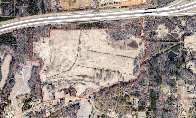
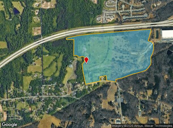
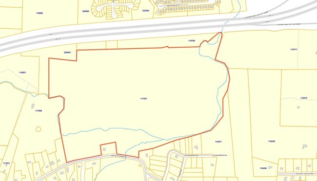
Property Record
3921 Presbyterian Rd, Greensboro, NC 27406
NEARBY LISTINGS FOR SALE OR LEASE
Property Detail
3921 Presbyterian Rd
Greensboro-High Point, NC
Welker
0117937
WELKER & 6321-843
Commercialnec
Guilford
AE
North Carolina
3710788200J
1
2024
151.17 AC
2025
SE Guilford County
012803
Greensboro/Winston-Salem
1,774 SF
DEMOGRAPHICS near 3921 Presbyterian Rd
1 Mile
3 Mile
5 Mile
2024 Total Population
2,382
15,586
58,853
2029 Population
2,362
15,473
58,847
Pop Growth 2024-2029
(0.84%)
(0.73%)
(0.01%)
Average Age
40
40
38
2024 Total Households
873
5,995
22,381
HH Growth 2024-2029
(0.80%)
(0.70%)
+ 0.04%
Median Household Inc
$70,714
$66,736
$47,132
Avg Household Size
2.60
2.50
2.50
2024 Avg HH Vehicles
3.00
2.00
2.00
Median Home Value
$192,835
$207,235
$167,199
Median Year Built
1996
1994
1981
Nearby Places
Map Layers
Map Styles
 Street
 Aerial
- Restaurants
- Banks
- Shops
- Fitness
- Groceries
PUBLIC TRANSPORTATION
COMMUTER RAIL
Greensboro Station (Piedmont - North Carolina by Train (NC Train))
DRIVE
WALK
Distance
Greensboro Station (Piedmont - North Carolina by Train (NC Train))
13 min
6.1 mi
AIRPORT
Piedmont Triad International
DRIVE
WALK
Distance
Piedmont Triad International
29 min
19.1 mi
Freight Ports
Virginia Port Authority - Richmond
DRIVE
WALK
Distance
Virginia Port Authority - Richmond
223 min
194.1 mi
SALE & LEASE HISTORY
LISTING DATE
SALE/LEASE

Sep 24, 2016
For Sale
Nearby Properties
Address
Land Use
TOTAL SIZE
Lot Size
Zoning
Address
Land Use
TOTAL SIZE
Lot Size
Zoning
313,033 SF
71.38 AC
O
Address
Land Use
TOTAL SIZE
Lot Size
Zoning
402,136 SF
31.27 AC
HI
Address
Land Use
TOTAL SIZE
Lot Size
Zoning
364,783 SF
30.12 AC
RM-18
Address
Land Use
TOTAL SIZE
Lot Size
Zoning
418,596 SF
23.53 AC
LI
Address
Land Use
TOTAL SIZE
Lot Size
Zoning
505,615 SF
39.50 AC
LI
Address
Land Use
TOTAL SIZE
Lot Size
Zoning
281,330 SF
21.18 AC
HI
Address
Land Use
TOTAL SIZE
Lot Size
Zoning
293,760 SF
21.94 AC
LI
Address
Land Use
TOTAL SIZE
Lot Size
Zoning
363,920 SF
34.27 AC
LI
Address
Land Use
TOTAL SIZE
Lot Size
Zoning
419,126 SF
33.68 AC
LI
Address
Land Use
TOTAL SIZE
Lot Size
Zoning
82,450 SF
117.82 AC
R-5
Address
Land Use
TOTAL SIZE
Lot Size
Zoning
240,170 SF
14.01 AC
LI
Address
Land Use
TOTAL SIZE
Lot Size
Zoning
301,592 SF
19.38 AC
LI
Address
Land Use
TOTAL SIZE
Lot Size
Zoning
128,500 SF
14.15 AC
LI
Address
Land Use
TOTAL SIZE
Lot Size
Zoning
153,900 SF
14.23 AC
LI
Address
Land Use
TOTAL SIZE
Lot Size
Zoning
65,756 SF
121.44 AC
PI
Address
Land Use
TOTAL SIZE
Lot Size
Zoning
91,232 SF
12.34 AC
RM-8
Address
Land Use
TOTAL SIZE
Lot Size
Zoning
107,806 SF
33.49 AC
PI
Address
Land Use
TOTAL SIZE
Lot Size
Zoning
41,288 SF
4.52 AC
O
Address
Land Use
TOTAL SIZE
Lot Size
Zoning
66,372 SF
17.77 AC
LI
Address
Land Use
TOTAL SIZE
Lot Size
Zoning
110,332 SF
20.17 AC
LI
Address
Land Use
TOTAL SIZE
Lot Size
Zoning
43,428 SF
4.58 AC
C-M
Address
Land Use
TOTAL SIZE
Lot Size
Zoning
44,899 SF
11.26 AC
RM-8
Address
Land Use
TOTAL SIZE
Lot Size
Zoning
16,920 SF
15.03 AC
LI
Address
Land Use
TOTAL SIZE
Lot Size
Zoning
21,231 SF
305.68 AC
HI
Address
Land Use
TOTAL SIZE
Lot Size
Zoning
22,016 SF
93.77 AC
PD-M
Address
Land Use
TOTAL SIZE
Lot Size
Zoning
53,332 SF
34.48 AC
PI
Address
Land Use
TOTAL SIZE
Lot Size
Zoning
4,938 SF
2.19 AC
C-M
Address
Land Use
TOTAL SIZE
Lot Size
Zoning
26,764 SF
186.74 AC
RS-40
Address
Land Use
TOTAL SIZE
Lot Size
Zoning
32,672 SF
17.30 AC
RS-40
The World's #1 Commercial Real Estate Marketplace
Connect with us
© 2026 CoStar Group
The information above has been obtained from sources believed reliable. While we do not doubt its accuracy we have not verified it and make no guarantee, warranty or representation about it. It is your responsibility to independently confirm its accuracy and completeness. Any projections, opinions, assumptions, or estimates used are for example only and do not represent the current or future performance of the property. The value of this transaction to you depends on tax and other factors which should be evaluated by your tax, financial, and legal advisors. You and your advisors should conduct a careful, independent investigation of the property to determine to your satisfaction the suitability of the property for your needs.