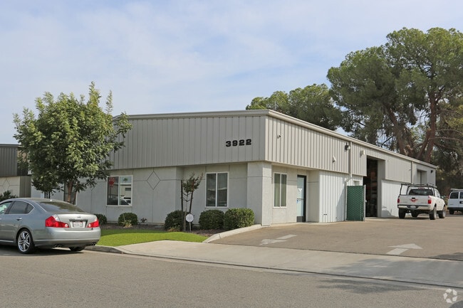
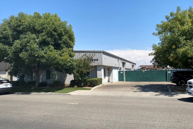
Property Record
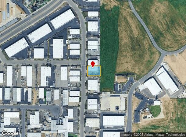
3922 N Ann Ave, Fresno, CA 93727
Current Lease Availabilities
NEARBY LISTINGS FOR SALE OR LEASE
Property Detail
3922 N Ann Ave
493-191-08
PARCEL H P/M 2004-24 BK 67 PGS 95-97
Warehouse
Fresno
X
California
06019C1590H
0.31 AC
2025
Northeast Fresno
2025
Fresno
003104
Fresno, CA
4,955 SF
DEMOGRAPHICS near 3922 N Ann Ave
1 Mile
3 Mile
5 Mile
2024 Total Population
12,480
150,983
408,689
2029 Population
12,816
154,122
417,769
Pop Growth 2024-2029
+ 2.69%
+ 2.08%
+ 2.22%
Average Age
34
35
36
2024 Total Households
4,534
50,758
135,914
HH Growth 2024-2029
+ 2.80%
+ 2.14%
+ 2.23%
Median Household Inc
$48,765
$50,481
$60,366
Avg Household Size
2.70
2.90
2.90
2024 Avg HH Vehicles
2.00
2.00
2.00
Median Home Value
$262,880
$261,641
$323,121
Median Year Built
1974
1971
1975
Nearby Places
- Restaurants
- Banks
- Shops
- Fitness
- Groceries
PUBLIC TRANSPORTATION
COMMUTER RAIL
Fresno (San Joaquins - Amtrak)
DRIVE
WALK
Distance
Fresno (San Joaquins - Amtrak)
10 min
6.2 mi
AIRPORT
Fresno Yosemite International
DRIVE
WALK
Distance
Fresno Yosemite International
5 min
2.6 mi
Freight Ports
Port of Stockton
DRIVE
WALK
Distance
Port of Stockton
158 min
129.3 mi
Nearby Properties
Address
Land Use
TOTAL SIZE
Lot Size
Zoning
Address
Land Use
TOTAL SIZE
Lot Size
Zoning
1,081,456 SF
113.56 AC
M1
Address
Land Use
TOTAL SIZE
Lot Size
Zoning
574,093 SF
25.54 AC
C3
Address
Land Use
TOTAL SIZE
Lot Size
Zoning
794,471 SF
73.71 AC
Address
Land Use
TOTAL SIZE
Lot Size
Zoning
74,499 SF
17.48 AC
M3
Address
Land Use
TOTAL SIZE
Lot Size
Zoning
2,008 SF
20.14 AC
M1
Address
Land Use
TOTAL SIZE
Lot Size
Zoning
202,149 SF
27.56 AC
SPLIT
Address
Land Use
TOTAL SIZE
Lot Size
Zoning
385,529 SF
29.36 AC
R2
Address
Land Use
TOTAL SIZE
Lot Size
Zoning
268,956 SF
13.25 AC
R3
Address
Land Use
TOTAL SIZE
Lot Size
Zoning
249,818 SF
12.24 AC
PCC
Address
Land Use
TOTAL SIZE
Lot Size
Zoning
60,227 SF
4.72 AC
M1
Address
Land Use
TOTAL SIZE
Lot Size
Zoning
121,491 SF
4.52 AC
R3
Address
Land Use
TOTAL SIZE
Lot Size
Zoning
91,715 SF
4.50 AC
R3
Address
Land Use
TOTAL SIZE
Lot Size
Zoning
94,584 SF
10.93 AC
M1
Address
Land Use
TOTAL SIZE
Lot Size
Zoning
152,918 SF
15.85 AC
C2
Address
Land Use
TOTAL SIZE
Lot Size
Zoning
157,702 SF
4.61 AC
R2A
Address
Land Use
TOTAL SIZE
Lot Size
Zoning
93,172 SF
4.97 AC
Address
Land Use
TOTAL SIZE
Lot Size
Zoning
86,678 SF
4.16 AC
CP
Address
Land Use
TOTAL SIZE
Lot Size
Zoning
156,738 SF
12.05 AC
R3A
Address
Land Use
TOTAL SIZE
Lot Size
Zoning
249,126 SF
17.33 AC
SPLIT
Address
Land Use
TOTAL SIZE
Lot Size
Zoning
83,458 SF
2.66 AC
PCC
Address
Land Use
TOTAL SIZE
Lot Size
Zoning
250,412 SF
16.09 AC
RM3
Address
Land Use
TOTAL SIZE
Lot Size
Zoning
190,006 SF
19.35 AC
RM1
Address
Land Use
TOTAL SIZE
Lot Size
Zoning
151,980 SF
4.94 AC
CM
Address
Land Use
TOTAL SIZE
Lot Size
Zoning
6,288 SF
33.78 AC
TP
Address
Land Use
TOTAL SIZE
Lot Size
Zoning
138,502 SF
3.46 AC
C2
Address
Land Use
TOTAL SIZE
Lot Size
Zoning
57,695 SF
4.99 AC
R2A
Address
Land Use
TOTAL SIZE
Lot Size
Zoning
401,192 SF
0.01 AC
PCC
Address
Land Use
TOTAL SIZE
Lot Size
Zoning
67,394 SF
2.41 AC
C2
Address
Land Use
TOTAL SIZE
Lot Size
Zoning
80,771 SF
7.47 AC
C2
Address
Land Use
TOTAL SIZE
Lot Size
Zoning
141,577 SF
12.76 AC
IL
The World's #1 Commercial Real Estate Marketplace
Connect with us
© 2025 CoStar Group
The information above has been obtained from sources believed reliable. While we do not doubt its accuracy we have not verified it and make no guarantee, warranty or representation about it. It is your responsibility to independently confirm its accuracy and completeness. Any projections, opinions, assumptions, or estimates used are for example only and do not represent the current or future performance of the property. The value of this transaction to you depends on tax and other factors which should be evaluated by your tax, financial, and legal advisors. You and your advisors should conduct a careful, independent investigation of the property to determine to your satisfaction the suitability of the property for your needs.