Property Record
3925 Michael Blvd, Mobile, AL 36609
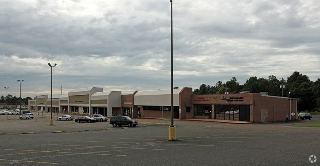

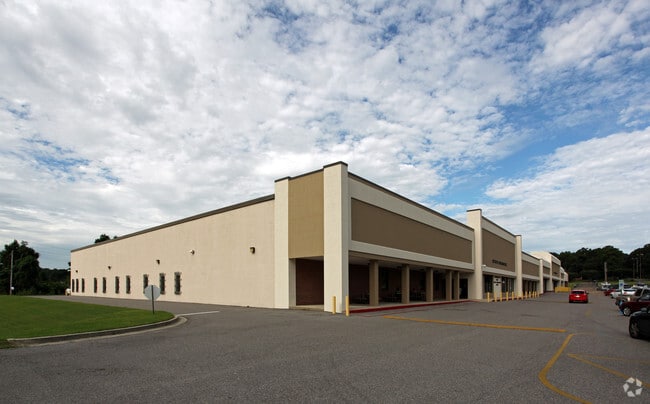
Property Detail
3925 Michael Blvd
Mobile, AL
THAT PT OF LAND LYING SWLY OF MICHAEL BOULEVARD IN NE 1/4 OF SW 1/4 OF SEC 28 T4S R2W KNOWN AS PART OF LOT 1 MICHAEL SQUARE
28-07-26-3-000-001
Mobile
Officebuilding
Alabama
B and X Area of moderate flood hazard, usually the area between the limits of the 100-year and 500-year floods.
1
0
14.68 AC
2025
West Mobile
003205
Mobile
92,329 SF
NEARBY LISTINGS FOR SALE OR LEASE
DEMOGRAPHICS near 3925 Michael Blvd
1 mile
3 mile
5 mile
2025 Total Population
11,499
67,485
160,606
2030 Population
11,361
66,259
159,325
Pop Growth 2025-2030
(1.20%)
(1.82%)
(0.80%)
Average Age
35
38
39
2025 Total Households
5,082
28,040
66,402
HH Growth 2025-2030
(1.42%)
(1.99%)
(0.91%)
Median Household Inc
$45,208
$54,642
$52,492
Avg Household Size
2.20
2.20
2.30
2025 Avg HH Vehicles
2.00
2.00
2.00
Median Home Value
$177,987
$234,469
$193,768
Median Year Built
1976
1975
1974
Nearby Places
Map Layers
Map Styles
 Street
 Aerial
Transit
 Traffic
 Biking
Places
Listings with unknown addresses are not visible on the map
- Restaurants
- Banks
- Shops
- Fitness
- Groceries
PUBLIC TRANSPORTATION
AIRPORT
Mobile Regional
Drive
Walk
Distance
Mobile Regional
18 min
7.8 mi
Mobile International
Drive
Walk
Distance
Mobile International
15 min
8.9 mi
Nearby Properties
Address
Land Use
TOTAL SIZE
Lot Size
Zoning
Address
Land Use
TOTAL SIZE
Lot Size
Zoning
170,500 SF
154.49 AC
Address
Land Use
TOTAL SIZE
Lot Size
Zoning
142,425 SF
160 AC
Address
Land Use
TOTAL SIZE
Lot Size
Zoning
216,528 SF
159 AC
Address
Land Use
TOTAL SIZE
Lot Size
Zoning
296,060 SF
40.49 AC
Address
Land Use
TOTAL SIZE
Lot Size
Zoning
148,656 SF
112.97 AC
Address
Land Use
TOTAL SIZE
Lot Size
Zoning
118,712 SF
9.90 AC
Address
Land Use
TOTAL SIZE
Lot Size
Zoning
359,478 SF
3.69 AC
Address
Land Use
TOTAL SIZE
Lot Size
Zoning
169,511 SF
44.42 AC
Address
Land Use
TOTAL SIZE
Lot Size
Zoning
139,460 SF
27.51 AC
Address
Land Use
TOTAL SIZE
Lot Size
Zoning
119,648 SF
38.21 AC
Address
Land Use
TOTAL SIZE
Lot Size
Zoning
194,016 SF
10.74 AC
Address
Land Use
TOTAL SIZE
Lot Size
Zoning
102,380 SF
12.24 AC
Address
Land Use
TOTAL SIZE
Lot Size
Zoning
30,972 SF
4.75 AC
Address
Land Use
TOTAL SIZE
Lot Size
Zoning
228,018 SF
4.80 AC
Address
Land Use
TOTAL SIZE
Lot Size
Zoning
57,452 SF
14.58 AC
Address
Land Use
TOTAL SIZE
Lot Size
Zoning
18,368 SF
14.70 AC
Address
Land Use
TOTAL SIZE
Lot Size
Zoning
31,452 SF
10.60 AC
Address
Land Use
TOTAL SIZE
Lot Size
Zoning
66,798 SF
10.31 AC
Address
Land Use
TOTAL SIZE
Lot Size
Zoning
65,356 SF
6.35 AC
Address
Land Use
TOTAL SIZE
Lot Size
Zoning
34,200 SF
30.03 AC
Address
Land Use
TOTAL SIZE
Lot Size
Zoning
19,536 SF
14.68 AC
Address
Land Use
TOTAL SIZE
Lot Size
Zoning
9,104 SF
13.52 AC
Address
Land Use
TOTAL SIZE
Lot Size
Zoning
208,683 SF
11.68 AC
Address
Land Use
TOTAL SIZE
Lot Size
Zoning
17,240 SF
12 AC
Address
Land Use
TOTAL SIZE
Lot Size
Zoning
29,448 SF
7.64 AC
Address
Land Use
TOTAL SIZE
Lot Size
Zoning
9,184 SF
12 AC
Address
Land Use
TOTAL SIZE
Lot Size
Zoning
62,859 SF
6.84 AC
Address
Land Use
TOTAL SIZE
Lot Size
Zoning
150,800 SF
15.39 AC
Address
Land Use
TOTAL SIZE
Lot Size
Zoning
16,584 SF
15.25 AC
Address
Land Use
TOTAL SIZE
Lot Size
Zoning
30,395 SF
44.92 AC
The World's #1 Commercial Real Estate Marketplace
Connect with us
© 2026 CoStar Group
The information above has been obtained from sources believed reliable. While we do not doubt its accuracy we have not verified it and make no guarantee, warranty or representation about it. It is your responsibility to independently confirm its accuracy and completeness. Any projections, opinions, assumptions, or estimates used are for example only and do not represent the current or future performance of the property. The value of this transaction to you depends on tax and other factors which should be evaluated by your tax, financial, and legal advisors. You and your advisors should conduct a careful, independent investigation of the property to determine to your satisfaction the suitability of the property for your needs.