Property Record
3927 Hadjes Dr, Lake Worth, FL 33467


NEARBY LISTINGS FOR SALE OR LEASE
-
-
View all Lake Worth listings for sale on LoopNet.com
Property Detail
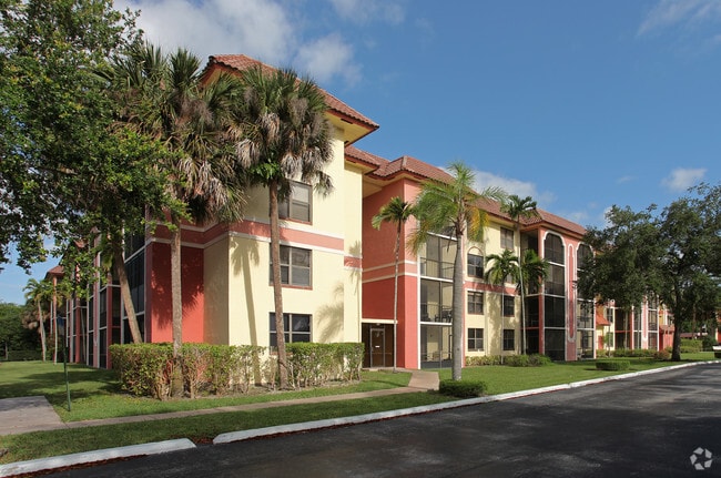
3927 Hadjes Dr
00-42-44-20-04-001-0000
Willow Bend Pl No 10
Hospitalprivate
WILLOW BEND PL NO 10 IN PB49P132 ALL OF PLAT
X
Palm Beach
12099C0760F
Florida
2024
7.29 AC
2025
Royal Palm Bch/Wellington
004817
South Florida
152,101 SF
West Palm Beach-Boca Raton-Delray Beach, FL
DEMOGRAPHICS near 3927 Hadjes Dr
1 Mile
3 Mile
5 Mile
2024 Total Population
7,714
103,514
262,193
2029 Population
7,926
106,334
268,828
Pop Growth 2024-2029
+ 2.75%
+ 2.72%
+ 2.53%
Average Age
51
42
40
2024 Total Households
3,502
38,300
91,769
HH Growth 2024-2029
+ 2.31%
+ 2.48%
+ 2.17%
Median Household Inc
$52,838
$60,671
$67,120
Avg Household Size
2.10
2.50
2.70
2024 Avg HH Vehicles
2.00
2.00
2.00
Median Home Value
$248,705
$268,395
$313,363
Median Year Built
1982
1987
1988
Nearby Places
Map Layers
Map Styles
 Street
 Aerial
- Restaurants
- Banks
- Shops
- Fitness
- Groceries
PUBLIC TRANSPORTATION
COMMUTER RAIL
Lake Worth (Tri-County Commuter - South Florida Regional Transportation Authority (Tri-Rail))
DRIVE
WALK
Distance
Lake Worth (Tri-County Commuter - South Florida Regional Transportation Authority (Tri-Rail))
14 min
6.6 mi
AIRPORT
Palm Beach International
DRIVE
WALK
Distance
Palm Beach International
16 min
9.6 mi
Nearby Properties
Address
Land Use
TOTAL SIZE
Lot Size
Zoning
Address
Land Use
TOTAL SIZE
Lot Size
Zoning
466,497 SF
21.05 AC
PUD
Address
Land Use
TOTAL SIZE
Lot Size
Zoning
466,667 SF
36.10 AC
PUD
Address
Land Use
TOTAL SIZE
Lot Size
Zoning
199,032 SF
769.86 AC
PO
Address
Land Use
TOTAL SIZE
Lot Size
Zoning
435,320 SF
13.75 AC
MCPD
Address
Land Use
TOTAL SIZE
Lot Size
Zoning
371,130 SF
19.90 AC
PUD
Address
Land Use
TOTAL SIZE
Lot Size
Zoning
691,249 SF
33.20 AC
MUPD
Address
Land Use
TOTAL SIZE
Lot Size
Zoning
335,373 SF
16.55 AC
MUPD
Address
Land Use
TOTAL SIZE
Lot Size
Zoning
379,598 SF
17.06 AC
RM-2
Address
Land Use
TOTAL SIZE
Lot Size
Zoning
379,598 SF
17.02 AC
RM-2
Address
Land Use
TOTAL SIZE
Lot Size
Zoning
344,071 SF
27.34 AC
RM-2
Address
Land Use
TOTAL SIZE
Lot Size
Zoning
52,656 SF
849.42 AC
PO
Address
Land Use
TOTAL SIZE
Lot Size
Zoning
338,248 SF
54.21 AC
CF
Address
Land Use
TOTAL SIZE
Lot Size
Zoning
273,023 SF
12.61 AC
RM-2
Address
Land Use
TOTAL SIZE
Lot Size
Zoning
219,628 SF
26.59 AC
PUD
Address
Land Use
TOTAL SIZE
Lot Size
Zoning
226,094 SF
27.47 AC
CI
Address
Land Use
TOTAL SIZE
Lot Size
Zoning
106,630 SF
25.01 AC
MUPD
Address
Land Use
TOTAL SIZE
Lot Size
Zoning
113,379 SF
16.56 AC
MUPD
Address
Land Use
TOTAL SIZE
Lot Size
Zoning
251,365 SF
23.01 AC
CG
Address
Land Use
TOTAL SIZE
Lot Size
Zoning
185,453 SF
9.63 AC
PUD
Address
Land Use
TOTAL SIZE
Lot Size
Zoning
191,404 SF
30.48 AC
GU
Address
Land Use
TOTAL SIZE
Lot Size
Zoning
131,955 SF
9.15 AC
MUPD
Address
Land Use
TOTAL SIZE
Lot Size
Zoning
192,427 SF
23.70 AC
RM
Address
Land Use
TOTAL SIZE
Lot Size
Zoning
189,687 SF
5.81 AC
MUPD
Address
Land Use
TOTAL SIZE
Lot Size
Zoning
236,045 SF
26.50 AC
RM-2
Address
Land Use
TOTAL SIZE
Lot Size
Zoning
134,221 SF
17.44 AC
MUPD
Address
Land Use
TOTAL SIZE
Lot Size
Zoning
156,873 SF
13.21 AC
CI
Address
Land Use
TOTAL SIZE
Lot Size
Zoning
119,061 SF
19.14 AC
MUPD
Address
Land Use
TOTAL SIZE
Lot Size
Zoning
95,440 SF
6.74 AC
PUD
Address
Land Use
TOTAL SIZE
Lot Size
Zoning
185,020 SF
17.48 AC
GU
Address
Land Use
TOTAL SIZE
Lot Size
Zoning
127,201 SF
2.37 AC
PUD
The World's #1 Commercial Real Estate Marketplace
Connect with us
© 2026 CoStar Group
The information above has been obtained from sources believed reliable. While we do not doubt its accuracy we have not verified it and make no guarantee, warranty or representation about it. It is your responsibility to independently confirm its accuracy and completeness. Any projections, opinions, assumptions, or estimates used are for example only and do not represent the current or future performance of the property. The value of this transaction to you depends on tax and other factors which should be evaluated by your tax, financial, and legal advisors. You and your advisors should conduct a careful, independent investigation of the property to determine to your satisfaction the suitability of the property for your needs.