Property Record
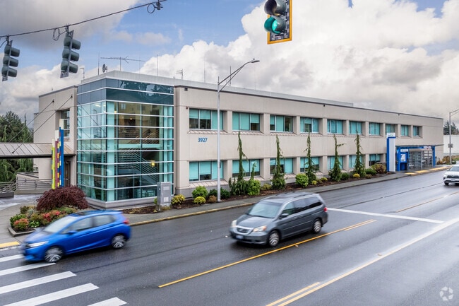
3927 Rucker Ave, Everett, WA 98201


Property Detail
3927 Rucker Ave
004113-005-013-00
CLIMAX LAND CO S 1ST ADD TO EVERETT BLK 005 D-00 - LOTS 13-14-15-16- LG LOT 16 BLK 5
Medicalbuilding
Snohomish
MU
Washington
B and X Area of moderate flood hazard, usually the area between the limits of the 100-year and 500-year floods.
13-16
2025
0.31 AC
2026
Everett CBD
041000
Seattle/Puget Sound
64,296 SF
Seattle-Tacoma-Bellevue, WA
NEARBY LISTINGS FOR SALE OR LEASE
DEMOGRAPHICS near 3927 Rucker Ave
1 mile
3 mile
5 mile
2025 Total Population
13,075
68,186
141,858
2030 Population
13,610
70,758
147,381
Pop Growth 2025-2030
+ 4.09%
+ 3.77%
+ 3.89%
Average Age
42
40
39
2025 Total Households
6,029
28,420
55,988
HH Growth 2025-2030
+ 4.43%
+ 4.01%
+ 4.05%
Median Household Inc
$65,589
$85,494
$87,701
Avg Household Size
2.00
2.30
2.40
2025 Avg HH Vehicles
2.00
2.00
2.00
Median Home Value
$632,801
$626,365
$660,008
Median Year Built
1971
1970
1982
Nearby Places
Map Layers
Map Styles
 Street
 Aerial
Layers
 Traffic
 Biking
Places
Listings with unknown addresses are not visible on the map
- Restaurants
- Banks
- Shops
- Fitness
- Groceries
PUBLIC TRANSPORTATION
COMMUTER RAIL
Everett Station (Sounder South Line - Central Puget Sound Regional Transit Authority Rail (Link Light Rail/Sounder))
Drive
Walk
Distance
Everett Station (Sounder South Line - Central Puget Sound Regional Transit Authority Rail (Link Light Rail/Sounder))
5 min
1.8 mi
AIRPORT
Seattle Paine Field International
Drive
Walk
Distance
Seattle Paine Field International
14 min
8.4 mi
Nearby Properties
Address
Land Use
TOTAL SIZE
Lot Size
Zoning
Address
Land Use
TOTAL SIZE
Lot Size
Zoning
61.99 AC
FE
Address
Land Use
TOTAL SIZE
Lot Size
Zoning
651,084 SF
1.10 AC
R-2
Address
Land Use
TOTAL SIZE
Lot Size
Zoning
372,084 SF
4.18 AC
R-2
Address
Land Use
TOTAL SIZE
Lot Size
Zoning
523,186 SF
32.29 AC
UR3
Address
Land Use
TOTAL SIZE
Lot Size
Zoning
647,181 SF
3.53 AC
UR4
Address
Land Use
TOTAL SIZE
Lot Size
Zoning
640,282 SF
2.75 AC
MU
Address
Land Use
TOTAL SIZE
Lot Size
Zoning
177,625 SF
22.70 AC
R-2
Address
Land Use
TOTAL SIZE
Lot Size
Zoning
339,059 SF
1.19 AC
MU
Address
Land Use
TOTAL SIZE
Lot Size
Zoning
146,740 SF
15.14 AC
Address
Land Use
TOTAL SIZE
Lot Size
Zoning
37.30 AC
R-1
Address
Land Use
TOTAL SIZE
Lot Size
Zoning
53.95 AC
MU
Address
Land Use
TOTAL SIZE
Lot Size
Zoning
219,030 SF
11.53 AC
LI2
Address
Land Use
TOTAL SIZE
Lot Size
Zoning
367,153 SF
0.14 AC
F6
Address
Land Use
TOTAL SIZE
Lot Size
Zoning
256,778 SF
14.44 AC
UR3
Address
Land Use
TOTAL SIZE
Lot Size
Zoning
317,771 SF
18.17 AC
LI2
Address
Land Use
TOTAL SIZE
Lot Size
Zoning
146,740 SF
27.70 AC
Address
Land Use
TOTAL SIZE
Lot Size
Zoning
77.67 AC
P
Address
Land Use
TOTAL SIZE
Lot Size
Zoning
5,956 SF
1.04 AC
MU
Address
Land Use
TOTAL SIZE
Lot Size
Zoning
186,258 SF
2.76 AC
MU
Address
Land Use
TOTAL SIZE
Lot Size
Zoning
130,353 SF
28.73 AC
UR3
Address
Land Use
TOTAL SIZE
Lot Size
Zoning
7,436 SF
5.06 AC
MU
Address
Land Use
TOTAL SIZE
Lot Size
Zoning
291,604 SF
20.69 AC
UR3
Address
Land Use
TOTAL SIZE
Lot Size
Zoning
249,940 SF
1.72 AC
R-2
Address
Land Use
TOTAL SIZE
Lot Size
Zoning
182,739 SF
4.77 AC
MU
Address
Land Use
TOTAL SIZE
Lot Size
Zoning
47.29 AC
FY
Address
Land Use
TOTAL SIZE
Lot Size
Zoning
285,572 SF
1.73 AC
UR3
Address
Land Use
TOTAL SIZE
Lot Size
Zoning
78,467 SF
1.04 AC
MU
Address
Land Use
TOTAL SIZE
Lot Size
Zoning
263,226 SF
4.22 AC
UR4
Address
Land Use
TOTAL SIZE
Lot Size
Zoning
200,000 SF
13.01 AC
LI2
The World's #1 Commercial Real Estate Marketplace
Connect with us
© 2026 CoStar Group
The information above has been obtained from sources believed reliable. While we do not doubt its accuracy we have not verified it and make no guarantee, warranty or representation about it. It is your responsibility to independently confirm its accuracy and completeness. Any projections, opinions, assumptions, or estimates used are for example only and do not represent the current or future performance of the property. The value of this transaction to you depends on tax and other factors which should be evaluated by your tax, financial, and legal advisors. You and your advisors should conduct a careful, independent investigation of the property to determine to your satisfaction the suitability of the property for your needs.