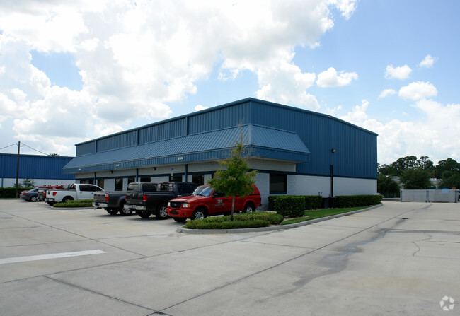
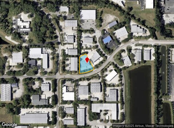
Property Record
3950 Saint Johns Pkwy, Sanford, FL 32771
Current Lease Availabilities
NEARBY LISTINGS FOR SALE OR LEASE
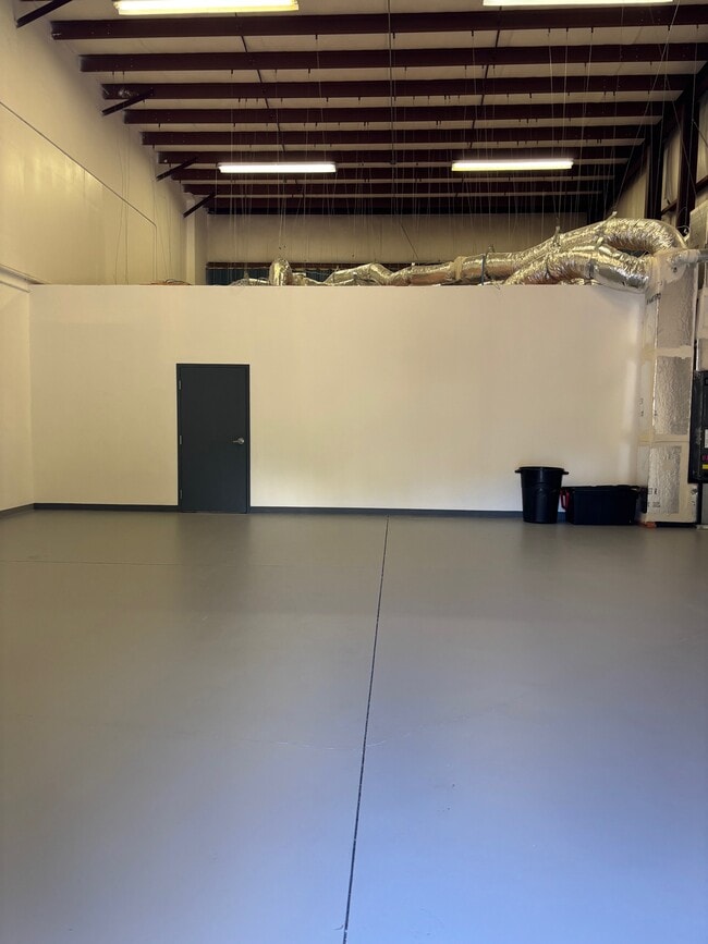
Property Detail
3950 Saint Johns Pkwy
Orlando-Kissimmee-Sanford, FL
Sanford Central Park Ph 2
28-19-30-5NR-0000-0150
LOT 15 SANFORD CENTRAL PARK PH 2 AMENDED PB 54 PGS 8 THRU 10
Commercialnec
Seminole
X
Florida
12069C0450E
15
2024
0.67 AC
2024
Seminole County
020601
Orlando
6,000 SF
DEMOGRAPHICS near 3950 Saint Johns Pkwy
1 Mile
3 Mile
5 Mile
2024 Total Population
8,227
64,879
132,737
2029 Population
8,664
68,444
139,384
Pop Growth 2024-2029
+ 5.31%
+ 5.49%
+ 5.01%
Average Age
35
39
40
2024 Total Households
3,270
25,541
50,935
HH Growth 2024-2029
+ 5.50%
+ 5.65%
+ 5.15%
Median Household Inc
$62,116
$66,518
$69,395
Avg Household Size
2.50
2.50
2.50
2024 Avg HH Vehicles
2.00
2.00
2.00
Median Home Value
$305,524
$308,905
$304,580
Median Year Built
2004
1999
1994
Nearby Places
- Restaurants
- Banks
- Shops
- Fitness
- Groceries
PUBLIC TRANSPORTATION
COMMUTER RAIL
Sanford (SunRail - Florida Department of Transportation)
DRIVE
WALK
Distance
Sanford (SunRail - Florida Department of Transportation)
6 min
2.4 mi
Sanford Amtrak Auto Train Station (Auto Train - Amtrak)
DRIVE
WALK
Distance
Sanford Amtrak Auto Train Station (Auto Train - Amtrak)
6 min
2.5 mi
AIRPORT
Orlando Sanford International
DRIVE
WALK
Distance
Orlando Sanford International
15 min
6.8 mi
Orlando International
DRIVE
WALK
Distance
Orlando International
44 min
35.1 mi
Freight Ports
Port Canaveral
DRIVE
WALK
Distance
Port Canaveral
80 min
68.0 mi
Nearby Properties
Address
Land Use
TOTAL SIZE
Lot Size
Zoning
Address
Land Use
TOTAL SIZE
Lot Size
Zoning
1,225 SF
17 AC
Address
Land Use
TOTAL SIZE
Lot Size
Zoning
3,206 SF
47.56 AC
PUD
Address
Land Use
TOTAL SIZE
Lot Size
Zoning
1,096 SF
22.55 AC
PUD
Address
Land Use
TOTAL SIZE
Lot Size
Zoning
1,992 SF
4.76 AC
A1
Address
Land Use
TOTAL SIZE
Lot Size
Zoning
6.26 AC
Address
Land Use
TOTAL SIZE
Lot Size
Zoning
36.94 AC
A1
Address
Land Use
TOTAL SIZE
Lot Size
Zoning
425,407 SF
19.88 AC
Address
Land Use
TOTAL SIZE
Lot Size
Zoning
2,181 SF
4.92 AC
A1
Address
Land Use
TOTAL SIZE
Lot Size
Zoning
0.93 AC
A1
Address
Land Use
TOTAL SIZE
Lot Size
Zoning
120,877 SF
12 AC
Address
Land Use
TOTAL SIZE
Lot Size
Zoning
312 SF
10.47 AC
Address
Land Use
TOTAL SIZE
Lot Size
Zoning
311,881 SF
10.52 AC
PCD
Address
Land Use
TOTAL SIZE
Lot Size
Zoning
23,184 SF
31.05 AC
PUD
Address
Land Use
TOTAL SIZE
Lot Size
Zoning
92,995 SF
31.61 AC
PUD
Address
Land Use
TOTAL SIZE
Lot Size
Zoning
4,254 SF
23.23 AC
PUD
Address
Land Use
TOTAL SIZE
Lot Size
Zoning
250 SF
14.29 AC
RMOI
Address
Land Use
TOTAL SIZE
Lot Size
Zoning
24,382 SF
18.45 AC
A1
Address
Land Use
TOTAL SIZE
Lot Size
Zoning
220,400 SF
13.45 AC
Address
Land Use
TOTAL SIZE
Lot Size
Zoning
3,433 SF
11.15 AC
Address
Land Use
TOTAL SIZE
Lot Size
Zoning
269,490 SF
24.57 AC
PD
Address
Land Use
TOTAL SIZE
Lot Size
Zoning
62,547 SF
15.16 AC
Address
Land Use
TOTAL SIZE
Lot Size
Zoning
365,546 SF
50.24 AC
M1A
Address
Land Use
TOTAL SIZE
Lot Size
Zoning
938 SF
9.46 AC
SC3
Address
Land Use
TOTAL SIZE
Lot Size
Zoning
208,074 SF
13.17 AC
Address
Land Use
TOTAL SIZE
Lot Size
Zoning
11.66 AC
Address
Land Use
TOTAL SIZE
Lot Size
Zoning
93,837 SF
4.40 AC
Address
Land Use
TOTAL SIZE
Lot Size
Zoning
492,285 SF
19.58 AC
PD
Address
Land Use
TOTAL SIZE
Lot Size
Zoning
172,642 SF
8.30 AC
Address
Land Use
TOTAL SIZE
Lot Size
Zoning
196,449 SF
10.15 AC
PUD
Address
Land Use
TOTAL SIZE
Lot Size
Zoning
209,950 SF
20.42 AC
RMOI
The World's #1 Commercial Real Estate Marketplace
Connect with us
© 2025 CoStar Group
The information above has been obtained from sources believed reliable. While we do not doubt its accuracy we have not verified it and make no guarantee, warranty or representation about it. It is your responsibility to independently confirm its accuracy and completeness. Any projections, opinions, assumptions, or estimates used are for example only and do not represent the current or future performance of the property. The value of this transaction to you depends on tax and other factors which should be evaluated by your tax, financial, and legal advisors. You and your advisors should conduct a careful, independent investigation of the property to determine to your satisfaction the suitability of the property for your needs.