Property Record
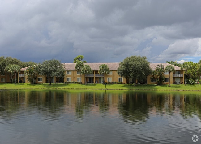
3930 Max Pl, Boynton Beach, FL 33436


Property Detail
3930 Max Pl
00-43-45-18-20-003-0000
GATEWAY APARTMENTS TRS C K/A RESIDENTIAL & D K/A OPEN SPACE
Multifamilydwelling
PALM BEACH
PUD
Florida
AE The base floodplain where base flood elevations are provided. AE Zones are now used on new format FIRMs instead of A1-A30 Zones.
24.14 AC
2024
Outer Boynton Beach
2025
South Florida
005813
West Palm Beach-Boca Raton-Delray Beach, FL
403,863 SF
NEARBY LISTINGS FOR SALE OR LEASE
DEMOGRAPHICS near 3930 Max Pl
1 mile
3 mile
5 mile
2025 Total Population
18,380
131,984
307,315
2030 Population
19,290
139,020
324,664
Pop Growth 2025-2030
+ 4.95%
+ 5.33%
+ 5.65%
Average Age
44
43
45
2025 Total Households
7,640
52,513
123,517
HH Growth 2025-2030
+ 4.80%
+ 5.03%
+ 5.48%
Median Household Inc
$71,368
$79,713
$84,644
Avg Household Size
2.30
2.40
2.40
2025 Avg HH Vehicles
2.00
2.00
2.00
Median Home Value
$342,920
$375,447
$425,284
Median Year Built
1990
1987
1988
Nearby Places
Map Layers
Map Styles
 Street
 Aerial
Layers
 Traffic
 Biking
Places
Listings with unknown addresses are not visible on the map
- Restaurants
- Banks
- Shops
- Fitness
- Groceries
PUBLIC TRANSPORTATION
COMMUTER RAIL
Boynton Beach Station (Mangonia Park - Miami Airport - Tri-Rail)
Drive
Walk
Distance
Boynton Beach Station (Mangonia Park - Miami Airport - Tri-Rail)
6 min
2.5 mi
Lake Worth Beach Station (Mangonia Park - Miami Airport - Tri-Rail)
Drive
Walk
Distance
Lake Worth Beach Station (Mangonia Park - Miami Airport - Tri-Rail)
13 min
7.2 mi
AIRPORT
Palm Beach International
Drive
Walk
Distance
Palm Beach International
21 min
13.9 mi
Freight Ports
Port of Palm Beach
Drive
Walk
Distance
Port of Palm Beach
31 min
19.3 mi
Nearby Properties
Address
Land Use
TOTAL SIZE
Lot Size
Zoning
Address
Land Use
TOTAL SIZE
Lot Size
Zoning
514,687 SF
19.38 AC
SMU
Address
Land Use
TOTAL SIZE
Lot Size
Zoning
525,037 SF
25.65 AC
PUD
Address
Land Use
TOTAL SIZE
Lot Size
Zoning
1,028,686 SF
63.78 AC
PID
Address
Land Use
TOTAL SIZE
Lot Size
Zoning
436,808 SF
15.03 AC
MUPD
Address
Land Use
TOTAL SIZE
Lot Size
Zoning
391,475 SF
13.19 AC
SMU
Address
Land Use
TOTAL SIZE
Lot Size
Zoning
506,248 SF
34.87 AC
RS
Address
Land Use
TOTAL SIZE
Lot Size
Zoning
405,470 SF
36.24 AC
AR
Address
Land Use
TOTAL SIZE
Lot Size
Zoning
441,081 SF
20.08 AC
PUD
Address
Land Use
TOTAL SIZE
Lot Size
Zoning
440,818 SF
47.57 AC
RS
Address
Land Use
TOTAL SIZE
Lot Size
Zoning
429,061 SF
40.80 AC
PUD
Address
Land Use
TOTAL SIZE
Lot Size
Zoning
340,811 SF
49.49 AC
PID
Address
Land Use
TOTAL SIZE
Lot Size
Zoning
443,576 SF
92.86 AC
PO
Address
Land Use
TOTAL SIZE
Lot Size
Zoning
353,007 SF
33.60 AC
RS
Address
Land Use
TOTAL SIZE
Lot Size
Zoning
437,380 SF
18.05 AC
PID
Address
Land Use
TOTAL SIZE
Lot Size
Zoning
303,078 SF
19.62 AC
PUD
Address
Land Use
TOTAL SIZE
Lot Size
Zoning
267,923 SF
13.27 AC
AR
Address
Land Use
TOTAL SIZE
Lot Size
Zoning
276,168 SF
17.42 AC
AR
Address
Land Use
TOTAL SIZE
Lot Size
Zoning
259,857 SF
14.18 AC
PUD
Address
Land Use
TOTAL SIZE
Lot Size
Zoning
346,777 SF
15.91 AC
PUD
Address
Land Use
TOTAL SIZE
Lot Size
Zoning
278,460 SF
21.24 AC
PUD
Address
Land Use
TOTAL SIZE
Lot Size
Zoning
381,807 SF
3.98 AC
SMU
Address
Land Use
TOTAL SIZE
Lot Size
Zoning
296,278 SF
13.05 AC
PUD
Address
Land Use
TOTAL SIZE
Lot Size
Zoning
334,014 SF
3.35 AC
SMU
Address
Land Use
TOTAL SIZE
Lot Size
Zoning
256,459 SF
12.24 AC
PUD
Address
Land Use
TOTAL SIZE
Lot Size
Zoning
285,837 SF
14.86 AC
PUD
Address
Land Use
TOTAL SIZE
Lot Size
Zoning
214,095 SF
7.67 AC
PUD
Address
Land Use
TOTAL SIZE
Lot Size
Zoning
211,944 SF
22.76 AC
PCD
Address
Land Use
TOTAL SIZE
Lot Size
Zoning
476,774 SF
38.76 AC
RM
Address
Land Use
TOTAL SIZE
Lot Size
Zoning
143,959 SF
70.47 AC
IPF
The World's #1 Commercial Real Estate Marketplace
Connect with us
© 2026 CoStar Group
The information above has been obtained from sources believed reliable. While we do not doubt its accuracy we have not verified it and make no guarantee, warranty or representation about it. It is your responsibility to independently confirm its accuracy and completeness. Any projections, opinions, assumptions, or estimates used are for example only and do not represent the current or future performance of the property. The value of this transaction to you depends on tax and other factors which should be evaluated by your tax, financial, and legal advisors. You and your advisors should conduct a careful, independent investigation of the property to determine to your satisfaction the suitability of the property for your needs.