Property Record
3933 S Brooks Rd, Muskegon, MI 49444

NEARBY LISTINGS FOR SALE OR LEASE
-
-
View all Muskegon listings for sale on LoopNet.com
Property Detail
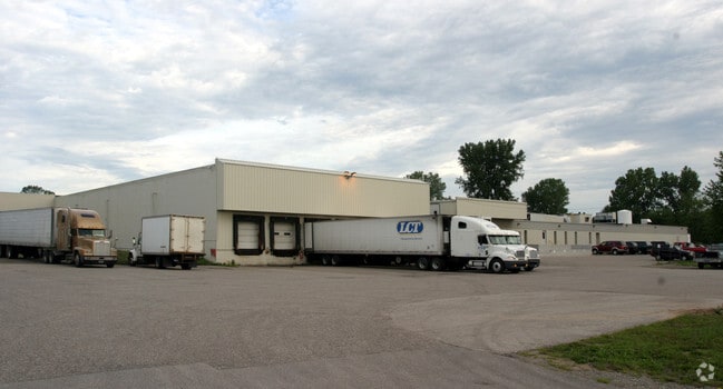
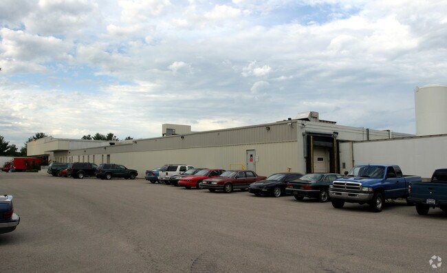
3933 S Brooks Rd
15-112-400-0006-00
Orth
Industrialgeneral
STR: S605 FT E1980 N2SE4 S12T09NR16W
X
Muskegon
26121C0295E
Michigan
2024
29.67 AC
2025
Eastern Muskegon County
002702
West Michigan
81,537 SF
Muskegon, MI
DEMOGRAPHICS near 3933 S Brooks Rd
1 Mile
3 Mile
5 Mile
2024 Total Population
1,604
13,726
55,521
2029 Population
1,590
13,697
55,909
Pop Growth 2024-2029
(0.87%)
(0.21%)
+ 0.70%
Average Age
40
41
40
2024 Total Households
612
5,272
20,516
HH Growth 2024-2029
(0.82%)
(0.21%)
+ 0.72%
Median Household Inc
$53,289
$58,505
$50,823
Avg Household Size
2.60
2.50
2.50
2024 Avg HH Vehicles
2.00
2.00
2.00
Median Home Value
$156,782
$149,929
$141,442
Median Year Built
1968
1974
1971
Nearby Places
Map Layers
Map Styles
 Street
 Aerial
- Restaurants
- Banks
- Shops
- Fitness
- Groceries
Nearby Properties
Address
Land Use
TOTAL SIZE
Lot Size
Zoning
Address
Land Use
TOTAL SIZE
Lot Size
Zoning
129,264 SF
R
Address
Land Use
TOTAL SIZE
Lot Size
Zoning
367,111 SF
80.50 AC
I2
Address
Land Use
TOTAL SIZE
Lot Size
Zoning
2,466 SF
95.29 AC
RMH
Address
Land Use
TOTAL SIZE
Lot Size
Zoning
143,193 SF
13.82 AC
SC-1
Address
Land Use
TOTAL SIZE
Lot Size
Zoning
378,727 SF
44.76 AC
B-2
Address
Land Use
TOTAL SIZE
Lot Size
Zoning
38,563 SF
B-3
Address
Land Use
TOTAL SIZE
Lot Size
Zoning
71,360 SF
8.27 AC
B-3
Address
Land Use
TOTAL SIZE
Lot Size
Zoning
60,762 SF
4.61 AC
PUD
Address
Land Use
TOTAL SIZE
Lot Size
Zoning
31,602 SF
5.86 AC
I-2
Address
Land Use
TOTAL SIZE
Lot Size
Zoning
100.29 AC
R4
Address
Land Use
TOTAL SIZE
Lot Size
Zoning
96,209 SF
11.41 AC
I
Address
Land Use
TOTAL SIZE
Lot Size
Zoning
226,353 SF
6.44 AC
I2
Address
Land Use
TOTAL SIZE
Lot Size
Zoning
167,290 SF
33.43 AC
B-3
Address
Land Use
TOTAL SIZE
Lot Size
Zoning
32,797 SF
B-3
Address
Land Use
TOTAL SIZE
Lot Size
Zoning
105,780 SF
9.98 AC
I-2
Address
Land Use
TOTAL SIZE
Lot Size
Zoning
89,492 SF
15.59 AC
I-2
Address
Land Use
TOTAL SIZE
Lot Size
Zoning
2,240 SF
40.57 AC
RMH
Address
Land Use
TOTAL SIZE
Lot Size
Zoning
70,915 SF
10.01 AC
I-2
Address
Land Use
TOTAL SIZE
Lot Size
Zoning
1,200 SF
150.19 AC
MLTPZ
Address
Land Use
TOTAL SIZE
Lot Size
Zoning
69,032 SF
3.70 AC
B-3
Address
Land Use
TOTAL SIZE
Lot Size
Zoning
27,637 SF
2.96 AC
PUD
Address
Land Use
TOTAL SIZE
Lot Size
Zoning
378,727 SF
60.59 AC
B-2
Address
Land Use
TOTAL SIZE
Lot Size
Zoning
2,574 SF
8.80 AC
PUD
Address
Land Use
TOTAL SIZE
Lot Size
Zoning
40 AC
MHP
Address
Land Use
TOTAL SIZE
Lot Size
Zoning
46,202 SF
Address
Land Use
TOTAL SIZE
Lot Size
Zoning
69,797 SF
R1
Address
Land Use
TOTAL SIZE
Lot Size
Zoning
85,480 SF
17.90 AC
M-1
Address
Land Use
TOTAL SIZE
Lot Size
Zoning
66,322 SF
4.40 AC
I-2
Address
Land Use
TOTAL SIZE
Lot Size
Zoning
25,960 SF
15.59 AC
The World's #1 Commercial Real Estate Marketplace
Connect with us
© 2026 CoStar Group
The information above has been obtained from sources believed reliable. While we do not doubt its accuracy we have not verified it and make no guarantee, warranty or representation about it. It is your responsibility to independently confirm its accuracy and completeness. Any projections, opinions, assumptions, or estimates used are for example only and do not represent the current or future performance of the property. The value of this transaction to you depends on tax and other factors which should be evaluated by your tax, financial, and legal advisors. You and your advisors should conduct a careful, independent investigation of the property to determine to your satisfaction the suitability of the property for your needs.