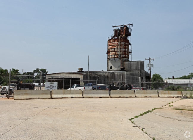
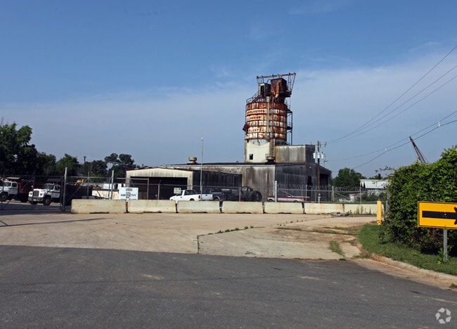
Property Record
3934 Raleigh St, Charlotte, NC 28206

NEARBY LISTINGS FOR SALE OR LEASE
Property Detail
3934 Raleigh St
091-072-02
SEE 9107202
Multifamilydwelling
Mecklenburg
X
North Carolina
3710456500K
2
0
4.59 AC
2025
Sugar Creek
005301
Charlotte
10,392 SF
Charlotte-Concord-Gastonia, NC-SC
DEMOGRAPHICS near 3934 Raleigh St
1 Mile
3 Mile
5 Mile
2024 Total Population
13,044
108,988
284,938
2029 Population
14,155
116,641
303,657
Pop Growth 2024-2029
+ 8.52%
+ 7.02%
+ 6.57%
Average Age
35
36
36
2024 Total Households
6,036
47,563
124,529
HH Growth 2024-2029
+ 8.48%
+ 7.17%
+ 6.76%
Median Household Inc
$60,684
$55,687
$62,107
Avg Household Size
2.10
2.20
2.20
2024 Avg HH Vehicles
1.00
1.00
2.00
Median Home Value
$426,114
$311,020
$296,761
Median Year Built
1992
1985
1991
Nearby Places
Map Layers
Map Styles
 Street
 Aerial
- Restaurants
- Banks
- Shops
- Fitness
- Groceries
PUBLIC TRANSPORTATION
COMMUTER RAIL
DRIVE
WALK
Distance
5 min
2.2 mi
AIRPORT
Charlotte/Douglas International
DRIVE
WALK
Distance
Charlotte/Douglas International
24 min
11.1 mi
Concord-Padgett Regional
DRIVE
WALK
Distance
Concord-Padgett Regional
20 min
12.4 mi
Nearby Properties
Address
Land Use
TOTAL SIZE
Lot Size
Zoning
Address
Land Use
TOTAL SIZE
Lot Size
Zoning
1,097,257 SF
2.34 AC
UMUD-O
Address
Land Use
TOTAL SIZE
Lot Size
Zoning
955,273 SF
1.83 AC
Address
Land Use
TOTAL SIZE
Lot Size
Zoning
1,052,203 SF
2.17 AC
Address
Land Use
TOTAL SIZE
Lot Size
Zoning
733,107 SF
3.48 AC
UMUD
Address
Land Use
TOTAL SIZE
Lot Size
Zoning
729,709 SF
10.67 AC
B2
Address
Land Use
TOTAL SIZE
Lot Size
Zoning
690,862 SF
136.80 AC
R17MF
Address
Land Use
TOTAL SIZE
Lot Size
Zoning
447,803 SF
0.27 AC
Address
Land Use
TOTAL SIZE
Lot Size
Zoning
643,185 SF
2.34 AC
UMUD
Address
Land Use
TOTAL SIZE
Lot Size
Zoning
533,477 SF
3.15 AC
I2
Address
Land Use
TOTAL SIZE
Lot Size
Zoning
499,729 SF
3.90 AC
I2
Address
Land Use
TOTAL SIZE
Lot Size
Zoning
584,543 SF
4.42 AC
I2
Address
Land Use
TOTAL SIZE
Lot Size
Zoning
335,338 SF
3.37 AC
B1
Address
Land Use
TOTAL SIZE
Lot Size
Zoning
285,032 SF
9.43 AC
UR2CD
Address
Land Use
TOTAL SIZE
Lot Size
Zoning
500,761 SF
3.18 AC
TOD-CC
Address
Land Use
TOTAL SIZE
Lot Size
Zoning
388,364 SF
3.26 AC
I2
Address
Land Use
TOTAL SIZE
Lot Size
Zoning
603,789 SF
1.74 AC
Address
Land Use
TOTAL SIZE
Lot Size
Zoning
437,989 SF
4.30 AC
B2
Address
Land Use
TOTAL SIZE
Lot Size
Zoning
465,134 SF
3.65 AC
I2
Address
Land Use
TOTAL SIZE
Lot Size
Zoning
337,775 SF
0.67 AC
UMUD
Address
Land Use
TOTAL SIZE
Lot Size
Zoning
374,360 SF
9.89 AC
MUDDO
Address
Land Use
TOTAL SIZE
Lot Size
Zoning
499,296 SF
6.04 AC
Address
Land Use
TOTAL SIZE
Lot Size
Zoning
347,636 SF
2.38 AC
B2
Address
Land Use
TOTAL SIZE
Lot Size
Zoning
440,772 SF
3.46 AC
UMUDO
Address
Land Use
TOTAL SIZE
Lot Size
Zoning
373,451 SF
3.06 AC
I2
Address
Land Use
TOTAL SIZE
Lot Size
Zoning
450,292 SF
28.95 AC
R22MF
Address
Land Use
TOTAL SIZE
Lot Size
Zoning
378,072 SF
2.11 AC
TOD-NC
Address
Land Use
TOTAL SIZE
Lot Size
Zoning
426,404 SF
4.20 AC
Address
Land Use
TOTAL SIZE
Lot Size
Zoning
436,898 SF
3.20 AC
Address
Land Use
TOTAL SIZE
Lot Size
Zoning
344,404 SF
3.57 AC
MUDDO
Address
Land Use
TOTAL SIZE
Lot Size
Zoning
402,661 SF
2.91 AC
I2
The World's #1 Commercial Real Estate Marketplace
Connect with us
© 2025 CoStar Group
The information above has been obtained from sources believed reliable. While we do not doubt its accuracy we have not verified it and make no guarantee, warranty or representation about it. It is your responsibility to independently confirm its accuracy and completeness. Any projections, opinions, assumptions, or estimates used are for example only and do not represent the current or future performance of the property. The value of this transaction to you depends on tax and other factors which should be evaluated by your tax, financial, and legal advisors. You and your advisors should conduct a careful, independent investigation of the property to determine to your satisfaction the suitability of the property for your needs.