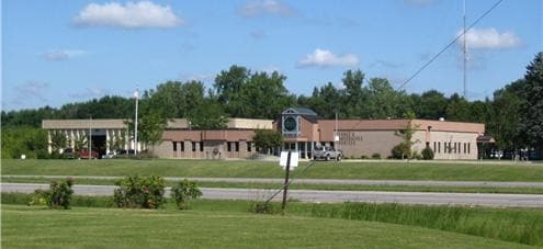
Property Record
3935 Highway 14 E, Rochester, MN 55904
NEARBY LISTINGS FOR SALE OR LEASE
Property Detail
3935 Highway 14 E
63.05.41.050597
City Lands 106-13-05
Privateschool
SECT-05 TWP-106 RANGE-013 CITY LANDS 106-13-05 19.80 AC ALL TH PT E12 SE14 LYING N OF CEN LINE TH 14 SEC 5 106-13
X
Olmsted
27109C0169E
Minnesota
2025
17.08 AC
2024
Rochester
000901
Other Market Areas
53,530 SF
Rochester, MN
DEMOGRAPHICS near 3935 Highway 14 E
1 Mile
3 Mile
5 Mile
2024 Total Population
2,864
33,277
78,465
2029 Population
2,955
34,249
80,628
Pop Growth 2024-2029
+ 3.18%
+ 2.92%
+ 2.76%
Average Age
36
38
40
2024 Total Households
1,068
13,068
33,251
HH Growth 2024-2029
+ 3.18%
+ 2.81%
+ 2.81%
Median Household Inc
$104,556
$70,586
$75,222
Avg Household Size
2.60
2.40
2.20
2024 Avg HH Vehicles
2.00
2.00
2.00
Median Home Value
$280,611
$242,627
$269,390
Median Year Built
2003
1977
1979
Nearby Places
Map Layers
Map Styles
 Street
 Aerial
- Restaurants
- Banks
- Shops
- Fitness
- Groceries
PUBLIC TRANSPORTATION
AIRPORT
Rochester International
DRIVE
WALK
Distance
Rochester International
18 min
10.9 mi
Nearby Properties
Address
Land Use
TOTAL SIZE
Lot Size
Zoning
Address
Land Use
TOTAL SIZE
Lot Size
Zoning
454,243 SF
3.92 AC
Address
Land Use
TOTAL SIZE
Lot Size
Zoning
443,223 SF
4.44 AC
Address
Land Use
TOTAL SIZE
Lot Size
Zoning
45.84 AC
Address
Land Use
TOTAL SIZE
Lot Size
Zoning
1,836 SF
80.90 AC
Address
Land Use
TOTAL SIZE
Lot Size
Zoning
576 SF
48.26 AC
Address
Land Use
TOTAL SIZE
Lot Size
Zoning
76,338 SF
7.90 AC
Address
Land Use
TOTAL SIZE
Lot Size
Zoning
210,691 SF
34.19 AC
Address
Land Use
TOTAL SIZE
Lot Size
Zoning
61,632 SF
53.25 AC
Address
Land Use
TOTAL SIZE
Lot Size
Zoning
9.01 AC
Address
Land Use
TOTAL SIZE
Lot Size
Zoning
47,741 SF
16.21 AC
Address
Land Use
TOTAL SIZE
Lot Size
Zoning
176,131 SF
1.16 AC
Address
Land Use
TOTAL SIZE
Lot Size
Zoning
182,517 SF
12.64 AC
Address
Land Use
TOTAL SIZE
Lot Size
Zoning
133,474 SF
22.12 AC
Address
Land Use
TOTAL SIZE
Lot Size
Zoning
15,930 SF
2.99 AC
Address
Land Use
TOTAL SIZE
Lot Size
Zoning
82,628 SF
4.95 AC
Address
Land Use
TOTAL SIZE
Lot Size
Zoning
Address
Land Use
TOTAL SIZE
Lot Size
Zoning
126,248 SF
0.62 AC
Address
Land Use
TOTAL SIZE
Lot Size
Zoning
2.44 AC
Address
Land Use
TOTAL SIZE
Lot Size
Zoning
88,634 SF
9.42 AC
Address
Land Use
TOTAL SIZE
Lot Size
Zoning
82,509 SF
4.41 AC
Address
Land Use
TOTAL SIZE
Lot Size
Zoning
91,087 SF
14.95 AC
Address
Land Use
TOTAL SIZE
Lot Size
Zoning
72,284 SF
1.12 AC
Address
Land Use
TOTAL SIZE
Lot Size
Zoning
102,676 SF
10.10 AC
Address
Land Use
TOTAL SIZE
Lot Size
Zoning
114,803 SF
1.03 AC
Address
Land Use
TOTAL SIZE
Lot Size
Zoning
44,060 SF
34.60 AC
Address
Land Use
TOTAL SIZE
Lot Size
Zoning
21,102 SF
2 AC
Address
Land Use
TOTAL SIZE
Lot Size
Zoning
43,288 SF
0.67 AC
Address
Land Use
TOTAL SIZE
Lot Size
Zoning
5.32 AC
Address
Land Use
TOTAL SIZE
Lot Size
Zoning
89,306 SF
7.97 AC
Address
Land Use
TOTAL SIZE
Lot Size
Zoning
69,936 SF
0.46 AC
The World's #1 Commercial Real Estate Marketplace
Connect with us
© 2025 CoStar Group
The information above has been obtained from sources believed reliable. While we do not doubt its accuracy we have not verified it and make no guarantee, warranty or representation about it. It is your responsibility to independently confirm its accuracy and completeness. Any projections, opinions, assumptions, or estimates used are for example only and do not represent the current or future performance of the property. The value of this transaction to you depends on tax and other factors which should be evaluated by your tax, financial, and legal advisors. You and your advisors should conduct a careful, independent investigation of the property to determine to your satisfaction the suitability of the property for your needs.