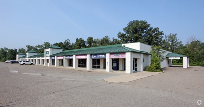
Property Record
3937 Northpointe Dr, Zanesville, OH 43701

NEARBY LISTINGS FOR SALE OR LEASE
Property Detail
3937 Northpointe Dr
Zanesville, OH
Sibleys Subdivision
86-34-01-01-019
R 8 TP 1 QT 1 PT LOT 6 SIBLEYS 2.695A
Communitycenter
Muskingum
X
Ohio
39119C0285G
6
2024
2.70 AC
2024
Ohio South Area
911602
Other Market Areas
24,576 SF
DEMOGRAPHICS near 3937 Northpointe Dr
1 Mile
3 Mile
5 Mile
2024 Total Population
2,715
19,208
37,712
2029 Population
2,690
19,169
37,866
Pop Growth 2024-2029
(0.92%)
(0.20%)
+ 0.41%
Average Age
49
43
41
2024 Total Households
1,415
8,726
16,030
HH Growth 2024-2029
(1.06%)
(0.23%)
+ 0.32%
Median Household Inc
$57,015
$55,422
$47,815
Avg Household Size
1.90
2.10
2.30
2024 Avg HH Vehicles
2.00
2.00
2.00
Median Home Value
$180,678
$166,776
$147,963
Median Year Built
1991
1972
1965
Nearby Places
Map Layers
Map Styles
 Street
 Aerial
- Restaurants
- Banks
- Shops
- Fitness
- Groceries
SALE & LEASE HISTORY
LISTING DATE
SALE/LEASE

Sep 25, 2016
For Lease
Sep 24, 2016
For Sale
Sep 04, 2024
For Lease
Nearby Properties
Address
Land Use
TOTAL SIZE
Lot Size
Zoning
Address
Land Use
TOTAL SIZE
Lot Size
Zoning
219,630 SF
9.80 AC
O2
Address
Land Use
TOTAL SIZE
Lot Size
Zoning
41,718 SF
165.54 AC
Address
Land Use
TOTAL SIZE
Lot Size
Zoning
149,148 SF
61.69 AC
RS2
Address
Land Use
TOTAL SIZE
Lot Size
Zoning
0.81 AC
Address
Land Use
TOTAL SIZE
Lot Size
Zoning
119,150 SF
9.13 AC
C2
Address
Land Use
TOTAL SIZE
Lot Size
Zoning
121,905 SF
10.21 AC
Address
Land Use
TOTAL SIZE
Lot Size
Zoning
14,968 SF
15.87 AC
C2
Address
Land Use
TOTAL SIZE
Lot Size
Zoning
1,370 SF
691.53 AC
Address
Land Use
TOTAL SIZE
Lot Size
Zoning
4,896 SF
21.31 AC
RM2
Address
Land Use
TOTAL SIZE
Lot Size
Zoning
224,851 SF
28.78 AC
I1
Address
Land Use
TOTAL SIZE
Lot Size
Zoning
135,726 SF
16.84 AC
C4
Address
Land Use
TOTAL SIZE
Lot Size
Zoning
317,584 SF
49.15 AC
C2
Address
Land Use
TOTAL SIZE
Lot Size
Zoning
51,332 SF
5.50 AC
C4
Address
Land Use
TOTAL SIZE
Lot Size
Zoning
197,951 SF
22.47 AC
C2
Address
Land Use
TOTAL SIZE
Lot Size
Zoning
42,255 SF
6.51 AC
Address
Land Use
TOTAL SIZE
Lot Size
Zoning
125,135 SF
13.85 AC
C2
Address
Land Use
TOTAL SIZE
Lot Size
Zoning
42,000 SF
10.08 AC
O2
Address
Land Use
TOTAL SIZE
Lot Size
Zoning
58,396 SF
9.83 AC
Address
Land Use
TOTAL SIZE
Lot Size
Zoning
64,732 SF
6.37 AC
RM1
Address
Land Use
TOTAL SIZE
Lot Size
Zoning
104,280 SF
9.77 AC
C4
Address
Land Use
TOTAL SIZE
Lot Size
Zoning
3,186 SF
11.07 AC
O-2
Address
Land Use
TOTAL SIZE
Lot Size
Zoning
6,320 SF
13.49 AC
PUD
Address
Land Use
TOTAL SIZE
Lot Size
Zoning
54,131 SF
10.55 AC
O2
Address
Land Use
TOTAL SIZE
Lot Size
Zoning
48,002 SF
7.13 AC
Address
Land Use
TOTAL SIZE
Lot Size
Zoning
10,469 SF
8.63 AC
RM1
Address
Land Use
TOTAL SIZE
Lot Size
Zoning
87,834 SF
7.21 AC
C4
Address
Land Use
TOTAL SIZE
Lot Size
Zoning
48.72 AC
C4
Address
Land Use
TOTAL SIZE
Lot Size
Zoning
73,080 SF
3.75 AC
C4
Address
Land Use
TOTAL SIZE
Lot Size
Zoning
28,906 SF
4.75 AC
COMM
Address
Land Use
TOTAL SIZE
Lot Size
Zoning
17,180 SF
5.28 AC
PUD
The World's #1 Commercial Real Estate Marketplace
Connect with us
© 2025 CoStar Group
The information above has been obtained from sources believed reliable. While we do not doubt its accuracy we have not verified it and make no guarantee, warranty or representation about it. It is your responsibility to independently confirm its accuracy and completeness. Any projections, opinions, assumptions, or estimates used are for example only and do not represent the current or future performance of the property. The value of this transaction to you depends on tax and other factors which should be evaluated by your tax, financial, and legal advisors. You and your advisors should conduct a careful, independent investigation of the property to determine to your satisfaction the suitability of the property for your needs.