Property Record
24001 Clay Rd, Katy, TX 77493


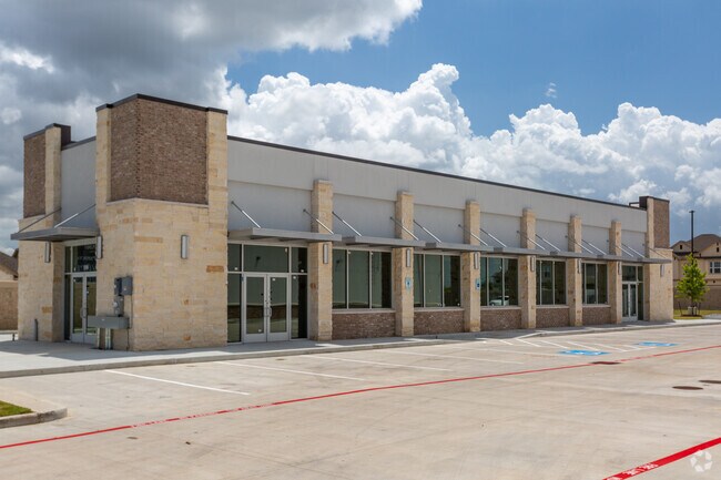
Property Detail
24001 Clay Rd
0471120000003
TR 3A ABST 1339 M L JONES
Servicestationmarket
HARRIS
B and X Area of moderate flood hazard, usually the area between the limits of the 100-year and 500-year floods.
Texas
2024
2.15 AC
2025
Far Katy North
542902
Houston
9,092 SF
Houston-Pasadena-The Woodlands, TX
NEARBY LISTINGS FOR SALE OR LEASE
DEMOGRAPHICS near 24001 Clay Rd
1 mile
3 mile
5 mile
2024 Total Population
13,345
81,136
206,470
2029 Population
14,681
86,108
218,536
Pop Growth 2024-2029
+ 10.01%
+ 6.13%
+ 5.84%
Average Age
31
34
35
2024 Total Households
3,942
25,257
66,051
HH Growth 2024-2029
+ 9.94%
+ 5.93%
+ 5.75%
Median Household Inc
$112,973
$100,557
$86,333
Avg Household Size
3.30
3.20
3.10
2024 Avg HH Vehicles
2.00
2.00
2.00
Median Home Value
$287,958
$256,698
$243,565
Median Year Built
2011
2010
2008
Nearby Places
Map Layers
Map Styles
 Street
 Aerial
Transit
 Traffic
 Biking
Places
Listings with unknown addresses are not visible on the map
- Restaurants
- Banks
- Shops
- Fitness
- Groceries
PUBLIC TRANSPORTATION
AIRPORT
George Bush Intcntl/Houston
Drive
Walk
Distance
George Bush Intcntl/Houston
51 min
37.5 mi
Freight Ports
Port of Houston
Drive
Walk
Distance
Port of Houston
56 min
39.5 mi
SALE & LEASE HISTORY
LISTING DATE
SALE/LEASE

May 24, 2021
For Lease
Aug 17, 2018
For Lease
Aug 15, 2019
For Lease
Nearby Properties
Address
Land Use
TOTAL SIZE
Lot Size
Zoning
Address
Land Use
TOTAL SIZE
Lot Size
Zoning
807,360 SF
54.15 AC
Address
Land Use
TOTAL SIZE
Lot Size
Zoning
765,465 SF
63.65 AC
Address
Land Use
TOTAL SIZE
Lot Size
Zoning
838,700 SF
36.68 AC
Address
Land Use
TOTAL SIZE
Lot Size
Zoning
329,918 SF
19.18 AC
Address
Land Use
TOTAL SIZE
Lot Size
Zoning
380,278 SF
12.61 AC
Address
Land Use
TOTAL SIZE
Lot Size
Zoning
339,835 SF
12.09 AC
Address
Land Use
TOTAL SIZE
Lot Size
Zoning
327,699 SF
11.64 AC
Address
Land Use
TOTAL SIZE
Lot Size
Zoning
319,341 SF
14.88 AC
Address
Land Use
TOTAL SIZE
Lot Size
Zoning
324,201 SF
12.39 AC
Address
Land Use
TOTAL SIZE
Lot Size
Zoning
290,973 SF
15 AC
Address
Land Use
TOTAL SIZE
Lot Size
Zoning
347,834 SF
15.25 AC
Address
Land Use
TOTAL SIZE
Lot Size
Zoning
395,495 SF
13.83 AC
Address
Land Use
TOTAL SIZE
Lot Size
Zoning
270,728 SF
9.45 AC
Address
Land Use
TOTAL SIZE
Lot Size
Zoning
322,774 SF
9.19 AC
Address
Land Use
TOTAL SIZE
Lot Size
Zoning
276,470 SF
8.88 AC
Address
Land Use
TOTAL SIZE
Lot Size
Zoning
292,645 SF
12.71 AC
Address
Land Use
TOTAL SIZE
Lot Size
Zoning
439,808 SF
23.75 AC
Address
Land Use
TOTAL SIZE
Lot Size
Zoning
290,607 SF
14.50 AC
Address
Land Use
TOTAL SIZE
Lot Size
Zoning
321,565 SF
11.47 AC
Address
Land Use
TOTAL SIZE
Lot Size
Zoning
385,744 SF
25.88 AC
Address
Land Use
TOTAL SIZE
Lot Size
Zoning
375,152 SF
19.57 AC
Address
Land Use
TOTAL SIZE
Lot Size
Zoning
262,943 SF
11.51 AC
Address
Land Use
TOTAL SIZE
Lot Size
Zoning
131,544 SF
19.04 AC
Address
Land Use
TOTAL SIZE
Lot Size
Zoning
189,260 SF
25.24 AC
Address
Land Use
TOTAL SIZE
Lot Size
Zoning
195,501 SF
7.79 AC
Address
Land Use
TOTAL SIZE
Lot Size
Zoning
151,385 SF
8.58 AC
Address
Land Use
TOTAL SIZE
Lot Size
Zoning
226,076 SF
10.37 AC
Address
Land Use
TOTAL SIZE
Lot Size
Zoning
270,000 SF
14.25 AC
Address
Land Use
TOTAL SIZE
Lot Size
Zoning
122,133 SF
13.46 AC
Address
Land Use
TOTAL SIZE
Lot Size
Zoning
123,466 SF
11.37 AC
The World's #1 Commercial Real Estate Marketplace
Connect with us
© 2026 CoStar Group
The information above has been obtained from sources believed reliable. While we do not doubt its accuracy we have not verified it and make no guarantee, warranty or representation about it. It is your responsibility to independently confirm its accuracy and completeness. Any projections, opinions, assumptions, or estimates used are for example only and do not represent the current or future performance of the property. The value of this transaction to you depends on tax and other factors which should be evaluated by your tax, financial, and legal advisors. You and your advisors should conduct a careful, independent investigation of the property to determine to your satisfaction the suitability of the property for your needs.