Property Record
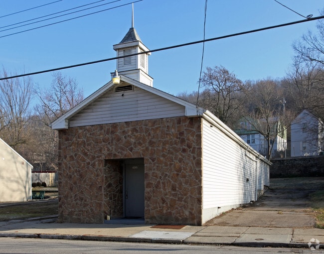
3938 Eastern Ave, Cincinnati, OH 45226

NEARBY LISTINGS FOR SALE OR LEASE
Property Detail
3938 Eastern Ave
Cincinnati, OH-KY-IN
Longworth Tusculum Sub
027-0006-0040-90
N S EASTERN AVE 25.50 X 100 IRR PT LOT 40 LONGWORTH TUSCULUM SUB
Commercialnec
Hamilton
X
Ohio
39061C0356G
40
2025
0.06 AC
2025
Fairfax/Mt. Lookout
026600
Cincinnati/Dayton
1,600 SF
DEMOGRAPHICS near 3938 Eastern Ave
1 Mile
3 Mile
5 Mile
2024 Total Population
4,170
75,881
269,825
2029 Population
4,145
75,866
271,082
Pop Growth 2024-2029
(0.60%)
(0.02%)
+ 0.47%
Average Age
39
40
38
2024 Total Households
2,024
35,490
121,919
HH Growth 2024-2029
(0.74%)
(0.22%)
+ 0.49%
Median Household Inc
$103,872
$87,908
$65,137
Avg Household Size
2.00
2.10
2.00
2024 Avg HH Vehicles
2.00
2.00
2.00
Median Home Value
$443,333
$300,482
$255,831
Median Year Built
1963
1949
1950
Nearby Places
Map Layers
Map Styles
 Street
 Aerial
- Restaurants
- Banks
- Shops
- Fitness
- Groceries
PUBLIC TRANSPORTATION
AIRPORT
Cincinnati/Northern Kentucky International
DRIVE
WALK
Distance
Cincinnati/Northern Kentucky International
24 min
17.6 mi
Freight Ports
Virginia Port Authority - Richmond
DRIVE
WALK
Distance
Virginia Port Authority - Richmond
1 min
397.0 mi
SALE & LEASE HISTORY
LISTING DATE
SALE/LEASE

Jan 23, 2017
For Lease
Nearby Properties
Address
Land Use
TOTAL SIZE
Lot Size
Zoning
Address
Land Use
TOTAL SIZE
Lot Size
Zoning
13.80 AC
Address
Land Use
TOTAL SIZE
Lot Size
Zoning
411,750 SF
21.25 AC
Address
Land Use
TOTAL SIZE
Lot Size
Zoning
27.30 AC
M2
Address
Land Use
TOTAL SIZE
Lot Size
Zoning
153,312 SF
4 AC
Address
Land Use
TOTAL SIZE
Lot Size
Zoning
11.68 AC
Address
Land Use
TOTAL SIZE
Lot Size
Zoning
165,016 SF
15.23 AC
Address
Land Use
TOTAL SIZE
Lot Size
Zoning
12,150 SF
10.02 AC
Address
Land Use
TOTAL SIZE
Lot Size
Zoning
26,453 SF
19.91 AC
M2
Address
Land Use
TOTAL SIZE
Lot Size
Zoning
60,772 SF
0.78 AC
Address
Land Use
TOTAL SIZE
Lot Size
Zoning
148,748 SF
24.90 AC
CGA
Address
Land Use
TOTAL SIZE
Lot Size
Zoning
3.17 AC
R2PUD
Address
Land Use
TOTAL SIZE
Lot Size
Zoning
12.46 AC
Address
Land Use
TOTAL SIZE
Lot Size
Zoning
119,574 SF
10.40 AC
Address
Land Use
TOTAL SIZE
Lot Size
Zoning
Address
Land Use
TOTAL SIZE
Lot Size
Zoning
70,541 SF
7.08 AC
Address
Land Use
TOTAL SIZE
Lot Size
Zoning
134,500 SF
9.68 AC
Address
Land Use
TOTAL SIZE
Lot Size
Zoning
109,000 SF
3.28 AC
Address
Land Use
TOTAL SIZE
Lot Size
Zoning
25,740 SF
0.07 AC
Address
Land Use
TOTAL SIZE
Lot Size
Zoning
15,892 SF
0.46 AC
Address
Land Use
TOTAL SIZE
Lot Size
Zoning
89,925 SF
1.72 AC
Address
Land Use
TOTAL SIZE
Lot Size
Zoning
83,122 SF
1.99 AC
Address
Land Use
TOTAL SIZE
Lot Size
Zoning
24,572 SF
4.70 AC
Address
Land Use
TOTAL SIZE
Lot Size
Zoning
22,188 SF
8.88 AC
Address
Land Use
TOTAL SIZE
Lot Size
Zoning
3,864 SF
0.15 AC
PD
Address
Land Use
TOTAL SIZE
Lot Size
Zoning
33,468 SF
1.04 AC
Address
Land Use
TOTAL SIZE
Lot Size
Zoning
2.59 AC
Address
Land Use
TOTAL SIZE
Lot Size
Zoning
2.17 AC
O
Address
Land Use
TOTAL SIZE
Lot Size
Zoning
9,515 SF
19.13 AC
Address
Land Use
TOTAL SIZE
Lot Size
Zoning
45,604 SF
0.64 AC
Address
Land Use
TOTAL SIZE
Lot Size
Zoning
2.20 AC
The World's #1 Commercial Real Estate Marketplace
Connect with us
© 2026 CoStar Group
The information above has been obtained from sources believed reliable. While we do not doubt its accuracy we have not verified it and make no guarantee, warranty or representation about it. It is your responsibility to independently confirm its accuracy and completeness. Any projections, opinions, assumptions, or estimates used are for example only and do not represent the current or future performance of the property. The value of this transaction to you depends on tax and other factors which should be evaluated by your tax, financial, and legal advisors. You and your advisors should conduct a careful, independent investigation of the property to determine to your satisfaction the suitability of the property for your needs.