Property Record
3939 Synott Rd, Houston, TX 77082
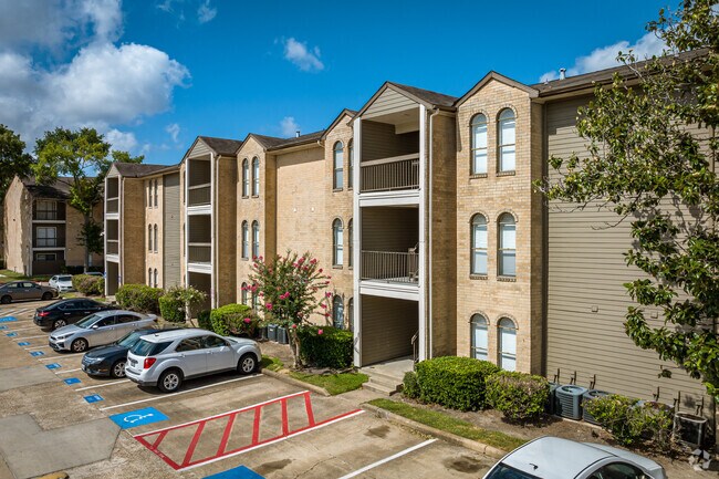


Property Detail
3939 Synott Rd
Houston-Pasadena-The Woodlands, TX
RES A & C (HARTFORD PARK APT N LTD) ASHFORD POINT SEC 2
1152040000001
HARRIS
Apartment
Texas
AE The base floodplain where base flood elevations are provided. AE Zones are now used on new format FIRMs instead of A1-A30 Zones.
d
2025
9.50 AC
2025
Briar Village
451903
Houston
281,696 SF
NEARBY LISTINGS FOR SALE OR LEASE
-
-
View all Houston listings for sale on LoopNet.com
DEMOGRAPHICS near 3939 Synott Rd
1 mile
3 mile
5 mile
2025 Total Population
22,545
204,267
506,535
2030 Population
23,859
216,752
543,470
Pop Growth 2025-2030
+ 5.83%
+ 6.11%
+ 7.29%
Average Age
38
38
37
2025 Total Households
8,072
75,606
185,246
HH Growth 2025-2030
+ 6.07%
+ 6.35%
+ 7.39%
Median Household Inc
$44,786
$60,950
$61,208
Avg Household Size
2.70
2.60
2.70
2025 Avg HH Vehicles
2.00
2.00
2.00
Median Home Value
$227,601
$258,969
$278,224
Median Year Built
1984
1987
1985
Nearby Places
Map Layers
Map Styles
 Street
 Aerial
Layers
 Traffic
 Biking
Places
Listings with unknown addresses are not visible on the map
- Restaurants
- Banks
- Shops
- Fitness
- Groceries
PUBLIC TRANSPORTATION
AIRPORT
William P Hobby
Drive
Walk
Distance
William P Hobby
43 min
26.8 mi
George Bush Intcntl/Houston
Drive
Walk
Distance
George Bush Intcntl/Houston
45 min
35.3 mi
Freight Ports
Port of Houston
Drive
Walk
Distance
Port of Houston
39 min
26.2 mi
Nearby Properties
Address
Land Use
TOTAL SIZE
Lot Size
Zoning
Address
Land Use
TOTAL SIZE
Lot Size
Zoning
1,376,776 SF
113.43 AC
Address
Land Use
TOTAL SIZE
Lot Size
Zoning
430,096 SF
18.99 AC
Address
Land Use
TOTAL SIZE
Lot Size
Zoning
638,248 SF
23.38 AC
Address
Land Use
TOTAL SIZE
Lot Size
Zoning
526,410 SF
20.43 AC
Address
Land Use
TOTAL SIZE
Lot Size
Zoning
403,650 SF
20.19 AC
Address
Land Use
TOTAL SIZE
Lot Size
Zoning
367,309 SF
14.72 AC
Address
Land Use
TOTAL SIZE
Lot Size
Zoning
488,573 SF
20.57 AC
Address
Land Use
TOTAL SIZE
Lot Size
Zoning
499,216 SF
6.30 AC
Address
Land Use
TOTAL SIZE
Lot Size
Zoning
682,312 SF
4.67 AC
Address
Land Use
TOTAL SIZE
Lot Size
Zoning
497,267 SF
24.69 AC
Address
Land Use
TOTAL SIZE
Lot Size
Zoning
380,423 SF
15.14 AC
Address
Land Use
TOTAL SIZE
Lot Size
Zoning
550,035 SF
5.77 AC
Address
Land Use
TOTAL SIZE
Lot Size
Zoning
489,192 SF
23.11 AC
Address
Land Use
TOTAL SIZE
Lot Size
Zoning
344,088 SF
13.77 AC
Address
Land Use
TOTAL SIZE
Lot Size
Zoning
362,473 SF
15.65 AC
Address
Land Use
TOTAL SIZE
Lot Size
Zoning
288,868 SF
9.37 AC
Address
Land Use
TOTAL SIZE
Lot Size
Zoning
370,358 SF
9.96 AC
Address
Land Use
TOTAL SIZE
Lot Size
Zoning
370,132 SF
9.56 AC
Address
Land Use
TOTAL SIZE
Lot Size
Zoning
421,435 SF
22.30 AC
Address
Land Use
TOTAL SIZE
Lot Size
Zoning
442,006 SF
20.06 AC
Address
Land Use
TOTAL SIZE
Lot Size
Zoning
309,704 SF
8.84 AC
Address
Land Use
TOTAL SIZE
Lot Size
Zoning
526,945 SF
23.05 AC
Address
Land Use
TOTAL SIZE
Lot Size
Zoning
325,312 SF
13.66 AC
Address
Land Use
TOTAL SIZE
Lot Size
Zoning
666,184 SF
22.45 AC
Address
Land Use
TOTAL SIZE
Lot Size
Zoning
423,596 SF
17.16 AC
Address
Land Use
TOTAL SIZE
Lot Size
Zoning
283,782 SF
11.57 AC
Address
Land Use
TOTAL SIZE
Lot Size
Zoning
323,438 SF
8.24 AC
Address
Land Use
TOTAL SIZE
Lot Size
Zoning
679,340 SF
9.63 AC
Address
Land Use
TOTAL SIZE
Lot Size
Zoning
690,119 SF
23 AC
Address
Land Use
TOTAL SIZE
Lot Size
Zoning
143,028 SF
14.95 AC
The World's #1 Commercial Real Estate Marketplace
Connect with us
© 2026 CoStar Group
The information above has been obtained from sources believed reliable. While we do not doubt its accuracy we have not verified it and make no guarantee, warranty or representation about it. It is your responsibility to independently confirm its accuracy and completeness. Any projections, opinions, assumptions, or estimates used are for example only and do not represent the current or future performance of the property. The value of this transaction to you depends on tax and other factors which should be evaluated by your tax, financial, and legal advisors. You and your advisors should conduct a careful, independent investigation of the property to determine to your satisfaction the suitability of the property for your needs.