Property Record
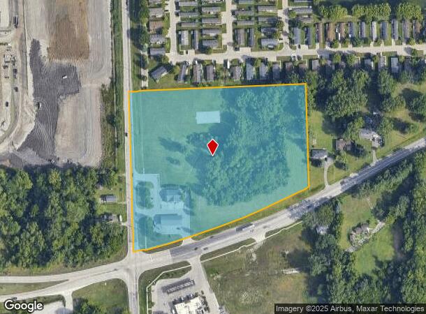
39390 Ecorse Rd, Romulus, MI 48174


NEARBY LISTINGS FOR SALE OR LEASE
Property Detail
39390 Ecorse Rd
80-026-99-0015-705
07L2C2 PT OF THE N W 1/4 OF SEC 7 DESC AS BEG S 0D 06M 30S E 394.92 FT FROM THE N W COR OF SEC 7 AND PROCEEDING TH N 88D 43M
Conveniencestore
Wayne
X
Michigan
26163C0356E
0015
2024
1.17 AC
2025
Airport District
585800
Detroit
2,940 SF
Detroit-Warren-Dearborn, MI
DEMOGRAPHICS near 39390 Ecorse Rd
1 Mile
3 Mile
5 Mile
2024 Total Population
2,591
33,988
120,288
2029 Population
2,517
32,561
115,571
Pop Growth 2024-2029
(2.86%)
(4.20%)
(3.92%)
Average Age
38
39
40
2024 Total Households
906
13,824
48,671
HH Growth 2024-2029
(2.98%)
(4.28%)
(3.94%)
Median Household Inc
$84,558
$64,750
$69,156
Avg Household Size
2.80
2.40
2.40
2024 Avg HH Vehicles
2.00
2.00
2.00
Median Home Value
$144,067
$177,196
$195,568
Median Year Built
1996
1975
1975
Nearby Places
Map Layers
Map Styles
 Street
 Aerial
- Restaurants
- Banks
- Shops
- Fitness
- Groceries
PUBLIC TRANSPORTATION
AIRPORT
Detroit Metro Wayne County
DRIVE
WALK
Distance
Detroit Metro Wayne County
13 min
9.4 mi
Windsor International
DRIVE
WALK
Distance
Windsor International
53 min
33.2 mi
Freight Ports
Port of Toledo
DRIVE
WALK
Distance
Port of Toledo
63 min
51.1 mi
SALE & LEASE HISTORY
LISTING DATE
SALE/LEASE

Sep 27, 2021
For Sale
Oct 05, 2021
For Sale
Jun 20, 2018
For Sale
Feb 13, 2018
For Sale
Nearby Properties
Address
Land Use
TOTAL SIZE
Lot Size
Zoning
Address
Land Use
TOTAL SIZE
Lot Size
Zoning
739,289 SF
238.69 AC
AG
Address
Land Use
TOTAL SIZE
Lot Size
Zoning
919,978 SF
65.96 AC
MT IND
Address
Land Use
TOTAL SIZE
Lot Size
Zoning
461,566 SF
50.13 AC
RM MULT
Address
Land Use
TOTAL SIZE
Lot Size
Zoning
495,062 SF
52.40 AC
M1 LIG
Address
Land Use
TOTAL SIZE
Lot Size
Zoning
1,141,765 SF
154.21 AC
M2-GEN
Address
Land Use
TOTAL SIZE
Lot Size
Zoning
393,948 SF
43.43 AC
M2-GEN
Address
Land Use
TOTAL SIZE
Lot Size
Zoning
435,648 SF
27.84 AC
M2-GEN
Address
Land Use
TOTAL SIZE
Lot Size
Zoning
1,182 SF
25.21 AC
G-1
Address
Land Use
TOTAL SIZE
Lot Size
Zoning
1,071,200 SF
85.27 AC
M1 LIG
Address
Land Use
TOTAL SIZE
Lot Size
Zoning
685,104 SF
44.25 AC
M1 LIG
Address
Land Use
TOTAL SIZE
Lot Size
Zoning
1,789,755 SF
138.32 AC
IND-2 HVY
Address
Land Use
TOTAL SIZE
Lot Size
Zoning
920,139 SF
56.56 AC
M2-GEN
Address
Land Use
TOTAL SIZE
Lot Size
Zoning
250,263 SF
18.81 AC
RM-MLTI
Address
Land Use
TOTAL SIZE
Lot Size
Zoning
285,080 SF
21.89 AC
M2-GEN
Address
Land Use
TOTAL SIZE
Lot Size
Zoning
186,738 SF
15.89 AC
RM-MLTI
Address
Land Use
TOTAL SIZE
Lot Size
Zoning
443,082 SF
30.01 AC
LI-2
Address
Land Use
TOTAL SIZE
Lot Size
Zoning
489,500 SF
58.51 AC
M2-GEN
Address
Land Use
TOTAL SIZE
Lot Size
Zoning
240,355 SF
26.05 AC
M2-GEN
Address
Land Use
TOTAL SIZE
Lot Size
Zoning
5,382 SF
109.33 AC
RMH-MOB
Address
Land Use
TOTAL SIZE
Lot Size
Zoning
1,619,168 SF
150.49 AC
M2-GEN
Address
Land Use
TOTAL SIZE
Lot Size
Zoning
659,516 SF
46.15 AC
MT IND
Address
Land Use
TOTAL SIZE
Lot Size
Zoning
437,836 SF
28.75 AC
M1 LIG
Address
Land Use
TOTAL SIZE
Lot Size
Zoning
249,090 SF
27.15 AC
M1-LIG
Address
Land Use
TOTAL SIZE
Lot Size
Zoning
161,794 SF
17.73 AC
RM MULT
Address
Land Use
TOTAL SIZE
Lot Size
Zoning
1,200,000 SF
71.38 AC
IND-2 HVY
Address
Land Use
TOTAL SIZE
Lot Size
Zoning
1,059,457 SF
23.05 AC
IND-2 HVY
Address
Land Use
TOTAL SIZE
Lot Size
Zoning
399,840 SF
28.40 AC
M1 LIG
Address
Land Use
TOTAL SIZE
Lot Size
Zoning
113,622 SF
45.04 AC
RP
Address
Land Use
TOTAL SIZE
Lot Size
Zoning
413,000 SF
25 AC
M2-GEN
Address
Land Use
TOTAL SIZE
Lot Size
Zoning
150,000 SF
21.80 AC
M2-GEN
The World's #1 Commercial Real Estate Marketplace
Connect with us
© 2025 CoStar Group
The information above has been obtained from sources believed reliable. While we do not doubt its accuracy we have not verified it and make no guarantee, warranty or representation about it. It is your responsibility to independently confirm its accuracy and completeness. Any projections, opinions, assumptions, or estimates used are for example only and do not represent the current or future performance of the property. The value of this transaction to you depends on tax and other factors which should be evaluated by your tax, financial, and legal advisors. You and your advisors should conduct a careful, independent investigation of the property to determine to your satisfaction the suitability of the property for your needs.