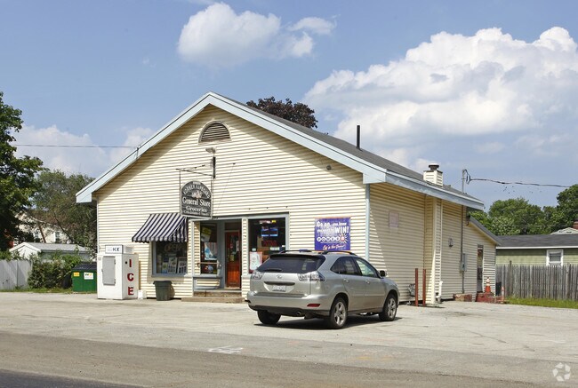
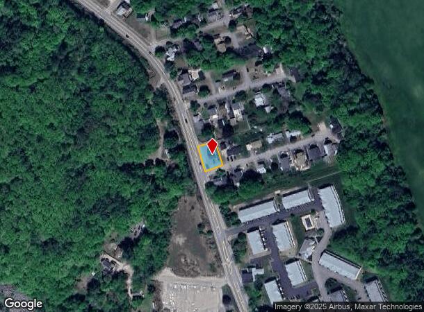
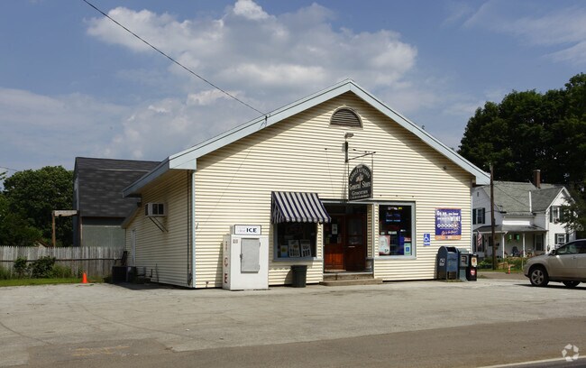
Property Record
394 N State St, Concord, NH 03301
NEARBY LISTINGS FOR SALE OR LEASE
Property Detail
394 N State St
Departmentstore
Merrimack
X
New Hampshire
33013C0527E
0.18 AC
2024
Other Market Areas
2024
Concord, NH
032600
CNCD-000393Z-000000-000107
1,452 SF
DEMOGRAPHICS near 394 N State St
1 Mile
3 Mile
5 Mile
2024 Total Population
1,775
23,951
46,762
2029 Population
1,860
25,169
49,136
Pop Growth 2024-2029
+ 4.79%
+ 5.09%
+ 5.08%
Average Age
43
42
43
2024 Total Households
514
9,534
19,521
HH Growth 2024-2029
+ 6.23%
+ 5.36%
+ 5.17%
Median Household Inc
$89,494
$76,814
$73,477
Avg Household Size
2.30
2.20
2.20
2024 Avg HH Vehicles
2.00
2.00
2.00
Median Home Value
$274,999
$299,913
$284,597
Median Year Built
1948
1974
1972
Nearby Places
Map Layers
Map Styles
 Street
 Aerial
- Restaurants
- Banks
- Shops
- Fitness
- Groceries
PUBLIC TRANSPORTATION
AIRPORT
Manchester Boston Regional
DRIVE
WALK
Distance
Manchester Boston Regional
41 min
26.6 mi
SALE & LEASE HISTORY
LISTING DATE
SALE/LEASE

Nov 28, 2017
For Sale
Dec 23, 2016
For Sale
Nearby Properties
Address
Land Use
TOTAL SIZE
Lot Size
Zoning
Address
Land Use
TOTAL SIZE
Lot Size
Zoning
392 AC
IS
Address
Land Use
TOTAL SIZE
Lot Size
Zoning
196 AC
IS
Address
Land Use
TOTAL SIZE
Lot Size
Zoning
7.22 AC
IS
Address
Land Use
TOTAL SIZE
Lot Size
Zoning
230,929 SF
127 AC
IS
Address
Land Use
TOTAL SIZE
Lot Size
Zoning
293,984 SF
IS
Address
Land Use
TOTAL SIZE
Lot Size
Zoning
156 AC
IS
Address
Land Use
TOTAL SIZE
Lot Size
Zoning
45.40 AC
RO
Address
Land Use
TOTAL SIZE
Lot Size
Zoning
15.59 AC
GWP
Address
Land Use
TOTAL SIZE
Lot Size
Zoning
10.48 AC
IS
Address
Land Use
TOTAL SIZE
Lot Size
Zoning
56.19 AC
IN
Address
Land Use
TOTAL SIZE
Lot Size
Zoning
1.92 AC
IS
Address
Land Use
TOTAL SIZE
Lot Size
Zoning
79,703 SF
2.16 AC
CVP
Address
Land Use
TOTAL SIZE
Lot Size
Zoning
6,816 SF
64.44 AC
RO
Address
Land Use
TOTAL SIZE
Lot Size
Zoning
75,917 SF
0.30 AC
CBP
Address
Land Use
TOTAL SIZE
Lot Size
Zoning
15.22 AC
OCP
Address
Land Use
TOTAL SIZE
Lot Size
Zoning
1.34 AC
CVP
Address
Land Use
TOTAL SIZE
Lot Size
Zoning
34.94 AC
RM
Address
Land Use
TOTAL SIZE
Lot Size
Zoning
136,536 SF
17.69 AC
GWP
Address
Land Use
TOTAL SIZE
Lot Size
Zoning
109,643 SF
128.35 AC
IS
Address
Land Use
TOTAL SIZE
Lot Size
Zoning
52,750 SF
3.26 AC
OCP
Address
Land Use
TOTAL SIZE
Lot Size
Zoning
132,828 SF
1.31 AC
CBP
Address
Land Use
TOTAL SIZE
Lot Size
Zoning
106,400 SF
34.33 AC
IS
Address
Land Use
TOTAL SIZE
Lot Size
Zoning
73,281 SF
2.80 AC
RD
Address
Land Use
TOTAL SIZE
Lot Size
Zoning
2.32 AC
CVP
Address
Land Use
TOTAL SIZE
Lot Size
Zoning
8.50 AC
CG
Address
Land Use
TOTAL SIZE
Lot Size
Zoning
100,826 SF
0.64 AC
IS
Address
Land Use
TOTAL SIZE
Lot Size
Zoning
63,634 SF
0.53 AC
CBP
Address
Land Use
TOTAL SIZE
Lot Size
Zoning
14.13 AC
GWP
Address
Land Use
TOTAL SIZE
Lot Size
Zoning
3.75 AC
IS
Address
Land Use
TOTAL SIZE
Lot Size
Zoning
54,395 SF
8 AC
IS
The World's #1 Commercial Real Estate Marketplace
Connect with us
© 2026 CoStar Group
The information above has been obtained from sources believed reliable. While we do not doubt its accuracy we have not verified it and make no guarantee, warranty or representation about it. It is your responsibility to independently confirm its accuracy and completeness. Any projections, opinions, assumptions, or estimates used are for example only and do not represent the current or future performance of the property. The value of this transaction to you depends on tax and other factors which should be evaluated by your tax, financial, and legal advisors. You and your advisors should conduct a careful, independent investigation of the property to determine to your satisfaction the suitability of the property for your needs.