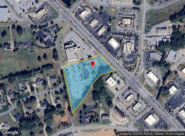
Property Record
3941 Highway 9, Boiling Springs, SC 29316

NEARBY LISTINGS FOR SALE OR LEASE
Property Detail
3941 Highway 9
2-44-01-006.01
W SIDE SC HWY 9 N OF OLD FURNACE RD PB 130-529 DB 122T-759
Taxexempt
Spartanburg
X
South Carolina
45083C0161D
3.69 AC
0
North Side/Rt 9 Corridor
2025
Greenville/Spartanburg
022405
Spartanburg, SC
DEMOGRAPHICS near 3941 Highway 9
1 Mile
3 Mile
5 Mile
2024 Total Population
2,450
34,409
63,202
2029 Population
2,766
39,006
71,706
Pop Growth 2024-2029
+ 12.90%
+ 13.36%
+ 13.46%
Average Age
39
38
38
2024 Total Households
975
12,943
23,391
HH Growth 2024-2029
+ 13.03%
+ 13.62%
+ 13.79%
Median Household Inc
$71,090
$68,146
$65,874
Avg Household Size
2.50
2.60
2.60
2024 Avg HH Vehicles
2.00
2.00
2.00
Median Home Value
$233,333
$193,588
$193,967
Median Year Built
2001
2001
1997
Nearby Places
Map Layers
Map Styles
 Street
 Aerial
- Restaurants
- Banks
- Shops
- Fitness
- Groceries
PUBLIC TRANSPORTATION
COMMUTER RAIL
DRIVE
WALK
Distance
16 min
7.5 mi
AIRPORT
Greenville Spartanburg International
DRIVE
WALK
Distance
Greenville Spartanburg International
32 min
22.5 mi
Asheville Regional
DRIVE
WALK
Distance
Asheville Regional
59 min
46.8 mi
Nearby Properties
Address
Land Use
TOTAL SIZE
Lot Size
Zoning
Address
Land Use
TOTAL SIZE
Lot Size
Zoning
22,955 SF
5.05 AC
Address
Land Use
TOTAL SIZE
Lot Size
Zoning
3,406 SF
13.10 AC
Address
Land Use
TOTAL SIZE
Lot Size
Zoning
7,218 SF
16 AC
Address
Land Use
TOTAL SIZE
Lot Size
Zoning
3,412 SF
21.60 AC
Address
Land Use
TOTAL SIZE
Lot Size
Zoning
5,034 SF
17.60 AC
Address
Land Use
TOTAL SIZE
Lot Size
Zoning
24,738 SF
34.52 AC
Address
Land Use
TOTAL SIZE
Lot Size
Zoning
62,000 SF
10.17 AC
Address
Land Use
TOTAL SIZE
Lot Size
Zoning
3,112 SF
20.17 AC
Address
Land Use
TOTAL SIZE
Lot Size
Zoning
8,911 SF
23.64 AC
Address
Land Use
TOTAL SIZE
Lot Size
Zoning
9,649 SF
9.67 AC
Address
Land Use
TOTAL SIZE
Lot Size
Zoning
7,000 SF
3 AC
Address
Land Use
TOTAL SIZE
Lot Size
Zoning
184,015 SF
19.23 AC
Address
Land Use
TOTAL SIZE
Lot Size
Zoning
42,657 SF
11.57 AC
Address
Land Use
TOTAL SIZE
Lot Size
Zoning
641,891 SF
16.26 AC
Address
Land Use
TOTAL SIZE
Lot Size
Zoning
108,060 SF
2.95 AC
Address
Land Use
TOTAL SIZE
Lot Size
Zoning
Address
Land Use
TOTAL SIZE
Lot Size
Zoning
5,236 SF
0.65 AC
Address
Land Use
TOTAL SIZE
Lot Size
Zoning
6,695 SF
0.30 AC
Address
Land Use
TOTAL SIZE
Lot Size
Zoning
53,066 SF
8.39 AC
Address
Land Use
TOTAL SIZE
Lot Size
Zoning
4,426 SF
Address
Land Use
TOTAL SIZE
Lot Size
Zoning
172,332 SF
15.01 AC
Address
Land Use
TOTAL SIZE
Lot Size
Zoning
4,283 SF
0.50 AC
Address
Land Use
TOTAL SIZE
Lot Size
Zoning
5,263 SF
0.77 AC
Address
Land Use
TOTAL SIZE
Lot Size
Zoning
Address
Land Use
TOTAL SIZE
Lot Size
Zoning
3,683 SF
0.21 AC
Address
Land Use
TOTAL SIZE
Lot Size
Zoning
4,398 SF
0.25 AC
Address
Land Use
TOTAL SIZE
Lot Size
Zoning
4,260 SF
0.66 AC
Address
Land Use
TOTAL SIZE
Lot Size
Zoning
5,267 SF
1.18 AC
Address
Land Use
TOTAL SIZE
Lot Size
Zoning
4,091 SF
0.28 AC
Address
Land Use
TOTAL SIZE
Lot Size
Zoning
5,190 SF
0.93 AC
The World's #1 Commercial Real Estate Marketplace
Connect with us
© 2025 CoStar Group
The information above has been obtained from sources believed reliable. While we do not doubt its accuracy we have not verified it and make no guarantee, warranty or representation about it. It is your responsibility to independently confirm its accuracy and completeness. Any projections, opinions, assumptions, or estimates used are for example only and do not represent the current or future performance of the property. The value of this transaction to you depends on tax and other factors which should be evaluated by your tax, financial, and legal advisors. You and your advisors should conduct a careful, independent investigation of the property to determine to your satisfaction the suitability of the property for your needs.