Property Record
3941 Traxler Ct, Bay City, MI 48706
NEARBY LISTINGS FOR SALE OR LEASE
Property Detail
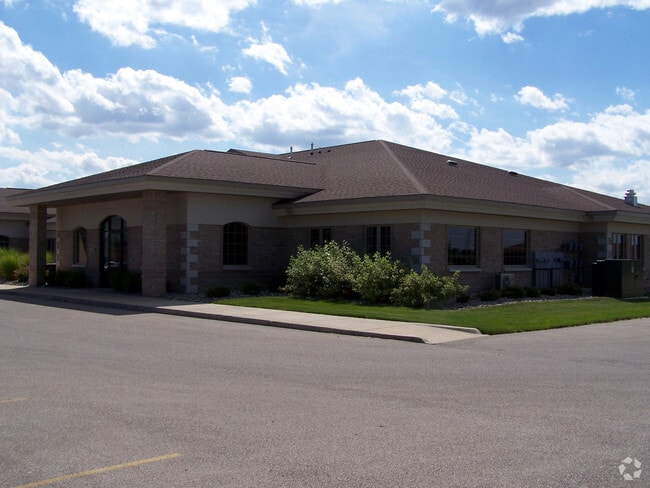
3941 Traxler Ct
Bay City, MI
Monitor Park Plaza
09-100-M03-000-005-00
LOT 4 MONITOR PARK PLAZA SUB, L11/P10 BCR
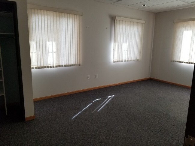
Medicalbuilding
Bay
X
Michigan
26017C0218F
4
2024
0.85 AC
2025
Midland/Flint
285700
Other Market Areas
7,744 SF
DEMOGRAPHICS near 3941 Traxler Ct
1 Mile
3 Mile
5 Mile
2024 Total Population
2,727
28,577
64,900
2029 Population
2,682
28,219
64,295
Pop Growth 2024-2029
(1.65%)
(1.25%)
(0.93%)
Average Age
43
43
43
2024 Total Households
1,190
12,505
28,469
HH Growth 2024-2029
(1.76%)
(1.33%)
(0.98%)
Median Household Inc
$40,238
$54,652
$52,494
Avg Household Size
2.20
2.20
2.20
2024 Avg HH Vehicles
2.00
2.00
2.00
Median Home Value
$140,145
$104,290
$95,804
Median Year Built
1969
1960
1955
Nearby Places
- Restaurants
- Banks
- Shops
- Fitness
- Groceries
PUBLIC TRANSPORTATION
AIRPORT
MBS International
DRIVE
WALK
Distance
MBS International
21 min
14.3 mi
SALE & LEASE HISTORY
LISTING DATE
SALE/LEASE

Sep 25, 2016
For Lease
Sep 23, 2016
For Sale
Nearby Properties
Address
Land Use
TOTAL SIZE
Lot Size
Zoning
Address
Land Use
TOTAL SIZE
Lot Size
Zoning
164,241 SF
10.08 AC
RM-1
Address
Land Use
TOTAL SIZE
Lot Size
Zoning
16.52 AC
R-3
Address
Land Use
TOTAL SIZE
Lot Size
Zoning
169,440 SF
16.54 AC
RM-1
Address
Land Use
TOTAL SIZE
Lot Size
Zoning
41,011 SF
8.28 AC
C-2
Address
Land Use
TOTAL SIZE
Lot Size
Zoning
50,965 SF
0.83 AC
C-3 CTRL B
Address
Land Use
TOTAL SIZE
Lot Size
Zoning
39,417 SF
0.23 AC
C-3 CTRL B
Address
Land Use
TOTAL SIZE
Lot Size
Zoning
45,072 SF
4.81 AC
C-2B HWY B
Address
Land Use
TOTAL SIZE
Lot Size
Zoning
7,200 SF
0.69 AC
C-3 CTRL B
Address
Land Use
TOTAL SIZE
Lot Size
Zoning
139,237 SF
5.47 AC
C-3 CTRL B
Address
Land Use
TOTAL SIZE
Lot Size
Zoning
163,673 SF
17.85 AC
RM-1
Address
Land Use
TOTAL SIZE
Lot Size
Zoning
Address
Land Use
TOTAL SIZE
Lot Size
Zoning
107,921 SF
10.91 AC
C-2
Address
Land Use
TOTAL SIZE
Lot Size
Zoning
85,264 SF
5 AC
RM-1
Address
Land Use
TOTAL SIZE
Lot Size
Zoning
32.23 AC
C
Address
Land Use
TOTAL SIZE
Lot Size
Zoning
36,243 SF
3.41 AC
C-2
Address
Land Use
TOTAL SIZE
Lot Size
Zoning
109,649 SF
11.29 AC
C-2
Address
Land Use
TOTAL SIZE
Lot Size
Zoning
58,981 SF
3.09 AC
C
Address
Land Use
TOTAL SIZE
Lot Size
Zoning
472,836 SF
33.72 AC
C-2
Address
Land Use
TOTAL SIZE
Lot Size
Zoning
37,230 SF
10.03 AC
C-2
Address
Land Use
TOTAL SIZE
Lot Size
Zoning
90,435 SF
16.97 AC
C
Address
Land Use
TOTAL SIZE
Lot Size
Zoning
208,767 SF
33.91 AC
C
Address
Land Use
TOTAL SIZE
Lot Size
Zoning
37,730 SF
7.66 AC
RM-1
Address
Land Use
TOTAL SIZE
Lot Size
Zoning
41,252 SF
13.57 AC
C-2
Address
Land Use
TOTAL SIZE
Lot Size
Zoning
82,983 SF
9.18 AC
C-2
Address
Land Use
TOTAL SIZE
Lot Size
Zoning
76,056 SF
4.91 AC
RM-1
Address
Land Use
TOTAL SIZE
Lot Size
Zoning
97,880 SF
10.35 AC
C-2
Address
Land Use
TOTAL SIZE
Lot Size
Zoning
43,565 SF
10.21 AC
C
Address
Land Use
TOTAL SIZE
Lot Size
Zoning
11,630 SF
2.26 AC
C-2
Address
Land Use
TOTAL SIZE
Lot Size
Zoning
53,792 SF
7.27 AC
C-2
Address
Land Use
TOTAL SIZE
Lot Size
Zoning
17,005 SF
2.13 AC
C-2
The World's #1 Commercial Real Estate Marketplace
Connect with us
© 2025 CoStar Group
The information above has been obtained from sources believed reliable. While we do not doubt its accuracy we have not verified it and make no guarantee, warranty or representation about it. It is your responsibility to independently confirm its accuracy and completeness. Any projections, opinions, assumptions, or estimates used are for example only and do not represent the current or future performance of the property. The value of this transaction to you depends on tax and other factors which should be evaluated by your tax, financial, and legal advisors. You and your advisors should conduct a careful, independent investigation of the property to determine to your satisfaction the suitability of the property for your needs.