Property Record
3943 Franklin Tpke, Danville, VA 24540
NEARBY LISTINGS FOR SALE OR LEASE
-
-
View all Danville listings for sale on LoopNet.com
Property Detail
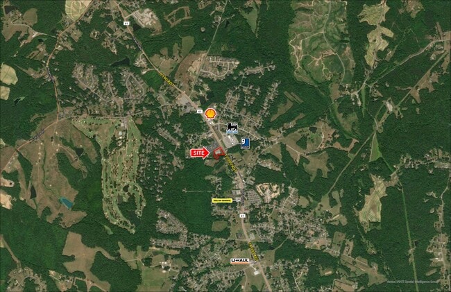
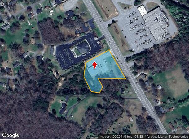
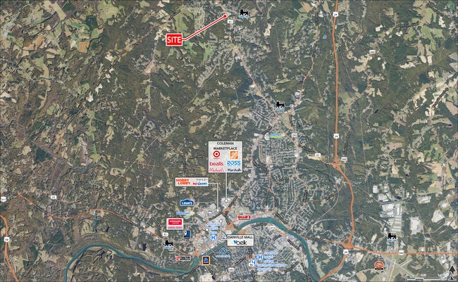
3943 Franklin Tpke
Danville, VA
Containing 2
2410-36-5023
FRANKLIN TPKE 41 LOT 31B
Industrialgeneral
Pittsylvania
X
Virginia
51143C0520E
31b
2025
2.36 AC
2025
Virginia South Central
011302
Other Market Areas
8,320 SF
DEMOGRAPHICS near 3943 Franklin Tpke
1 mile
3 mile
5 mile
2024 Total Population
2,011
8,515
24,107
2029 Population
1,959
8,297
23,632
Pop Growth 2024-2029
(2.59%)
(2.56%)
(1.97%)
Average Age
43
42
43
2024 Total Households
817
3,517
10,250
HH Growth 2024-2029
(2.57%)
(2.59%)
(1.98%)
Median Household Inc
$60,093
$58,838
$47,332
Avg Household Size
2.40
2.40
2.30
2024 Avg HH Vehicles
2.00
2.00
2.00
Median Home Value
$186,419
$167,859
$139,222
Median Year Built
1983
1983
1975
Nearby Places
Map Layers
Map Styles
 Street
 Aerial
Transit
 Traffic
 Biking
Places
Listings with unknown addresses are not visible on the map
- Restaurants
- Banks
- Shops
- Fitness
- Groceries
PUBLIC TRANSPORTATION
COMMUTER RAIL
Drive
Walk
Distance
13 min
7.3 mi
SALE & LEASE HISTORY
LISTING DATE
SALE/LEASE

Apr 03, 2019
For Sale
Nearby Properties
Address
Land Use
TOTAL SIZE
Lot Size
Zoning
Address
Land Use
TOTAL SIZE
Lot Size
Zoning
12.20 AC
B-2
Address
Land Use
TOTAL SIZE
Lot Size
Zoning
19.90 AC
R-1
Address
Land Use
TOTAL SIZE
Lot Size
Zoning
75,816 SF
7.04 AC
COND MULTI
Address
Land Use
TOTAL SIZE
Lot Size
Zoning
73,290 SF
5.94 AC
RMF
Address
Land Use
TOTAL SIZE
Lot Size
Zoning
9,200 SF
5.41 AC
R-1
Address
Land Use
TOTAL SIZE
Lot Size
Zoning
21.40 AC
A-1
Address
Land Use
TOTAL SIZE
Lot Size
Zoning
7.19 AC
B-2
Address
Land Use
TOTAL SIZE
Lot Size
Zoning
8.52 AC
B-2
Address
Land Use
TOTAL SIZE
Lot Size
Zoning
20.17 AC
M-1
Address
Land Use
TOTAL SIZE
Lot Size
Zoning
205.23 AC
B-1
Address
Land Use
TOTAL SIZE
Lot Size
Zoning
2,805 SF
5.22 AC
RMF
Address
Land Use
TOTAL SIZE
Lot Size
Zoning
2,788 SF
5.38 AC
RMF
Address
Land Use
TOTAL SIZE
Lot Size
Zoning
4.08 AC
B-2
Address
Land Use
TOTAL SIZE
Lot Size
Zoning
129,864 SF
14.35 AC
M-1
Address
Land Use
TOTAL SIZE
Lot Size
Zoning
8,089 SF
15.83 AC
A-1
Address
Land Use
TOTAL SIZE
Lot Size
Zoning
23,046 SF
1.38 AC
OLD TOWN R
Address
Land Use
TOTAL SIZE
Lot Size
Zoning
9,728 SF
3.45 AC
M-1
Address
Land Use
TOTAL SIZE
Lot Size
Zoning
5,980 SF
2.58 AC
B-2
Address
Land Use
TOTAL SIZE
Lot Size
Zoning
1,906 SF
2.07 AC
RMF
Address
Land Use
TOTAL SIZE
Lot Size
Zoning
2,128 SF
9.59 AC
B-2
Address
Land Use
TOTAL SIZE
Lot Size
Zoning
7,006 SF
2.73 AC
R-1
Address
Land Use
TOTAL SIZE
Lot Size
Zoning
8,586 SF
4.15 AC
B-2
Address
Land Use
TOTAL SIZE
Lot Size
Zoning
9,015 SF
1.92 AC
R-1
Address
Land Use
TOTAL SIZE
Lot Size
Zoning
40,000 SF
4.39 AC
B-2
Address
Land Use
TOTAL SIZE
Lot Size
Zoning
20,412 SF
5.14 AC
B-2
Address
Land Use
TOTAL SIZE
Lot Size
Zoning
5,194 SF
2.80 AC
B-2
Address
Land Use
TOTAL SIZE
Lot Size
Zoning
9,140 SF
7 AC
R-1
Address
Land Use
TOTAL SIZE
Lot Size
Zoning
97,425 SF
10 AC
M-1
Address
Land Use
TOTAL SIZE
Lot Size
Zoning
11,682 SF
2.05 AC
OLD TOWN R
Address
Land Use
TOTAL SIZE
Lot Size
Zoning
3.15 AC
B-2
The World's #1 Commercial Real Estate Marketplace
Connect with us
© 2026 CoStar Group
The information above has been obtained from sources believed reliable. While we do not doubt its accuracy we have not verified it and make no guarantee, warranty or representation about it. It is your responsibility to independently confirm its accuracy and completeness. Any projections, opinions, assumptions, or estimates used are for example only and do not represent the current or future performance of the property. The value of this transaction to you depends on tax and other factors which should be evaluated by your tax, financial, and legal advisors. You and your advisors should conduct a careful, independent investigation of the property to determine to your satisfaction the suitability of the property for your needs.