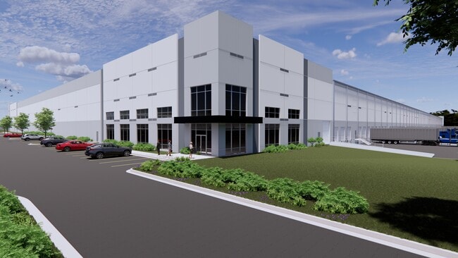
Property Record
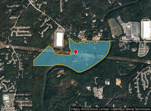
Highway 166 E, , GA
Current Lease Availabilities
NEARBY LISTINGS FOR SALE OR LEASE
Property Detail
Highway 166 E
Atlanta-Sandy Springs-Roswell, GA
Normandy S/D
0159-01-5-0-001
V/361.1038 ACRES +, GEORGIA HIGHWAY 166
Commercialnec
Douglas
AE
Georgia
13121C0309F
361.10 AC
2024
I-20 W/Douglasville
2024
Atlanta
DEMOGRAPHICS near Highway 166 E
1 Mile
3 Mile
5 Mile
2024 Total Population
1,160
23,923
69,118
2029 Population
1,211
25,100
72,432
Pop Growth 2024-2029
+ 4.40%
+ 4.92%
+ 4.79%
Average Age
38
37
38
2024 Total Households
378
7,916
23,576
HH Growth 2024-2029
+ 4.50%
+ 4.94%
+ 4.90%
Median Household Inc
$77,500
$106,176
$92,660
Avg Household Size
3.00
3.00
2.90
2024 Avg HH Vehicles
2.00
2.00
2.00
Median Home Value
$227,193
$257,519
$264,407
Median Year Built
2000
2005
2002
Nearby Places
- Restaurants
- Banks
- Shops
- Fitness
- Groceries
PUBLIC TRANSPORTATION
AIRPORT
Hartsfield - Jackson Atlanta International
DRIVE
WALK
Distance
Hartsfield - Jackson Atlanta International
30 min
19.7 mi
Freight Ports
Georgia Ports - Savannah
DRIVE
WALK
Distance
Georgia Ports - Savannah
292 min
257.0 mi
Nearby Properties
Address
Land Use
TOTAL SIZE
Lot Size
Zoning
Address
Land Use
TOTAL SIZE
Lot Size
Zoning
1,128,400 SF
76.60 AC
AG1
Address
Land Use
TOTAL SIZE
Lot Size
Zoning
75,628 SF
290.39 AC
DCD
Address
Land Use
TOTAL SIZE
Lot Size
Zoning
709,289 SF
112.06 AC
DCD
Address
Land Use
TOTAL SIZE
Lot Size
Zoning
799,971 SF
68.45 AC
LI-R
Address
Land Use
TOTAL SIZE
Lot Size
Zoning
546,600 SF
32.19 AC
M1
Address
Land Use
TOTAL SIZE
Lot Size
Zoning
1,262,965 SF
24.15 AC
AG1
Address
Land Use
TOTAL SIZE
Lot Size
Zoning
498,420 SF
26.70 AC
M1
Address
Land Use
TOTAL SIZE
Lot Size
Zoning
453,106 SF
36.69 AC
DCD
Address
Land Use
TOTAL SIZE
Lot Size
Zoning
611,500 SF
37.74 AC
M2
Address
Land Use
TOTAL SIZE
Lot Size
Zoning
623,968 SF
35.87 AC
M1
Address
Land Use
TOTAL SIZE
Lot Size
Zoning
459,006 SF
21.49 AC
M1
Address
Land Use
TOTAL SIZE
Lot Size
Zoning
314,792 SF
51.29 AC
DCD
Address
Land Use
TOTAL SIZE
Lot Size
Zoning
279,840 SF
44 AC
DCD
Address
Land Use
TOTAL SIZE
Lot Size
Zoning
477,317 SF
37 AC
M1
Address
Land Use
TOTAL SIZE
Lot Size
Zoning
433,333 SF
18 AC
M2
Address
Land Use
TOTAL SIZE
Lot Size
Zoning
427,698 SF
33.21 AC
M1
Address
Land Use
TOTAL SIZE
Lot Size
Zoning
384,200 SF
55.45 AC
M1
Address
Land Use
TOTAL SIZE
Lot Size
Zoning
33.74 AC
SUBA
Address
Land Use
TOTAL SIZE
Lot Size
Zoning
298,556 SF
13.90 AC
M1
Address
Land Use
TOTAL SIZE
Lot Size
Zoning
217,466 SF
23.50 AC
DCD
Address
Land Use
TOTAL SIZE
Lot Size
Zoning
24.59 AC
SUBA
Address
Land Use
TOTAL SIZE
Lot Size
Zoning
239,937 SF
12.25 AC
CUP
Address
Land Use
TOTAL SIZE
Lot Size
Zoning
268,795 SF
14.51 AC
M1
Address
Land Use
TOTAL SIZE
Lot Size
Zoning
101,855 SF
67.78 AC
AG1
Address
Land Use
TOTAL SIZE
Lot Size
Zoning
34.31 AC
SUBA
Address
Land Use
TOTAL SIZE
Lot Size
Zoning
243,320 SF
15.85 AC
M2
Address
Land Use
TOTAL SIZE
Lot Size
Zoning
74,435 SF
8.17 AC
M1
Address
Land Use
TOTAL SIZE
Lot Size
Zoning
33.35 AC
SUBA
Address
Land Use
TOTAL SIZE
Lot Size
Zoning
283,400 SF
25.96 AC
DCD
The World's #1 Commercial Real Estate Marketplace
Connect with us
© 2025 CoStar Group
The information above has been obtained from sources believed reliable. While we do not doubt its accuracy we have not verified it and make no guarantee, warranty or representation about it. It is your responsibility to independently confirm its accuracy and completeness. Any projections, opinions, assumptions, or estimates used are for example only and do not represent the current or future performance of the property. The value of this transaction to you depends on tax and other factors which should be evaluated by your tax, financial, and legal advisors. You and your advisors should conduct a careful, independent investigation of the property to determine to your satisfaction the suitability of the property for your needs.