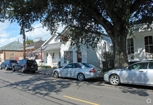
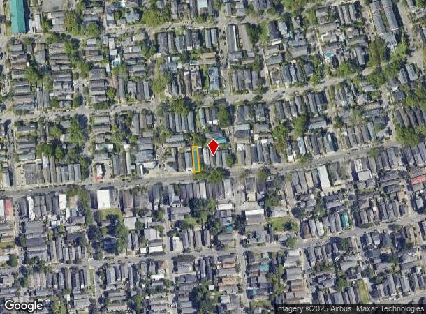
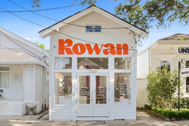
Property Record
3947 Magazine St, New Orleans, LA 70115

NEARBY LISTINGS FOR SALE OR LEASE
Property Detail
3947 Magazine St
New Orleans-Metairie, LA
Bouligny Sd
6-14-2-009-19
SQ 226 LOT C MAGAZINE 23X120 STORE-W MA CHNGD 1/20/98 FILE #56664-A 2-83
Storebuilding
Orleans
X
Louisiana
22051C0215F
c
2025
0.06 AC
2025
Uptown/Garden District
009900
New Orleans/Metairie/Kenner
1,230 SF
DEMOGRAPHICS near 3947 Magazine St
1 Mile
3 Mile
5 Mile
2024 Total Population
20,878
145,427
334,132
2029 Population
20,154
141,049
323,157
Pop Growth 2024-2029
(3.47%)
(3.01%)
(3.28%)
Average Age
43
40
41
2024 Total Households
10,600
65,691
146,845
HH Growth 2024-2029
(3.71%)
(2.92%)
(3.28%)
Median Household Inc
$84,885
$56,126
$50,892
Avg Household Size
1.90
2.00
2.10
2024 Avg HH Vehicles
1.00
1.00
1.00
Median Home Value
$601,904
$358,672
$263,045
Median Year Built
1946
1949
1956
Nearby Places
Map Layers
Map Styles
 Street
 Aerial
- Restaurants
- Banks
- Shops
- Fitness
- Groceries
PUBLIC TRANSPORTATION
TRANSIT/SUBWAY
St Charles and Constantinople (St. Charles Streetcar - New Orleans Regional Transit Authority Streetcars (New Orleans Streetcars))
DRIVE
WALK
Distance
St Charles and Constantinople (St. Charles Streetcar - New Orleans Regional Transit Authority Streetcars (New Orleans Streetcars))
2 min
9 min
0.4 mi
St Charles and Peniston (St. Charles Streetcar - New Orleans Regional Transit Authority Streetcars (New Orleans Streetcars))
DRIVE
WALK
Distance
St Charles and Peniston (St. Charles Streetcar - New Orleans Regional Transit Authority Streetcars (New Orleans Streetcars))
2 min
9 min
0.5 mi
St Charles and Milan (St. Charles Streetcar - New Orleans Regional Transit Authority Streetcars (New Orleans Streetcars))
DRIVE
WALK
Distance
St Charles and Milan (St. Charles Streetcar - New Orleans Regional Transit Authority Streetcars (New Orleans Streetcars))
2 min
11 min
0.6 mi
St Charles and Foucher (St. Charles Streetcar - New Orleans Regional Transit Authority Streetcars (New Orleans Streetcars))
DRIVE
WALK
Distance
St Charles and Foucher (St. Charles Streetcar - New Orleans Regional Transit Authority Streetcars (New Orleans Streetcars))
2 min
11 min
0.6 mi
St Charles and Louisiana (St. Charles Streetcar - New Orleans Regional Transit Authority Streetcars (New Orleans Streetcars))
DRIVE
WALK
Distance
St Charles and Louisiana (St. Charles Streetcar - New Orleans Regional Transit Authority Streetcars (New Orleans Streetcars))
3 min
14 min
0.7 mi
COMMUTER RAIL
DRIVE
WALK
Distance
8 min
2.8 mi
AIRPORT
Louis Armstrong New Orleans International
DRIVE
WALK
Distance
Louis Armstrong New Orleans International
26 min
16.8 mi
Freight Ports
Port of New Orleans
DRIVE
WALK
Distance
Port of New Orleans
10 min
2.8 mi
SALE & LEASE HISTORY
LISTING DATE
SALE/LEASE

Nov 29, 2021
For Lease
May 09, 2022
For Sale
Apr 18, 2024
For Sale
Nearby Properties
Address
Land Use
TOTAL SIZE
Lot Size
Zoning
Address
Land Use
TOTAL SIZE
Lot Size
Zoning
300 SF
2.19 AC
LS
Address
Land Use
TOTAL SIZE
Lot Size
Zoning
85,052 SF
2.19 AC
LS
Address
Land Use
TOTAL SIZE
Lot Size
Zoning
80.92 AC
EC
Address
Land Use
TOTAL SIZE
Lot Size
Zoning
44.43 AC
CBD-4
Address
Land Use
TOTAL SIZE
Lot Size
Zoning
66.23 AC
CBD-4
Address
Land Use
TOTAL SIZE
Lot Size
Zoning
468,704 SF
7.58 AC
MC
Address
Land Use
TOTAL SIZE
Lot Size
Zoning
3.66 AC
MC
Address
Land Use
TOTAL SIZE
Lot Size
Zoning
197,182 SF
0.01 AC
OS-R
Address
Land Use
TOTAL SIZE
Lot Size
Zoning
834,043 SF
1.40 AC
CBD-2
Address
Land Use
TOTAL SIZE
Lot Size
Zoning
18.31 AC
CBD-4
Address
Land Use
TOTAL SIZE
Lot Size
Zoning
1.87 AC
CBD-2
Address
Land Use
TOTAL SIZE
Lot Size
Zoning
844,362 SF
5.85 AC
CBD-4
Address
Land Use
TOTAL SIZE
Lot Size
Zoning
0.12 AC
Address
Land Use
TOTAL SIZE
Lot Size
Zoning
Address
Land Use
TOTAL SIZE
Lot Size
Zoning
444,121 SF
1.46 AC
CBD-1
Address
Land Use
TOTAL SIZE
Lot Size
Zoning
0.88 AC
CBD-2
Address
Land Use
TOTAL SIZE
Lot Size
Zoning
1.91 AC
CBD-1
Address
Land Use
TOTAL SIZE
Lot Size
Zoning
576,962 SF
3.31 AC
CBD-4
Address
Land Use
TOTAL SIZE
Lot Size
Zoning
1.79 AC
Address
Land Use
TOTAL SIZE
Lot Size
Zoning
609,449 SF
2 AC
EC
Address
Land Use
TOTAL SIZE
Lot Size
Zoning
512,729 SF
6.60 AC
Address
Land Use
TOTAL SIZE
Lot Size
Zoning
1.24 AC
CBD-1
Address
Land Use
TOTAL SIZE
Lot Size
Zoning
190,708 SF
1.09 AC
CBD-2
Address
Land Use
TOTAL SIZE
Lot Size
Zoning
10.42 AC
Address
Land Use
TOTAL SIZE
Lot Size
Zoning
499,287 SF
1.44 AC
VCE
Address
Land Use
TOTAL SIZE
Lot Size
Zoning
0.67 AC
CBD-3
Address
Land Use
TOTAL SIZE
Lot Size
Zoning
162,382 SF
1.25 AC
CBD-2
Address
Land Use
TOTAL SIZE
Lot Size
Zoning
258,024 SF
0.63 AC
CBD-2
Address
Land Use
TOTAL SIZE
Lot Size
Zoning
2.94 AC
CBD-1
Address
Land Use
TOTAL SIZE
Lot Size
Zoning
3.36 AC
EC
The World's #1 Commercial Real Estate Marketplace
Connect with us
© 2025 CoStar Group
The information above has been obtained from sources believed reliable. While we do not doubt its accuracy we have not verified it and make no guarantee, warranty or representation about it. It is your responsibility to independently confirm its accuracy and completeness. Any projections, opinions, assumptions, or estimates used are for example only and do not represent the current or future performance of the property. The value of this transaction to you depends on tax and other factors which should be evaluated by your tax, financial, and legal advisors. You and your advisors should conduct a careful, independent investigation of the property to determine to your satisfaction the suitability of the property for your needs.