Property Record
3947 Westpoint Blvd, Winston Salem, NC 27103

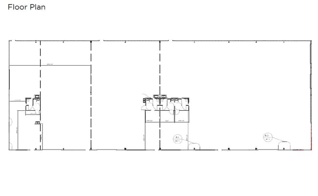
Current Lease Availabilities
NEARBY LISTINGS FOR SALE OR LEASE
Property Detail
3947 Westpoint Blvd
Winston-Salem, NC
Stratford Rd Past Hanes Mall Blvd
6813-04-9865
LO:201 BL:3930
Industrialacreage
Forsyth
AE
North Carolina
3710681300J
201
2024
12.16 AC
2025
South Forsyth County
003804
Greensboro/Winston-Salem
17,600 SF
DEMOGRAPHICS near 3947 Westpoint Blvd
1 Mile
3 Mile
5 Mile
2024 Total Population
1,859
41,947
124,284
2029 Population
1,920
43,080
127,827
Pop Growth 2024-2029
+ 3.28%
+ 2.70%
+ 2.85%
Average Age
40
40
41
2024 Total Households
866
18,625
54,315
HH Growth 2024-2029
+ 3.46%
+ 2.84%
+ 3.01%
Median Household Inc
$52,822
$64,549
$70,252
Avg Household Size
2.10
2.20
2.20
2024 Avg HH Vehicles
2.00
2.00
2.00
Median Home Value
$232,524
$230,406
$268,545
Median Year Built
2002
1989
1984
Nearby Places
Map Layers
Map Styles
 Street
 Aerial
- Restaurants
- Banks
- Shops
- Fitness
- Groceries
PUBLIC TRANSPORTATION
AIRPORT
Piedmont Triad International
DRIVE
WALK
Distance
Piedmont Triad International
43 min
27.3 mi
Freight Ports
Port of Wilmington
DRIVE
WALK
Distance
Port of Wilmington
280 min
236.0 mi
Nearby Properties
Address
Land Use
TOTAL SIZE
Lot Size
Zoning
Address
Land Use
TOTAL SIZE
Lot Size
Zoning
133,360 SF
60.44 AC
C,RMU-S
Address
Land Use
TOTAL SIZE
Lot Size
Zoning
822,684 SF
33.33 AC
GB
Address
Land Use
TOTAL SIZE
Lot Size
Zoning
125,328 SF
19.14 AC
RM18-S
Address
Land Use
TOTAL SIZE
Lot Size
Zoning
160,152 SF
26 AC
RM12-S,RM1
Address
Land Use
TOTAL SIZE
Lot Size
Zoning
120,259 SF
13.68 AC
MU-S
Address
Land Use
TOTAL SIZE
Lot Size
Zoning
30,360 SF
17.09 AC
CPO-S
Address
Land Use
TOTAL SIZE
Lot Size
Zoning
297,487 SF
40.24 AC
RM12,RM18
Address
Land Use
TOTAL SIZE
Lot Size
Zoning
143,081 SF
4.88 AC
GB-S
Address
Land Use
TOTAL SIZE
Lot Size
Zoning
198,730 SF
37.41 AC
RS9
Address
Land Use
TOTAL SIZE
Lot Size
Zoning
153,436 SF
17.46 AC
GB-S
Address
Land Use
TOTAL SIZE
Lot Size
Zoning
68,656 SF
6.25 AC
MU-S
Address
Land Use
TOTAL SIZE
Lot Size
Zoning
257,080 SF
23.47 AC
HB-S
Address
Land Use
TOTAL SIZE
Lot Size
Zoning
160,690 SF
17.81 AC
GB-S
Address
Land Use
TOTAL SIZE
Lot Size
Zoning
183,444 SF
45.19 AC
RS9
Address
Land Use
TOTAL SIZE
Lot Size
Zoning
129,977 SF
7.51 AC
RM12-S
Address
Land Use
TOTAL SIZE
Lot Size
Zoning
59,612 SF
10.91 AC
MU-S
Address
Land Use
TOTAL SIZE
Lot Size
Zoning
88,466 SF
9.94 AC
GO-S
Address
Land Use
TOTAL SIZE
Lot Size
Zoning
81,061 SF
10.33 AC
GB
Address
Land Use
TOTAL SIZE
Lot Size
Zoning
390,230 SF
35.43 AC
GI,RS9
Address
Land Use
TOTAL SIZE
Lot Size
Zoning
57,837 SF
9.45 AC
RM18-S
Address
Land Use
TOTAL SIZE
Lot Size
Zoning
111,173 SF
11.19 AC
GB-S,LB-S
Address
Land Use
TOTAL SIZE
Lot Size
Zoning
51,122 SF
10.64 AC
RM18-S
Address
Land Use
TOTAL SIZE
Lot Size
Zoning
98,061 SF
15.87 AC
RM12-S,RM1
Address
Land Use
TOTAL SIZE
Lot Size
Zoning
127,588 SF
14.47 AC
GB
Address
Land Use
TOTAL SIZE
Lot Size
Zoning
148,131 SF
17.80 AC
GB-S
Address
Land Use
TOTAL SIZE
Lot Size
Zoning
78,437 SF
9.94 AC
CPO,CPO-S,
Address
Land Use
TOTAL SIZE
Lot Size
Zoning
136,400 SF
16.54 AC
GB-S
Address
Land Use
TOTAL SIZE
Lot Size
Zoning
116,670 SF
95.97 AC
IP-S
Address
Land Use
TOTAL SIZE
Lot Size
Zoning
46,212 SF
20.79 AC
RM8-S
Address
Land Use
TOTAL SIZE
Lot Size
Zoning
100,247 SF
9.68 AC
GB
The World's #1 Commercial Real Estate Marketplace
Connect with us
© 2025 CoStar Group
The information above has been obtained from sources believed reliable. While we do not doubt its accuracy we have not verified it and make no guarantee, warranty or representation about it. It is your responsibility to independently confirm its accuracy and completeness. Any projections, opinions, assumptions, or estimates used are for example only and do not represent the current or future performance of the property. The value of this transaction to you depends on tax and other factors which should be evaluated by your tax, financial, and legal advisors. You and your advisors should conduct a careful, independent investigation of the property to determine to your satisfaction the suitability of the property for your needs.