Property Record
John Sharp Pkwy, Bryan, TX 77807

Property Detail
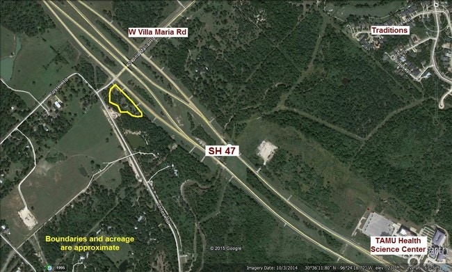
John Sharp Pkwy
College Station-Bryan, TX
A005901, T J WOOTEN (ICL), TRACT 36.11, 0.811 ACRES
301908
BRAZOS
Residentialacreage
Texas
B and X Area of moderate flood hazard, usually the area between the limits of the 100-year and 500-year floods.
36.11
2024
0.81 AC
2025
Bryan & College Station
000205
Other Market Areas
NEARBY LISTINGS FOR SALE OR LEASE
-
-
View all Bryan listings for sale on LoopNet.com
DEMOGRAPHICS near John Sharp Pkwy
1 mile
3 mile
5 mile
2025 Total Population
609
10,742
81,722
2030 Population
669
11,633
86,048
Pop Growth 2025-2030
+ 9.85%
+ 8.29%
+ 5.29%
Average Age
38
36
29
2025 Total Households
287
4,636
26,032
HH Growth 2025-2030
+ 10.45%
+ 8.82%
+ 6.05%
Median Household Inc
$77,778
$77,788
$38,144
Avg Household Size
2.10
2.30
2.40
2025 Avg HH Vehicles
2.00
2.00
2.00
Median Home Value
$346,000
$279,228
$222,732
Median Year Built
2010
2003
1996
Nearby Places
Map Layers
Map Styles
 Street
 Aerial
Layers
 Traffic
 Biking
Places
Listings with unknown addresses are not visible on the map
- Restaurants
- Banks
- Shops
- Fitness
- Groceries
PUBLIC TRANSPORTATION
AIRPORT
Easterwood Field
Drive
Walk
Distance
Easterwood Field
26 min
12.8 mi
Freight Ports
Port of Houston
Drive
Walk
Distance
Port of Houston
138 min
109.4 mi
SALE & LEASE HISTORY
LISTING DATE
SALE/LEASE

Sep 24, 2016
For Sale
Apr 10, 2023
For Sale
Nearby Properties
Address
Land Use
TOTAL SIZE
Lot Size
Zoning
Address
Land Use
TOTAL SIZE
Lot Size
Zoning
187,336 SF
10.54 AC
Address
Land Use
TOTAL SIZE
Lot Size
Zoning
349.63 AC
Address
Land Use
TOTAL SIZE
Lot Size
Zoning
64,095 SF
11.62 AC
Address
Land Use
TOTAL SIZE
Lot Size
Zoning
49,488 SF
30.01 AC
Address
Land Use
TOTAL SIZE
Lot Size
Zoning
65,615 SF
22.05 AC
Address
Land Use
TOTAL SIZE
Lot Size
Zoning
1,991.39 AC
Address
Land Use
TOTAL SIZE
Lot Size
Zoning
78,536 SF
5.76 AC
Address
Land Use
TOTAL SIZE
Lot Size
Zoning
48,744 SF
9.03 AC
Address
Land Use
TOTAL SIZE
Lot Size
Zoning
66,685 SF
13.48 AC
Address
Land Use
TOTAL SIZE
Lot Size
Zoning
3,523 SF
1,730.53 AC
Address
Land Use
TOTAL SIZE
Lot Size
Zoning
72,516 SF
10.03 AC
Address
Land Use
TOTAL SIZE
Lot Size
Zoning
64,553 SF
11.76 AC
Address
Land Use
TOTAL SIZE
Lot Size
Zoning
49,181 SF
10.49 AC
Address
Land Use
TOTAL SIZE
Lot Size
Zoning
31,250 SF
10 AC
Address
Land Use
TOTAL SIZE
Lot Size
Zoning
14.29 AC
Address
Land Use
TOTAL SIZE
Lot Size
Zoning
28,160 SF
13.05 AC
Address
Land Use
TOTAL SIZE
Lot Size
Zoning
54,240 SF
4.92 AC
Address
Land Use
TOTAL SIZE
Lot Size
Zoning
39,000 SF
17.41 AC
Address
Land Use
TOTAL SIZE
Lot Size
Zoning
174,840 SF
55.27 AC
Address
Land Use
TOTAL SIZE
Lot Size
Zoning
86,105 SF
7.85 AC
Address
Land Use
TOTAL SIZE
Lot Size
Zoning
28,766 SF
42.68 AC
Address
Land Use
TOTAL SIZE
Lot Size
Zoning
25,930 SF
7.73 AC
Address
Land Use
TOTAL SIZE
Lot Size
Zoning
12,692 SF
11.10 AC
Address
Land Use
TOTAL SIZE
Lot Size
Zoning
19,808 SF
5.35 AC
Address
Land Use
TOTAL SIZE
Lot Size
Zoning
71,900 SF
10.12 AC
Address
Land Use
TOTAL SIZE
Lot Size
Zoning
1,875 SF
20 AC
Address
Land Use
TOTAL SIZE
Lot Size
Zoning
8,519 SF
3.51 AC
Address
Land Use
TOTAL SIZE
Lot Size
Zoning
9,416 SF
0.94 AC
Address
Land Use
TOTAL SIZE
Lot Size
Zoning
17,750 SF
33.78 AC
Address
Land Use
TOTAL SIZE
Lot Size
Zoning
17,600 SF
116.64 AC
The World's #1 Commercial Real Estate Marketplace
Connect with us
© 2026 CoStar Group
The information above has been obtained from sources believed reliable. While we do not doubt its accuracy we have not verified it and make no guarantee, warranty or representation about it. It is your responsibility to independently confirm its accuracy and completeness. Any projections, opinions, assumptions, or estimates used are for example only and do not represent the current or future performance of the property. The value of this transaction to you depends on tax and other factors which should be evaluated by your tax, financial, and legal advisors. You and your advisors should conduct a careful, independent investigation of the property to determine to your satisfaction the suitability of the property for your needs.