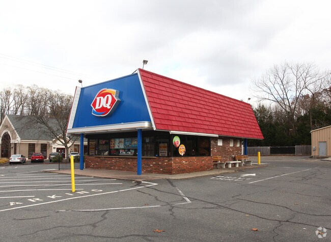
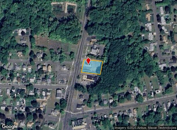
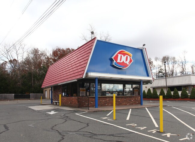
Property Record
395 Enfield St, Enfield, CT 06082
NEARBY LISTINGS FOR SALE OR LEASE
Property Detail
395 Enfield St
ENFI-000033-000000-000233
Hartford
Commercialbuilding
Connecticut
X
233
25013C0414E
0.58 AC
2025
Enfield
2025
Hartford
480500
Hartford-West Hartford-East Hartford, CT
760 SF
DEMOGRAPHICS near 395 Enfield St
1 Mile
3 Mile
5 Mile
2024 Total Population
5,952
37,797
91,220
2029 Population
5,941
37,528
90,320
Pop Growth 2024-2029
(0.18%)
(0.71%)
(0.99%)
Average Age
39
42
43
2024 Total Households
2,460
14,739
34,499
HH Growth 2024-2029
(0.20%)
(0.91%)
(1.23%)
Median Household Inc
$69,514
$87,865
$91,251
Avg Household Size
2.40
2.40
2.40
2024 Avg HH Vehicles
2.00
2.00
2.00
Median Home Value
$214,684
$263,375
$271,820
Median Year Built
1957
1960
1961
Nearby Places
Map Layers
Map Styles
 Street
 Aerial
- Restaurants
- Banks
- Shops
- Fitness
- Groceries
PUBLIC TRANSPORTATION
COMMUTER RAIL
DRIVE
WALK
Distance
12 min
7.7 mi
Windsor Locks (Hartford Line - CT Rail (CTRail))
DRIVE
WALK
Distance
Windsor Locks (Hartford Line - CT Rail (CTRail))
13 min
9.6 mi
AIRPORT
Bradley International
DRIVE
WALK
Distance
Bradley International
24 min
9.4 mi
Freight Ports
Port of New Haven
DRIVE
WALK
Distance
Port of New Haven
76 min
58.3 mi
Nearby Properties
Address
Land Use
TOTAL SIZE
Lot Size
Zoning
Address
Land Use
TOTAL SIZE
Lot Size
Zoning
179,293 SF
51.07 AC
HR33
Address
Land Use
TOTAL SIZE
Lot Size
Zoning
69.62 AC
MFHD
Address
Land Use
TOTAL SIZE
Lot Size
Zoning
166,268 SF
36.70 AC
R44
Address
Land Use
TOTAL SIZE
Lot Size
Zoning
8,712 SF
25.08 AC
RA1
Address
Land Use
TOTAL SIZE
Lot Size
Zoning
1,840 SF
148.78 AC
BB
Address
Land Use
TOTAL SIZE
Lot Size
Zoning
500,000 SF
71.20 AC
I-1
Address
Land Use
TOTAL SIZE
Lot Size
Zoning
32.97 AC
BR
Address
Land Use
TOTAL SIZE
Lot Size
Zoning
65.52 AC
BR
Address
Land Use
TOTAL SIZE
Lot Size
Zoning
24.27 AC
SDD
Address
Land Use
TOTAL SIZE
Lot Size
Zoning
32.44 AC
BR
Address
Land Use
TOTAL SIZE
Lot Size
Zoning
319,054 SF
30.02 AC
I-P
Address
Land Use
TOTAL SIZE
Lot Size
Zoning
211,256 SF
41.58 AC
R33
Address
Land Use
TOTAL SIZE
Lot Size
Zoning
26.82 AC
HR33
Address
Land Use
TOTAL SIZE
Lot Size
Zoning
24.92 AC
BL
Address
Land Use
TOTAL SIZE
Lot Size
Zoning
13.87 AC
BR
Address
Land Use
TOTAL SIZE
Lot Size
Zoning
103,324 SF
20.47 AC
RA1
Address
Land Use
TOTAL SIZE
Lot Size
Zoning
13.78 AC
BR
Address
Land Use
TOTAL SIZE
Lot Size
Zoning
1.87 AC
BP
Address
Land Use
TOTAL SIZE
Lot Size
Zoning
19.36 AC
BR
Address
Land Use
TOTAL SIZE
Lot Size
Zoning
144,625 SF
19 AC
BR
Address
Land Use
TOTAL SIZE
Lot Size
Zoning
23,660 SF
9.28 AC
RA1
Address
Land Use
TOTAL SIZE
Lot Size
Zoning
106,851 SF
20.33 AC
R25
Address
Land Use
TOTAL SIZE
Lot Size
Zoning
12 AC
HR33
Address
Land Use
TOTAL SIZE
Lot Size
Zoning
17.34 AC
R44
Address
Land Use
TOTAL SIZE
Lot Size
Zoning
91,735 SF
9.28 AC
RA1
Address
Land Use
TOTAL SIZE
Lot Size
Zoning
54.05 AC
I-1
Address
Land Use
TOTAL SIZE
Lot Size
Zoning
21.97 AC
I-1
Address
Land Use
TOTAL SIZE
Lot Size
Zoning
67,592 SF
7.70 AC
R25
Address
Land Use
TOTAL SIZE
Lot Size
Zoning
220.65 AC
RA1
Address
Land Use
TOTAL SIZE
Lot Size
Zoning
62,471 SF
28.11 AC
RA2
The World's #1 Commercial Real Estate Marketplace
Connect with us
© 2025 CoStar Group
The information above has been obtained from sources believed reliable. While we do not doubt its accuracy we have not verified it and make no guarantee, warranty or representation about it. It is your responsibility to independently confirm its accuracy and completeness. Any projections, opinions, assumptions, or estimates used are for example only and do not represent the current or future performance of the property. The value of this transaction to you depends on tax and other factors which should be evaluated by your tax, financial, and legal advisors. You and your advisors should conduct a careful, independent investigation of the property to determine to your satisfaction the suitability of the property for your needs.