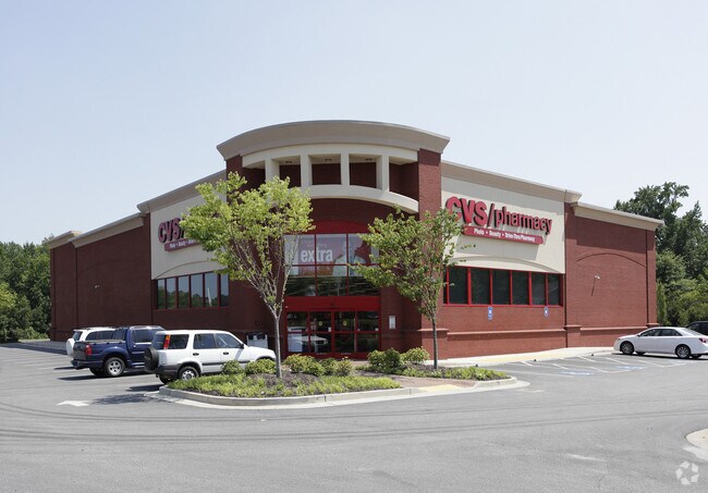
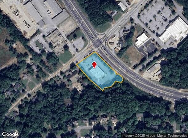
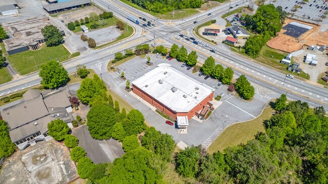
Property Record
395 Jackson St N, Newnan, GA 30263
NEARBY LISTINGS FOR SALE OR LEASE
Property Detail
395 Jackson St N
073-C-036A
CVS/2.471 AC ( LOT 1) LL 72 5 LD
Storebuilding
Coweta
X
Georgia
13077C0143D
1
2025
2.47 AC
2025
Coweta County
170200
Atlanta
12,225 SF
Atlanta-Sandy Springs-Roswell, GA
DEMOGRAPHICS near 395 Jackson St N
1 Mile
3 Mile
5 Mile
2024 Total Population
5,073
37,473
70,565
2029 Population
5,596
41,750
78,636
Pop Growth 2024-2029
+ 10.31%
+ 11.41%
+ 11.44%
Average Age
39
38
39
2024 Total Households
2,007
14,725
27,074
HH Growth 2024-2029
+ 10.41%
+ 11.42%
+ 11.48%
Median Household Inc
$76,474
$67,624
$74,938
Avg Household Size
2.50
2.50
2.60
2024 Avg HH Vehicles
2.00
2.00
2.00
Median Home Value
$265,209
$245,172
$261,336
Median Year Built
1987
1993
1997
Nearby Places
Map Layers
Map Styles
 Street
 Aerial
- Restaurants
- Banks
- Shops
- Fitness
- Groceries
PUBLIC TRANSPORTATION
AIRPORT
Hartsfield - Jackson Atlanta International
DRIVE
WALK
Distance
Hartsfield - Jackson Atlanta International
43 min
32.2 mi
Freight Ports
Port of Panama City
DRIVE
WALK
Distance
Port of Panama City
316 min
259.2 mi
SALE & LEASE HISTORY
LISTING DATE
SALE/LEASE

May 22, 2023
For Sale
Nearby Properties
Address
Land Use
TOTAL SIZE
Lot Size
Zoning
Address
Land Use
TOTAL SIZE
Lot Size
Zoning
286,548 SF
26.47 AC
ND
Address
Land Use
TOTAL SIZE
Lot Size
Zoning
269,327 SF
6.57 AC
ND
Address
Land Use
TOTAL SIZE
Lot Size
Zoning
449,108 SF
53.36 AC
C2
Address
Land Use
TOTAL SIZE
Lot Size
Zoning
208,092 SF
9.85 AC
R2
Address
Land Use
TOTAL SIZE
Lot Size
Zoning
1,955,650 SF
101.74 AC
M
Address
Land Use
TOTAL SIZE
Lot Size
Zoning
340,087 SF
24.91 AC
R1
Address
Land Use
TOTAL SIZE
Lot Size
Zoning
272,918 SF
24.21 AC
ND
Address
Land Use
TOTAL SIZE
Lot Size
Zoning
205,636 SF
32 AC
R1
Address
Land Use
TOTAL SIZE
Lot Size
Zoning
323,991 SF
22.48 AC
001
Address
Land Use
TOTAL SIZE
Lot Size
Zoning
395,621 SF
35.51 AC
001
Address
Land Use
TOTAL SIZE
Lot Size
Zoning
403,472 SF
61.64 AC
M
Address
Land Use
TOTAL SIZE
Lot Size
Zoning
208,524 SF
19.59 AC
R2
Address
Land Use
TOTAL SIZE
Lot Size
Zoning
237,164 SF
16.85 AC
R1
Address
Land Use
TOTAL SIZE
Lot Size
Zoning
188,907 SF
25.22 AC
001
Address
Land Use
TOTAL SIZE
Lot Size
Zoning
252,746 SF
20.93 AC
M
Address
Land Use
TOTAL SIZE
Lot Size
Zoning
349,504 SF
26.40 AC
C2
Address
Land Use
TOTAL SIZE
Lot Size
Zoning
196,093 SF
17.31 AC
002
Address
Land Use
TOTAL SIZE
Lot Size
Zoning
446,159 SF
49.05 AC
M
Address
Land Use
TOTAL SIZE
Lot Size
Zoning
229,770 SF
30 AC
001
Address
Land Use
TOTAL SIZE
Lot Size
Zoning
367,120 SF
28.64 AC
M
Address
Land Use
TOTAL SIZE
Lot Size
Zoning
136,343 SF
19.77 AC
R2
Address
Land Use
TOTAL SIZE
Lot Size
Zoning
121,224 SF
15.94 AC
R2
Address
Land Use
TOTAL SIZE
Lot Size
Zoning
137,519 SF
30.65 AC
R2
Address
Land Use
TOTAL SIZE
Lot Size
Zoning
111,730 SF
23.33 AC
001
Address
Land Use
TOTAL SIZE
Lot Size
Zoning
175,159 SF
20.20 AC
002
Address
Land Use
TOTAL SIZE
Lot Size
Zoning
71,484 SF
45.43 AC
R1
Address
Land Use
TOTAL SIZE
Lot Size
Zoning
118,282 SF
4.85 AC
C2
Address
Land Use
TOTAL SIZE
Lot Size
Zoning
128,510 SF
25.10 AC
R1
Address
Land Use
TOTAL SIZE
Lot Size
Zoning
124,120 SF
30.64 AC
001
Address
Land Use
TOTAL SIZE
Lot Size
Zoning
145,274 SF
10 AC
R1
The World's #1 Commercial Real Estate Marketplace
Connect with us
© 2026 CoStar Group
The information above has been obtained from sources believed reliable. While we do not doubt its accuracy we have not verified it and make no guarantee, warranty or representation about it. It is your responsibility to independently confirm its accuracy and completeness. Any projections, opinions, assumptions, or estimates used are for example only and do not represent the current or future performance of the property. The value of this transaction to you depends on tax and other factors which should be evaluated by your tax, financial, and legal advisors. You and your advisors should conduct a careful, independent investigation of the property to determine to your satisfaction the suitability of the property for your needs.