Property Record
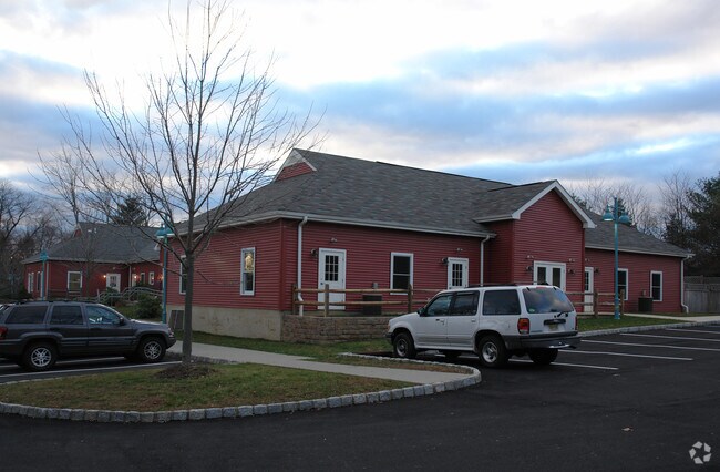
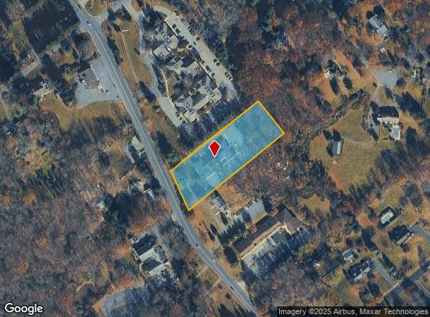
395 Route 24, Chester, NJ 07930

NEARBY LISTINGS FOR SALE OR LEASE
Property Detail
395 Route 24
Newark, NJ-PA
Chester
07-00026-05-00011-02
Morris
Daycare
New Jersey
2024
11.2
2025
2 AC
045904
Western Morris
9,137 SF
Northern New Jersey
DEMOGRAPHICS near 395 Route 24
1 Mile
3 Mile
5 Mile
2024 Total Population
1,639
9,717
35,045
2029 Population
1,637
9,663
34,858
Pop Growth 2024-2029
(0.12%)
(0.56%)
(0.53%)
Average Age
42
42
43
2024 Total Households
543
3,290
12,039
HH Growth 2024-2029
(0.18%)
(0.58%)
(0.54%)
Median Household Inc
$175,735
$179,626
$174,933
Avg Household Size
3.00
2.90
2.80
2024 Avg HH Vehicles
2.00
2.00
2.00
Median Home Value
$731,629
$758,538
$624,683
Median Year Built
1980
1979
1973
Nearby Places
Map Layers
Map Styles
 Street
 Aerial
- Restaurants
- Banks
- Shops
- Fitness
- Groceries
PUBLIC TRANSPORTATION
COMMUTER RAIL
Gladstone (Morris & Essex Gladstone Branch - NJ Transit Commuter Rail (NJ Transit))
DRIVE
WALK
Distance
Gladstone (Morris & Essex Gladstone Branch - NJ Transit Commuter Rail (NJ Transit))
12 min
6.9 mi
Peapack (Morris & Essex Gladstone Branch - NJ Transit Commuter Rail (NJ Transit))
DRIVE
WALK
Distance
Peapack (Morris & Essex Gladstone Branch - NJ Transit Commuter Rail (NJ Transit))
13 min
8.0 mi
AIRPORT
Newark Liberty International
DRIVE
WALK
Distance
Newark Liberty International
45 min
32.5 mi
Freight Ports
Maher Terminal
DRIVE
WALK
Distance
Maher Terminal
47 min
33.0 mi
SALE & LEASE HISTORY
LISTING DATE
SALE/LEASE

Sep 23, 2016
For Sale
Oct 30, 2020
For Lease
Oct 08, 2020
For Sale
Jun 05, 2017
For Sale
Nearby Properties
Address
Land Use
TOTAL SIZE
Lot Size
Zoning
Address
Land Use
TOTAL SIZE
Lot Size
Zoning
21.56 AC
B-3
Address
Land Use
TOTAL SIZE
Lot Size
Zoning
104,682 SF
8.96 AC
B-3
Address
Land Use
TOTAL SIZE
Lot Size
Zoning
720 SF
1,022.40 AC
R-2
Address
Land Use
TOTAL SIZE
Lot Size
Zoning
282.25 AC
CR-1
Address
Land Use
TOTAL SIZE
Lot Size
Zoning
27.40 AC
P
Address
Land Use
TOTAL SIZE
Lot Size
Zoning
610.04 AC
R-5
Address
Land Use
TOTAL SIZE
Lot Size
Zoning
39.63 AC
P
Address
Land Use
TOTAL SIZE
Lot Size
Zoning
111.68 AC
R-10
Address
Land Use
TOTAL SIZE
Lot Size
Zoning
Address
Land Use
TOTAL SIZE
Lot Size
Zoning
65,914 SF
7.25 AC
B-3
Address
Land Use
TOTAL SIZE
Lot Size
Zoning
1,036 SF
285.42 AC
P
Address
Land Use
TOTAL SIZE
Lot Size
Zoning
20.88 AC
R-5
Address
Land Use
TOTAL SIZE
Lot Size
Zoning
52,027 SF
33.23 AC
R-2
Address
Land Use
TOTAL SIZE
Lot Size
Zoning
1,516 SF
40.74 AC
R-LD
Address
Land Use
TOTAL SIZE
Lot Size
Zoning
3,328 SF
12.65 AC
B-2
Address
Land Use
TOTAL SIZE
Lot Size
Zoning
222.10 AC
R-3
Address
Land Use
TOTAL SIZE
Lot Size
Zoning
213.55 AC
R-5
Address
Land Use
TOTAL SIZE
Lot Size
Zoning
14,500 SF
1.10 AC
R5
Address
Land Use
TOTAL SIZE
Lot Size
Zoning
13,529 SF
4.96 AC
R-5
Address
Land Use
TOTAL SIZE
Lot Size
Zoning
85 AC
R-10
Address
Land Use
TOTAL SIZE
Lot Size
Zoning
10,889 SF
2.40 AC
R-HD
Address
Land Use
TOTAL SIZE
Lot Size
Zoning
146 AC
P
Address
Land Use
TOTAL SIZE
Lot Size
Zoning
9.52 AC
IL
Address
Land Use
TOTAL SIZE
Lot Size
Zoning
10,714 SF
1 AC
R-5
Address
Land Use
TOTAL SIZE
Lot Size
Zoning
31,680 SF
3.23 AC
OP
Address
Land Use
TOTAL SIZE
Lot Size
Zoning
28,260 SF
2.84 AC
B-3
Address
Land Use
TOTAL SIZE
Lot Size
Zoning
64.01 AC
I
Address
Land Use
TOTAL SIZE
Lot Size
Zoning
151.11 AC
R-2
Address
Land Use
TOTAL SIZE
Lot Size
Zoning
22,907 SF
1.88 AC
C-2
Address
Land Use
TOTAL SIZE
Lot Size
Zoning
12,818 SF
3 AC
R-10
The World's #1 Commercial Real Estate Marketplace
Connect with us
© 2025 CoStar Group
The information above has been obtained from sources believed reliable. While we do not doubt its accuracy we have not verified it and make no guarantee, warranty or representation about it. It is your responsibility to independently confirm its accuracy and completeness. Any projections, opinions, assumptions, or estimates used are for example only and do not represent the current or future performance of the property. The value of this transaction to you depends on tax and other factors which should be evaluated by your tax, financial, and legal advisors. You and your advisors should conduct a careful, independent investigation of the property to determine to your satisfaction the suitability of the property for your needs.