Property Record
395 W Keystone Rd, Imperial, CA 92251
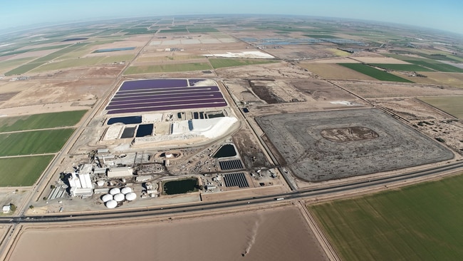

Property Detail
395 W Keystone Rd
El Centro, CA
TR 70 A & THAT POR OF TR 70 B T14S R14E 230 AC M/L
040-330-002-000
IMPERIAL
Industrialgeneral
California
B and X Area of moderate flood hazard, usually the area between the limits of the 100-year and 500-year floods.
315.15 AC
2024
Yuma & El Centro
2025
Other Market Areas
010402
NEARBY LISTINGS FOR SALE OR LEASE
DEMOGRAPHICS near 395 W Keystone Rd
1 mile
3 mile
5 mile
2025 Total Population
3
622
22,533
2030 Population
3
651
23,350
Pop Growth 2025-2030
0.00%
+ 4.66%
+ 3.63%
Average Age
0
34
36
2025 Total Households
1
177
7,074
HH Growth 2025-2030
0.00%
+ 4.52%
+ 3.39%
Median Household Inc
$0
$97,265
$88,981
Avg Household Size
.00
3.50
3.20
2025 Avg HH Vehicles
.00
2.00
2.00
Median Home Value
$0
$359,835
$355,878
Median Year Built
0
1996
1991
Nearby Places
Map Layers
Map Styles
 Street
 Aerial
Layers
 Traffic
 Biking
Places
Listings with unknown addresses are not visible on the map
- Restaurants
- Banks
- Shops
- Fitness
- Groceries
Nearby Properties
Address
Land Use
TOTAL SIZE
Lot Size
Zoning
Address
Land Use
TOTAL SIZE
Lot Size
Zoning
17.56 AC
Address
Land Use
TOTAL SIZE
Lot Size
Zoning
7.71 AC
Address
Land Use
TOTAL SIZE
Lot Size
Zoning
17.33 AC
Address
Land Use
TOTAL SIZE
Lot Size
Zoning
239.75 AC
Address
Land Use
TOTAL SIZE
Lot Size
Zoning
23.83 AC
Address
Land Use
TOTAL SIZE
Lot Size
Zoning
148.07 AC
Address
Land Use
TOTAL SIZE
Lot Size
Zoning
237.67 AC
Address
Land Use
TOTAL SIZE
Lot Size
Zoning
134.68 AC
Address
Land Use
TOTAL SIZE
Lot Size
Zoning
49.29 AC
Address
Land Use
TOTAL SIZE
Lot Size
Zoning
Address
Land Use
TOTAL SIZE
Lot Size
Zoning
Address
Land Use
TOTAL SIZE
Lot Size
Zoning
112.92 AC
Address
Land Use
TOTAL SIZE
Lot Size
Zoning
6.12 AC
Address
Land Use
TOTAL SIZE
Lot Size
Zoning
Address
Land Use
TOTAL SIZE
Lot Size
Zoning
Address
Land Use
TOTAL SIZE
Lot Size
Zoning
The World's #1 Commercial Real Estate Marketplace
Connect with us
© 2026 CoStar Group
The information above has been obtained from sources believed reliable. While we do not doubt its accuracy we have not verified it and make no guarantee, warranty or representation about it. It is your responsibility to independently confirm its accuracy and completeness. Any projections, opinions, assumptions, or estimates used are for example only and do not represent the current or future performance of the property. The value of this transaction to you depends on tax and other factors which should be evaluated by your tax, financial, and legal advisors. You and your advisors should conduct a careful, independent investigation of the property to determine to your satisfaction the suitability of the property for your needs.