Property Record
395 Westgate Plz, Franklin, NC 28734
Save to a Folder
{{folder.Name}}
{{folder.ListingIds.length}} Properties
{{folder.ListingIds.length}} Property
Create a New Folder
Property Detail
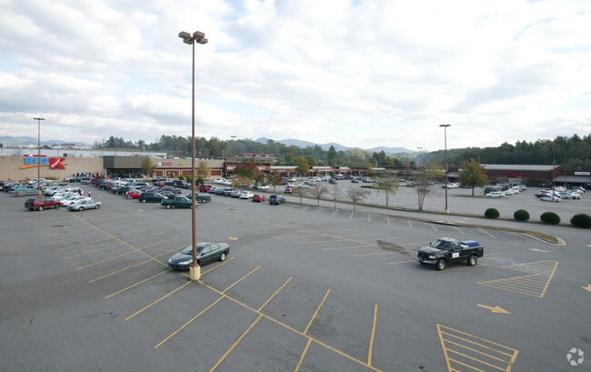
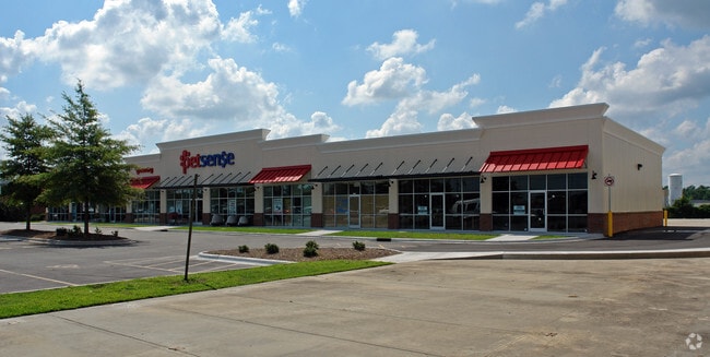
395 Westgate Plz
Wholesaleoutletdiscountstore
PHASE I SHOPS WESTGATE PLAZA
FC3
MACON
B and X Area of moderate flood hazard, usually the area between the limits of the 100-year and 500-year floods.
North Carolina
2025
6.20 AC
2025
North Carolina West/Cherokee Area
970700
Other Market Areas
89,999 SF
6584548341
NEARBY LISTINGS FOR SALE OR LEASE
DEMOGRAPHICS near 395 Westgate Plz
1 mile
3 mile
5 mile
2025 Total Population
1,565
10,078
19,457
2030 Population
1,572
10,143
19,766
Pop Growth 2025-2030
+ 0.45%
+ 0.64%
+ 1.59%
Average Age
42
44
45
2025 Total Households
658
4,367
8,450
HH Growth 2025-2030
+ 0.61%
+ 0.80%
+ 1.74%
Median Household Inc
$42,611
$46,340
$52,228
Avg Household Size
2.30
2.20
2.20
2025 Avg HH Vehicles
2.00
2.00
2.00
Median Home Value
$300,549
$236,533
$233,941
Median Year Built
1975
1982
1983
Nearby Places
Map Layers
Map Styles
 Street
 Aerial
Layers
 Traffic
 Biking
Places
Listings with unknown addresses are not visible on the map
- Restaurants
- Banks
- Shops
- Fitness
- Groceries
Nearby Properties
Address
Land Use
TOTAL SIZE
Lot Size
Zoning
Address
Land Use
TOTAL SIZE
Lot Size
Zoning
81,400 SF
12.89 AC
FC3
Address
Land Use
TOTAL SIZE
Lot Size
Zoning
37,816 SF
185.14 AC
FR1
Address
Land Use
TOTAL SIZE
Lot Size
Zoning
23,014 SF
20.40 AC
FNMU
Address
Land Use
TOTAL SIZE
Lot Size
Zoning
92,334 SF
19.92 AC
FC3
Address
Land Use
TOTAL SIZE
Lot Size
Zoning
105,575 SF
32.56 AC
EX
Address
Land Use
TOTAL SIZE
Lot Size
Zoning
72,971 SF
13.03 AC
FC3
Address
Land Use
TOTAL SIZE
Lot Size
Zoning
61,760 SF
11.12 AC
FC3
Address
Land Use
TOTAL SIZE
Lot Size
Zoning
30,000 SF
11.66 AC
FPCD
Address
Land Use
TOTAL SIZE
Lot Size
Zoning
47,839 SF
7.50 AC
FR2
Address
Land Use
TOTAL SIZE
Lot Size
Zoning
117,079 SF
28.67 AC
FC2SU
Address
Land Use
TOTAL SIZE
Lot Size
Zoning
122,246 SF
23.26 AC
FC3
Address
Land Use
TOTAL SIZE
Lot Size
Zoning
13,196 SF
17.47 AC
FMICR
Address
Land Use
TOTAL SIZE
Lot Size
Zoning
30,196 SF
5 AC
FMICR
Address
Land Use
TOTAL SIZE
Lot Size
Zoning
103,673 SF
30.75 AC
FI1
Address
Land Use
TOTAL SIZE
Lot Size
Zoning
88,118 SF
11.86 AC
FC3
Address
Land Use
TOTAL SIZE
Lot Size
Zoning
32,117 SF
1.61 AC
FC1
Address
Land Use
TOTAL SIZE
Lot Size
Zoning
51,566 SF
11.81 AC
FC3
Address
Land Use
TOTAL SIZE
Lot Size
Zoning
18,800 SF
4.27 AC
FC2SU
Address
Land Use
TOTAL SIZE
Lot Size
Zoning
38,232 SF
4.42 AC
FC3
Address
Land Use
TOTAL SIZE
Lot Size
Zoning
17,800 SF
2.54 AC
FC1
Address
Land Use
TOTAL SIZE
Lot Size
Zoning
22,224 SF
1.38 AC
FC1
Address
Land Use
TOTAL SIZE
Lot Size
Zoning
28,746 SF
6 AC
FC3
Address
Land Use
TOTAL SIZE
Lot Size
Zoning
16,122 SF
1.15 AC
FC1
Address
Land Use
TOTAL SIZE
Lot Size
Zoning
17,888 SF
0.88 AC
FC1
Address
Land Use
TOTAL SIZE
Lot Size
Zoning
17,500 SF
9 AC
FC3
Address
Land Use
TOTAL SIZE
Lot Size
Zoning
9,008 SF
8.80 AC
FC3
Address
Land Use
TOTAL SIZE
Lot Size
Zoning
30,036 SF
5 AC
FC2SU
Address
Land Use
TOTAL SIZE
Lot Size
Zoning
20,804 SF
4.52 AC
FC2
Address
Land Use
TOTAL SIZE
Lot Size
Zoning
16.54 AC
FNMU
Address
Land Use
TOTAL SIZE
Lot Size
Zoning
15,516 SF
2.03 AC
FR1
The World's #1 Commercial Real Estate Marketplace
Connect with us
© 2026 CoStar Group
The information above has been obtained from sources believed reliable. While we do not doubt its accuracy we have not verified it and make no guarantee, warranty or representation about it. It is your responsibility to independently confirm its accuracy and completeness. Any projections, opinions, assumptions, or estimates used are for example only and do not represent the current or future performance of the property. The value of this transaction to you depends on tax and other factors which should be evaluated by your tax, financial, and legal advisors. You and your advisors should conduct a careful, independent investigation of the property to determine to your satisfaction the suitability of the property for your needs.