Property Record
3950 Airport Center Dr, Palm Springs, CA 92264


NEARBY LISTINGS FOR SALE OR LEASE
-
-
View all Palm Springs listings for sale on LoopNet.com
Property Detail
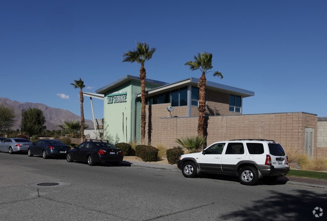
3950 Airport Center Dr
Riverside-San Bernardino-Ontario, CA
Parcel Map 26628
677-490-009
3.61 ACRES M/L IN PAR 2 PM 173/042 PM NO 26628
Publicstorage
Riverside
X
California
06065C1559G
2
2024
3.61 AC
2025
Coachella Valley
941200
Inland Empire (California)
76,490 SF
DEMOGRAPHICS near 3950 Airport Center Dr
1 Mile
3 Mile
5 Mile
2024 Total Population
7,142
92,562
133,680
2029 Population
7,783
101,017
146,532
Pop Growth 2024-2029
+ 8.98%
+ 9.13%
+ 9.61%
Average Age
46
48
48
2024 Total Households
3,144
41,886
61,074
HH Growth 2024-2029
+ 9.41%
+ 9.74%
+ 9.96%
Median Household Inc
$53,099
$64,893
$67,182
Avg Household Size
2.20
2.10
2.10
2024 Avg HH Vehicles
2.00
2.00
2.00
Median Home Value
$638,342
$575,392
$601,156
Median Year Built
1977
1982
1983
Nearby Places
Map Layers
Map Styles
 Street
 Aerial
- Restaurants
- Banks
- Shops
- Fitness
- Groceries
PUBLIC TRANSPORTATION
COMMUTER RAIL
Palm Springs Amtrak (Sunset Limited - Amtrak, Texas Eagle - Amtrak)
DRIVE
WALK
Distance
Palm Springs Amtrak (Sunset Limited - Amtrak, Texas Eagle - Amtrak)
16 min
8.2 mi
AIRPORT
Palm Springs International
DRIVE
WALK
Distance
Palm Springs International
5 min
2.4 mi
Freight Ports
Port of San Diego
DRIVE
WALK
Distance
Port of San Diego
158 min
128.2 mi
Nearby Properties
Address
Land Use
TOTAL SIZE
Lot Size
Zoning
Address
Land Use
TOTAL SIZE
Lot Size
Zoning
485,000 SF
14.71 AC
Address
Land Use
TOTAL SIZE
Lot Size
Zoning
97,065 SF
4.64 AC
R3
Address
Land Use
TOTAL SIZE
Lot Size
Zoning
197,439 SF
8.76 AC
Address
Land Use
TOTAL SIZE
Lot Size
Zoning
258,547 SF
3.84 AC
Address
Land Use
TOTAL SIZE
Lot Size
Zoning
332,356 SF
9.05 AC
Address
Land Use
TOTAL SIZE
Lot Size
Zoning
35,188 SF
5.98 AC
R3
Address
Land Use
TOTAL SIZE
Lot Size
Zoning
148,746 SF
6.21 AC
R3
Address
Land Use
TOTAL SIZE
Lot Size
Zoning
225,833 SF
22 AC
Address
Land Use
TOTAL SIZE
Lot Size
Zoning
207,931 SF
6.34 AC
C1AA
Address
Land Use
TOTAL SIZE
Lot Size
Zoning
129,852 SF
11.17 AC
Address
Land Use
TOTAL SIZE
Lot Size
Zoning
5,509 SF
10.06 AC
PCC
Address
Land Use
TOTAL SIZE
Lot Size
Zoning
120,754 SF
14.30 AC
Address
Land Use
TOTAL SIZE
Lot Size
Zoning
147,744 SF
3.62 AC
Address
Land Use
TOTAL SIZE
Lot Size
Zoning
120,548 SF
4.63 AC
Address
Land Use
TOTAL SIZE
Lot Size
Zoning
322,000 SF
19.09 AC
Address
Land Use
TOTAL SIZE
Lot Size
Zoning
3.20 AC
GR5
Address
Land Use
TOTAL SIZE
Lot Size
Zoning
48,958 SF
0.96 AC
Address
Land Use
TOTAL SIZE
Lot Size
Zoning
70,670 SF
3.90 AC
R4
Address
Land Use
TOTAL SIZE
Lot Size
Zoning
31,488 SF
3.40 AC
A
Address
Land Use
TOTAL SIZE
Lot Size
Zoning
56,129 SF
2.76 AC
R3
Address
Land Use
TOTAL SIZE
Lot Size
Zoning
28,506 SF
2.30 AC
R3
Address
Land Use
TOTAL SIZE
Lot Size
Zoning
233,083 SF
2.20 AC
Address
Land Use
TOTAL SIZE
Lot Size
Zoning
133,920 SF
8.26 AC
R1
Address
Land Use
TOTAL SIZE
Lot Size
Zoning
114,044 SF
5.40 AC
R3
Address
Land Use
TOTAL SIZE
Lot Size
Zoning
109,231 SF
5.57 AC
R4
Address
Land Use
TOTAL SIZE
Lot Size
Zoning
Address
Land Use
TOTAL SIZE
Lot Size
Zoning
53,229 SF
8.80 AC
Address
Land Use
TOTAL SIZE
Lot Size
Zoning
41,962 SF
5 AC
Address
Land Use
TOTAL SIZE
Lot Size
Zoning
86,810 SF
3.60 AC
R4VP
Address
Land Use
TOTAL SIZE
Lot Size
Zoning
38,388 SF
8.31 AC
R3
The World's #1 Commercial Real Estate Marketplace
Connect with us
© 2026 CoStar Group
The information above has been obtained from sources believed reliable. While we do not doubt its accuracy we have not verified it and make no guarantee, warranty or representation about it. It is your responsibility to independently confirm its accuracy and completeness. Any projections, opinions, assumptions, or estimates used are for example only and do not represent the current or future performance of the property. The value of this transaction to you depends on tax and other factors which should be evaluated by your tax, financial, and legal advisors. You and your advisors should conduct a careful, independent investigation of the property to determine to your satisfaction the suitability of the property for your needs.