Property Record
3950 Doubles Dr, Santa Rosa, CA 95407
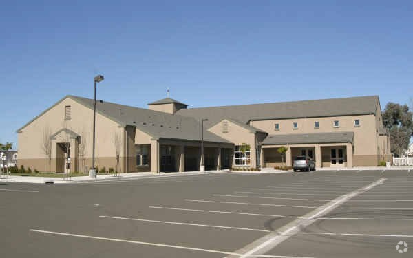


Property Detail
3950 Doubles Dr
Santa Rosa-Petaluma, CA
98FM35-102-023 & 30&27 COURTSIDE VILLAGE U1 LOT104
035-700-078
Sonoma
Religious
California
B and X Area of moderate flood hazard, usually the area between the limits of the 100-year and 500-year floods.
104
2025
1.41 AC
2025
Santa Rosa
153301
North Bay/Santa Rosa
11,098 SF
NEARBY LISTINGS FOR SALE OR LEASE
DEMOGRAPHICS near 3950 Doubles Dr
1 mile
3 mile
5 mile
2025 Total Population
12,391
90,833
174,259
2030 Population
12,283
91,030
174,539
Pop Growth 2025-2030
(0.87%)
+ 0.22%
+ 0.16%
Average Age
40
39
41
2025 Total Households
4,078
30,510
63,332
HH Growth 2025-2030
(0.91%)
+ 0.17%
+ 0.20%
Median Household Inc
$94,996
$89,545
$93,678
Avg Household Size
2.90
2.80
2.60
2025 Avg HH Vehicles
2.00
2.00
2.00
Median Home Value
$670,231
$682,453
$734,894
Median Year Built
1986
1982
1979
Nearby Places
Map Layers
Map Styles
 Street
 Aerial
Layers
 Traffic
 Biking
Places
Listings with unknown addresses are not visible on the map
- Restaurants
- Banks
- Shops
- Fitness
- Groceries
PUBLIC TRANSPORTATION
COMMUTER RAIL
Drive
Walk
Distance
6 min
3.6 mi
Drive
Walk
Distance
9 min
4.3 mi
AIRPORT
Charles M Schulz - Sonoma County
Drive
Walk
Distance
Charles M Schulz - Sonoma County
16 min
8.3 mi
Freight Ports
Port of Richmond
Drive
Walk
Distance
Port of Richmond
66 min
51.2 mi
Nearby Properties
Address
Land Use
TOTAL SIZE
Lot Size
Zoning
Address
Land Use
TOTAL SIZE
Lot Size
Zoning
22,841 SF
8.23 AC
Address
Land Use
TOTAL SIZE
Lot Size
Zoning
59,220 SF
22.98 AC
C-2
Address
Land Use
TOTAL SIZE
Lot Size
Zoning
222,278 SF
13.39 AC
CITYSR
Address
Land Use
TOTAL SIZE
Lot Size
Zoning
47,330 SF
22.01 AC
Address
Land Use
TOTAL SIZE
Lot Size
Zoning
167,485 SF
7.81 AC
Address
Land Use
TOTAL SIZE
Lot Size
Zoning
77,682 SF
0.51 AC
Address
Land Use
TOTAL SIZE
Lot Size
Zoning
57,740 SF
8.06 AC
Address
Land Use
TOTAL SIZE
Lot Size
Zoning
105,696 SF
5.46 AC
Address
Land Use
TOTAL SIZE
Lot Size
Zoning
87,300 SF
6.64 AC
Address
Land Use
TOTAL SIZE
Lot Size
Zoning
71,800 SF
7.76 AC
CIPD
Address
Land Use
TOTAL SIZE
Lot Size
Zoning
19,444 SF
7.91 AC
C2
Address
Land Use
TOTAL SIZE
Lot Size
Zoning
146,611 SF
9.44 AC
Address
Land Use
TOTAL SIZE
Lot Size
Zoning
85,920 SF
5.69 AC
CITYSR
Address
Land Use
TOTAL SIZE
Lot Size
Zoning
205,776 SF
9.96 AC
CITYSR
Address
Land Use
TOTAL SIZE
Lot Size
Zoning
53,600 SF
7.37 AC
C4
Address
Land Use
TOTAL SIZE
Lot Size
Zoning
142,272 SF
0.25 AC
C2
Address
Land Use
TOTAL SIZE
Lot Size
Zoning
95,238 SF
4.96 AC
CITYSR
Address
Land Use
TOTAL SIZE
Lot Size
Zoning
71,739 SF
3.14 AC
Address
Land Use
TOTAL SIZE
Lot Size
Zoning
109,126 SF
3.91 AC
Address
Land Use
TOTAL SIZE
Lot Size
Zoning
Address
Land Use
TOTAL SIZE
Lot Size
Zoning
86,889 SF
6.36 AC
Address
Land Use
TOTAL SIZE
Lot Size
Zoning
152,560 SF
10.92 AC
CITYSR
Address
Land Use
TOTAL SIZE
Lot Size
Zoning
50,121 SF
3.56 AC
Address
Land Use
TOTAL SIZE
Lot Size
Zoning
76,529 SF
6.10 AC
C2
Address
Land Use
TOTAL SIZE
Lot Size
Zoning
93,250 SF
8.02 AC
CITYSR
Address
Land Use
TOTAL SIZE
Lot Size
Zoning
137,312 SF
7.24 AC
CITYSR
Address
Land Use
TOTAL SIZE
Lot Size
Zoning
67,431 SF
4.24 AC
Address
Land Use
TOTAL SIZE
Lot Size
Zoning
208,379 SF
0.16 AC
CITYSR
Address
Land Use
TOTAL SIZE
Lot Size
Zoning
228,098 SF
11.64 AC
Address
Land Use
TOTAL SIZE
Lot Size
Zoning
92,282 SF
4.06 AC
The World's #1 Commercial Real Estate Marketplace
Connect with us
© 2026 CoStar Group
The information above has been obtained from sources believed reliable. While we do not doubt its accuracy we have not verified it and make no guarantee, warranty or representation about it. It is your responsibility to independently confirm its accuracy and completeness. Any projections, opinions, assumptions, or estimates used are for example only and do not represent the current or future performance of the property. The value of this transaction to you depends on tax and other factors which should be evaluated by your tax, financial, and legal advisors. You and your advisors should conduct a careful, independent investigation of the property to determine to your satisfaction the suitability of the property for your needs.