Property Record
3950 Lamar Ave, Memphis, TN 38118
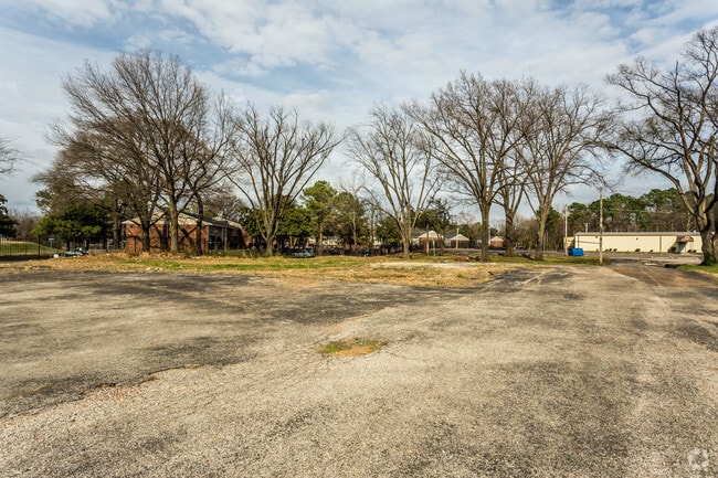
Property Detail
3950 Lamar Ave
Memphis, TN-MS-AR
Shelby
07-3041-0-0057C
Tennessee
Vacantlandnec
0.89 AC
CMU-3
Airport
B and X Area of moderate flood hazard, usually the area between the limits of the 100-year and 500-year floods.
Memphis
NEARBY LISTINGS FOR SALE OR LEASE
DEMOGRAPHICS near 3950 Lamar Ave
1 mile
3 mile
5 mile
2025 Total Population
10,135
66,810
185,231
2030 Population
10,312
66,609
184,129
Pop Growth 2025-2030
+ 1.75%
(0.30%)
(0.59%)
Average Age
34
35
36
2025 Total Households
3,558
23,850
73,327
HH Growth 2025-2030
+ 2.02%
(0.29%)
(0.67%)
Median Household Inc
$35,949
$44,422
$49,377
Avg Household Size
2.80
2.70
2.40
2025 Avg HH Vehicles
1.00
2.00
2.00
Median Home Value
$93,971
$125,372
$175,137
Median Year Built
1973
1967
1969
Nearby Places
Map Layers
Map Styles
 Street
 Aerial
Layers
 Traffic
 Biking
Places
Listings with unknown addresses are not visible on the map
- Restaurants
- Banks
- Shops
- Fitness
- Groceries
PUBLIC TRANSPORTATION
AIRPORT
Memphis International
Drive
Walk
Distance
Memphis International
11 min
4.0 mi
Nearby Properties
Address
Land Use
TOTAL SIZE
Lot Size
Zoning
Address
Land Use
TOTAL SIZE
Lot Size
Zoning
189,536 SF
49.14 AC
CMU-2
Address
Land Use
TOTAL SIZE
Lot Size
Zoning
237,911 SF
21.38 AC
EMP
Address
Land Use
TOTAL SIZE
Lot Size
Zoning
118,116 SF
60.70 AC
CMU-2
Address
Land Use
TOTAL SIZE
Lot Size
Zoning
1,292,907 SF
83.13 AC
IH
Address
Land Use
TOTAL SIZE
Lot Size
Zoning
2,847.82 AC
EMP
Address
Land Use
TOTAL SIZE
Lot Size
Zoning
38,488 SF
5.68 AC
CMU-1
Address
Land Use
TOTAL SIZE
Lot Size
Zoning
269,022 SF
23.76 AC
RU-3
Address
Land Use
TOTAL SIZE
Lot Size
Zoning
188,458 SF
29.19 AC
RU-3
Address
Land Use
TOTAL SIZE
Lot Size
Zoning
605,539 SF
28.59 AC
RU-1
Address
Land Use
TOTAL SIZE
Lot Size
Zoning
618,133 SF
37.58 AC
EMP
Address
Land Use
TOTAL SIZE
Lot Size
Zoning
585,535 SF
31.96 AC
EMP
Address
Land Use
TOTAL SIZE
Lot Size
Zoning
1,137,460 SF
62.54 AC
IH
Address
Land Use
TOTAL SIZE
Lot Size
Zoning
81,454 SF
EMP
Address
Land Use
TOTAL SIZE
Lot Size
Zoning
58.21 AC
R-6
Address
Land Use
TOTAL SIZE
Lot Size
Zoning
532,073 SF
20.99 AC
EMP
Address
Land Use
TOTAL SIZE
Lot Size
Zoning
509,111 SF
EMP
Address
Land Use
TOTAL SIZE
Lot Size
Zoning
300,702 SF
14.40 AC
RU-3
Address
Land Use
TOTAL SIZE
Lot Size
Zoning
342,605 SF
82.99 AC
CA
Address
Land Use
TOTAL SIZE
Lot Size
Zoning
411,635 SF
18.35 AC
EMP
Address
Land Use
TOTAL SIZE
Lot Size
Zoning
409,298 SF
18.94 AC
RU-1
Address
Land Use
TOTAL SIZE
Lot Size
Zoning
414,189 SF
16.71 AC
R-6
Address
Land Use
TOTAL SIZE
Lot Size
Zoning
15,370 SF
18.69 AC
RU-3
Address
Land Use
TOTAL SIZE
Lot Size
Zoning
383,949 SF
20.99 AC
EMP
Address
Land Use
TOTAL SIZE
Lot Size
Zoning
1,012,609 SF
38.67 AC
IH
Address
Land Use
TOTAL SIZE
Lot Size
Zoning
483,508 SF
27.70 AC
EMP
Address
Land Use
TOTAL SIZE
Lot Size
Zoning
338,368 SF
15.70 AC
R-8
Address
Land Use
TOTAL SIZE
Lot Size
Zoning
369,190 SF
23.75 AC
EMP
Address
Land Use
TOTAL SIZE
Lot Size
Zoning
344,016 SF
16.50 AC
R-8
Address
Land Use
TOTAL SIZE
Lot Size
Zoning
124,204 SF
8.31 AC
EMP
Address
Land Use
TOTAL SIZE
Lot Size
Zoning
671,940 SF
29.38 AC
EMP
The World's #1 Commercial Real Estate Marketplace
Connect with us
© 2026 CoStar Group
The information above has been obtained from sources believed reliable. While we do not doubt its accuracy we have not verified it and make no guarantee, warranty or representation about it. It is your responsibility to independently confirm its accuracy and completeness. Any projections, opinions, assumptions, or estimates used are for example only and do not represent the current or future performance of the property. The value of this transaction to you depends on tax and other factors which should be evaluated by your tax, financial, and legal advisors. You and your advisors should conduct a careful, independent investigation of the property to determine to your satisfaction the suitability of the property for your needs.