Property Record
3950 N 32Nd St, Muskogee, OK 74401
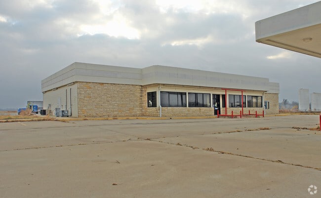


Property Detail
3950 N 32Nd St
45046
T15N R18E S09 PART N NE BEGINNING AT POINT N881905E 855.12 N\C S014046E 24.75 S840824W 346.58 S015254E 417 N881905E 705.26 N0
Truckstopfuelanddiner
Muskogee
AE The base floodplain where base flood elevations are provided. AE Zones are now used on new format FIRMs instead of A1-A30 Zones.
Oklahoma
2025
14.53 AC
2025
Muskogee County
001200
Tulsa
7,228 SF
Muskogee, OK
NEARBY LISTINGS FOR SALE OR LEASE
DEMOGRAPHICS near 3950 N 32Nd St
1 mile
3 mile
5 mile
2025 Total Population
56
5,758
26,422
2030 Population
56
5,902
27,037
Pop Growth 2025-2030
0.00%
+ 2.50%
+ 2.33%
Average Age
45
40
39
2025 Total Households
22
2,370
10,726
HH Growth 2025-2030
0.00%
+ 2.45%
+ 2.37%
Median Household Inc
$46,250
$30,915
$46,148
Avg Household Size
2.30
2.20
2.30
2025 Avg HH Vehicles
2.00
2.00
2.00
Median Home Value
$225,000
$150,564
$119,934
Median Year Built
1984
1970
1967
Nearby Places
Map Layers
Map Styles
 Street
 Aerial
Layers
 Traffic
 Biking
Places
Listings with unknown addresses are not visible on the map
- Restaurants
- Banks
- Shops
- Fitness
- Groceries
Nearby Properties
Address
Land Use
TOTAL SIZE
Lot Size
Zoning
Address
Land Use
TOTAL SIZE
Lot Size
Zoning
7,312 SF
27.94 AC
Address
Land Use
TOTAL SIZE
Lot Size
Zoning
50,548 SF
43.28 AC
Address
Land Use
TOTAL SIZE
Lot Size
Zoning
69,776 SF
20.13 AC
Address
Land Use
TOTAL SIZE
Lot Size
Zoning
5,984 SF
34.70 AC
Address
Land Use
TOTAL SIZE
Lot Size
Zoning
6,720 SF
20 AC
D
Address
Land Use
TOTAL SIZE
Lot Size
Zoning
21,332 SF
5.51 AC
Address
Land Use
TOTAL SIZE
Lot Size
Zoning
6,000 SF
1.39 AC
Address
Land Use
TOTAL SIZE
Lot Size
Zoning
4,752 SF
1.29 AC
B
Address
Land Use
TOTAL SIZE
Lot Size
Zoning
20.13 AC
A
Address
Land Use
TOTAL SIZE
Lot Size
Zoning
90,709 SF
11.61 AC
Address
Land Use
TOTAL SIZE
Lot Size
Zoning
21,856 SF
3.10 AC
B
Address
Land Use
TOTAL SIZE
Lot Size
Zoning
212,283 SF
26.18 AC
Address
Land Use
TOTAL SIZE
Lot Size
Zoning
25,820 SF
14.63 AC
A
Address
Land Use
TOTAL SIZE
Lot Size
Zoning
348 SF
7.61 AC
E1
Address
Land Use
TOTAL SIZE
Lot Size
Zoning
1,560 SF
1.24 AC
E1
Address
Land Use
TOTAL SIZE
Lot Size
Zoning
22,044 SF
1.29 AC
B
Address
Land Use
TOTAL SIZE
Lot Size
Zoning
207,672 SF
2.81 AC
Address
Land Use
TOTAL SIZE
Lot Size
Zoning
5,940 SF
27.24 AC
Address
Land Use
TOTAL SIZE
Lot Size
Zoning
567 SF
2.38 AC
Address
Land Use
TOTAL SIZE
Lot Size
Zoning
9,624 SF
9.50 AC
Address
Land Use
TOTAL SIZE
Lot Size
Zoning
4,760 SF
2.45 AC
D1
Address
Land Use
TOTAL SIZE
Lot Size
Zoning
6,934 SF
6.72 AC
Address
Land Use
TOTAL SIZE
Lot Size
Zoning
45,006 SF
4.69 AC
Address
Land Use
TOTAL SIZE
Lot Size
Zoning
202,992 SF
1.75 AC
Address
Land Use
TOTAL SIZE
Lot Size
Zoning
96,111 SF
3.90 AC
B
Address
Land Use
TOTAL SIZE
Lot Size
Zoning
32,135 SF
3.99 AC
F2
Address
Land Use
TOTAL SIZE
Lot Size
Zoning
3,572 SF
5.79 AC
Address
Land Use
TOTAL SIZE
Lot Size
Zoning
9,000 SF
1.12 AC
F2
The World's #1 Commercial Real Estate Marketplace
Connect with us
© 2026 CoStar Group
The information above has been obtained from sources believed reliable. While we do not doubt its accuracy we have not verified it and make no guarantee, warranty or representation about it. It is your responsibility to independently confirm its accuracy and completeness. Any projections, opinions, assumptions, or estimates used are for example only and do not represent the current or future performance of the property. The value of this transaction to you depends on tax and other factors which should be evaluated by your tax, financial, and legal advisors. You and your advisors should conduct a careful, independent investigation of the property to determine to your satisfaction the suitability of the property for your needs.