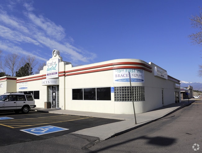
Property Record
3950 N Academy Blvd, Colorado Springs, CO 80917


NEARBY LISTINGS FOR SALE OR LEASE
Property Detail
3950 N Academy Blvd
Colorado Springs, CO
Stonebridge Sub Fil No 2
63274-01-033
LOT 2 STONEBRIDGE SUB FIL NO 2
Religious
El Paso
X
Colorado
08041C0519G
2
0
2.96 AC
2025
North
000103
Colorado Springs
48,117 SF
DEMOGRAPHICS near 3950 N Academy Blvd
1 Mile
3 Mile
5 Mile
2024 Total Population
16,736
122,287
306,860
2029 Population
17,482
126,972
319,678
Pop Growth 2024-2029
+ 4.46%
+ 3.83%
+ 4.18%
Average Age
37
39
38
2024 Total Households
7,322
50,101
123,239
HH Growth 2024-2029
+ 4.78%
+ 4.06%
+ 4.41%
Median Household Inc
$57,051
$72,367
$72,220
Avg Household Size
2.20
2.40
2.40
2024 Avg HH Vehicles
2.00
2.00
2.00
Median Home Value
$314,903
$353,539
$363,078
Median Year Built
1976
1979
1983
Nearby Places
Map Layers
Map Styles
 Street
 Aerial
- Restaurants
- Banks
- Shops
- Fitness
- Groceries
PUBLIC TRANSPORTATION
AIRPORT
City of Colorado Springs Municipal
DRIVE
WALK
Distance
City of Colorado Springs Municipal
18 min
8.7 mi
Freight Ports
Tulsa Port Of Catoosa
DRIVE
WALK
Distance
Tulsa Port Of Catoosa
736 min
690.3 mi
Nearby Properties
Address
Land Use
TOTAL SIZE
Lot Size
Zoning
Address
Land Use
TOTAL SIZE
Lot Size
Zoning
32,792 SF
7 AC
MX-M AO
Address
Land Use
TOTAL SIZE
Lot Size
Zoning
126,860 SF
23.92 AC
MX-N/CR AO
Address
Land Use
TOTAL SIZE
Lot Size
Zoning
167,120 SF
10.59 AC
MX-L/CR CU
Address
Land Use
TOTAL SIZE
Lot Size
Zoning
197,578 SF
7.98 AC
PDZ
Address
Land Use
TOTAL SIZE
Lot Size
Zoning
172,822 SF
8.74 AC
R-5 AO
Address
Land Use
TOTAL SIZE
Lot Size
Zoning
109,808 SF
8.11 AC
MX-M
Address
Land Use
TOTAL SIZE
Lot Size
Zoning
131,545 SF
12.46 AC
R-5/CR CU
Address
Land Use
TOTAL SIZE
Lot Size
Zoning
138,773 SF
4.45 AC
R-5
Address
Land Use
TOTAL SIZE
Lot Size
Zoning
86,020 SF
15.30 AC
R-1 6 CU H
Address
Land Use
TOTAL SIZE
Lot Size
Zoning
80,110 SF
2.61 AC
OR CU
Address
Land Use
TOTAL SIZE
Lot Size
Zoning
83,441 SF
4.20 AC
MX-M/CR CU
Address
Land Use
TOTAL SIZE
Lot Size
Zoning
1,223 SF
725.94 AC
PF PK SS
Address
Land Use
TOTAL SIZE
Lot Size
Zoning
86,290 SF
8.01 AC
I-2 CAD-O
Address
Land Use
TOTAL SIZE
Lot Size
Zoning
89,592 SF
7.60 AC
R-E CU
Address
Land Use
TOTAL SIZE
Lot Size
Zoning
71,542 SF
10.11 AC
PF
Address
Land Use
TOTAL SIZE
Lot Size
Zoning
30,475 SF
13.03 AC
MX-M/CR AO
Address
Land Use
TOTAL SIZE
Lot Size
Zoning
39,627 SF
1.61 AC
R-5 SS
Address
Land Use
TOTAL SIZE
Lot Size
Zoning
45,044 SF
2 AC
R-1 6
Address
Land Use
TOTAL SIZE
Lot Size
Zoning
104,162 SF
20.14 AC
R-1 6
Address
Land Use
TOTAL SIZE
Lot Size
Zoning
35,806 SF
4.41 AC
MX-M CU AO
Address
Land Use
TOTAL SIZE
Lot Size
Zoning
32,987 SF
6.55 AC
R-5/CR AO
Address
Land Use
TOTAL SIZE
Lot Size
Zoning
83,479 SF
0.03 AC
OC HS ??
Address
Land Use
TOTAL SIZE
Lot Size
Zoning
62,127 SF
6.39 AC
MX-M/CR
Address
Land Use
TOTAL SIZE
Lot Size
Zoning
45,579 SF
4.50 AC
MX-M AO
Address
Land Use
TOTAL SIZE
Lot Size
Zoning
43,800 SF
7 AC
R-1 6 CU A
Address
Land Use
TOTAL SIZE
Lot Size
Zoning
18,277 SF
5.80 AC
MX-M AO
Address
Land Use
TOTAL SIZE
Lot Size
Zoning
52,145 SF
4.09 AC
R-1 6 CU
Address
Land Use
TOTAL SIZE
Lot Size
Zoning
109,042 SF
15.56 AC
UNK
Address
Land Use
TOTAL SIZE
Lot Size
Zoning
45,320 SF
1.14 AC
MX-L/CR AO
The World's #1 Commercial Real Estate Marketplace
Connect with us
© 2026 CoStar Group
The information above has been obtained from sources believed reliable. While we do not doubt its accuracy we have not verified it and make no guarantee, warranty or representation about it. It is your responsibility to independently confirm its accuracy and completeness. Any projections, opinions, assumptions, or estimates used are for example only and do not represent the current or future performance of the property. The value of this transaction to you depends on tax and other factors which should be evaluated by your tax, financial, and legal advisors. You and your advisors should conduct a careful, independent investigation of the property to determine to your satisfaction the suitability of the property for your needs.