Property Record
3950 Pacheco Blvd, Martinez, CA 94553


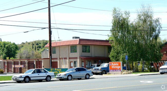
Property Detail
3950 Pacheco Blvd
161-240-015-8
PORTION RANCHO LAS JUNTAS
Publicstorage
CONTRA COSTA
C
California
A Areas with a 1% annual chance of flooding and a 26% chance of flooding over the life of a 30-year mortgage.
5.52 AC
2025
Martinez/Pacheco/Hercules
2025
East Bay/Oakland
320001
Oakland-Fremont-Berkeley, CA
94,538 SF
NEARBY LISTINGS FOR SALE OR LEASE
-
-
No Photo
-
View all Martinez listings for sale on LoopNet.com
DEMOGRAPHICS near 3950 Pacheco Blvd
1 mile
3 mile
5 mile
2025 Total Population
11,047
54,757
147,018
2030 Population
11,101
55,080
148,043
Pop Growth 2025-2030
+ 0.49%
+ 0.59%
+ 0.70%
Average Age
41
43
41
2025 Total Households
4,039
21,568
56,040
HH Growth 2025-2030
+ 0.54%
+ 0.65%
+ 0.74%
Median Household Inc
$130,216
$119,631
$112,991
Avg Household Size
2.70
2.50
2.50
2025 Avg HH Vehicles
2.00
2.00
2.00
Median Home Value
$738,711
$756,833
$777,980
Median Year Built
1984
1975
1972
Nearby Places
Map Layers
Map Styles
 Street
 Aerial
Layers
 Traffic
 Biking
Places
Listings with unknown addresses are not visible on the map
- Restaurants
- Banks
- Shops
- Fitness
- Groceries
PUBLIC TRANSPORTATION
COMMUTER RAIL
Martinez (California Zephyr - Capitol Corridor Joint Powers Authority, Capitol Corridor - Capitol Corridor Joint Powers Authority, Coast Starlight - Capitol Corridor Joint Powers Authority, San Joaquins - Capitol Corridor Joint Powers Authority)
Drive
Walk
Distance
Martinez (California Zephyr - Capitol Corridor Joint Powers Authority, Capitol Corridor - Capitol Corridor Joint Powers Authority, Coast Starlight - Capitol Corridor Joint Powers Authority, San Joaquins - Capitol Corridor Joint Powers Authority)
6 min
2.8 mi
AIRPORT
Metro Oakland International
Drive
Walk
Distance
Metro Oakland International
43 min
31.9 mi
Freight Ports
Port of Richmond
Drive
Walk
Distance
Port of Richmond
38 min
25.4 mi
Nearby Properties
Address
Land Use
TOTAL SIZE
Lot Size
Zoning
Address
Land Use
TOTAL SIZE
Lot Size
Zoning
228,197 SF
294.92 AC
HI
Address
Land Use
TOTAL SIZE
Lot Size
Zoning
28,948 SF
63.56 AC
HI
Address
Land Use
TOTAL SIZE
Lot Size
Zoning
9,000 SF
137.45 AC
Address
Land Use
TOTAL SIZE
Lot Size
Zoning
178.06 AC
HI
Address
Land Use
TOTAL SIZE
Lot Size
Zoning
25,089 SF
57.67 AC
HI
Address
Land Use
TOTAL SIZE
Lot Size
Zoning
12.82 AC
Address
Land Use
TOTAL SIZE
Lot Size
Zoning
187,998 SF
135.96 AC
Address
Land Use
TOTAL SIZE
Lot Size
Zoning
66,196 SF
40.92 AC
HI
Address
Land Use
TOTAL SIZE
Lot Size
Zoning
54,870 SF
34.53 AC
HI
Address
Land Use
TOTAL SIZE
Lot Size
Zoning
234,624 SF
6.63 AC
Address
Land Use
TOTAL SIZE
Lot Size
Zoning
70,000 SF
25.77 AC
Address
Land Use
TOTAL SIZE
Lot Size
Zoning
112,000 SF
18.40 AC
Address
Land Use
TOTAL SIZE
Lot Size
Zoning
9,840 SF
5.85 AC
Address
Land Use
TOTAL SIZE
Lot Size
Zoning
15.34 AC
Address
Land Use
TOTAL SIZE
Lot Size
Zoning
66.32 AC
Address
Land Use
TOTAL SIZE
Lot Size
Zoning
68.97 AC
Address
Land Use
TOTAL SIZE
Lot Size
Zoning
7.08 AC
Address
Land Use
TOTAL SIZE
Lot Size
Zoning
49,519 SF
2.04 AC
Address
Land Use
TOTAL SIZE
Lot Size
Zoning
3.07 AC
Address
Land Use
TOTAL SIZE
Lot Size
Zoning
71,000 SF
1.23 AC
Address
Land Use
TOTAL SIZE
Lot Size
Zoning
398.69 AC
HI
Address
Land Use
TOTAL SIZE
Lot Size
Zoning
196.06 AC
HI
Address
Land Use
TOTAL SIZE
Lot Size
Zoning
3,612 SF
4.74 AC
Address
Land Use
TOTAL SIZE
Lot Size
Zoning
27,223 SF
10.95 AC
HI
Address
Land Use
TOTAL SIZE
Lot Size
Zoning
18,626 SF
482.84 AC
U
Address
Land Use
TOTAL SIZE
Lot Size
Zoning
697.36 AC
HI
Address
Land Use
TOTAL SIZE
Lot Size
Zoning
22.30 AC
Address
Land Use
TOTAL SIZE
Lot Size
Zoning
17,752 SF
8.08 AC
LI
Address
Land Use
TOTAL SIZE
Lot Size
Zoning
188,299 SF
12.55 AC
Address
Land Use
TOTAL SIZE
Lot Size
Zoning
51,500 SF
5.92 AC
The World's #1 Commercial Real Estate Marketplace
Connect with us
© 2026 CoStar Group
The information above has been obtained from sources believed reliable. While we do not doubt its accuracy we have not verified it and make no guarantee, warranty or representation about it. It is your responsibility to independently confirm its accuracy and completeness. Any projections, opinions, assumptions, or estimates used are for example only and do not represent the current or future performance of the property. The value of this transaction to you depends on tax and other factors which should be evaluated by your tax, financial, and legal advisors. You and your advisors should conduct a careful, independent investigation of the property to determine to your satisfaction the suitability of the property for your needs.