Property Record
3950 S Rochester Rd, Rochester Hills, MI 48307


Current Lease Availabilities
NEARBY LISTINGS FOR SALE OR LEASE
Property Detail
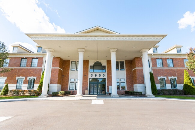
3950 S Rochester Rd
15-34-477-015
Gateway Of Rochester Hills
Commercialnec
T3N, R11E, SEC 34 PART OF SE 1/4 BEG AT PT DIST S 88-02-35 W 60.12 FT FROM SE SEC COR, TH S 88-02-35 W 401.75 FT, TH N
X
Oakland
26125C0532F
Michigan
2022
9.46 AC
2022
Rochester
194600
Detroit
43,218 SF
Detroit-Warren-Dearborn, MI
DEMOGRAPHICS near 3950 S Rochester Rd
1 Mile
3 Mile
5 Mile
2024 Total Population
7,438
71,362
203,463
2029 Population
7,305
70,739
201,584
Pop Growth 2024-2029
(1.79%)
(0.87%)
(0.92%)
Average Age
41
42
42
2024 Total Households
2,697
27,459
79,267
HH Growth 2024-2029
(1.82%)
(0.85%)
(0.90%)
Median Household Inc
$106,629
$106,289
$96,276
Avg Household Size
2.70
2.50
2.50
2024 Avg HH Vehicles
2.00
2.00
2.00
Median Home Value
$376,991
$336,264
$330,209
Median Year Built
1984
1983
1980
Nearby Places
Map Layers
Map Styles
 Street
 Aerial
- Restaurants
- Banks
- Shops
- Fitness
- Groceries
PUBLIC TRANSPORTATION
COMMUTER RAIL
Troy Amtrak Station (Wolverine - Amtrak)
DRIVE
WALK
Distance
Troy Amtrak Station (Wolverine - Amtrak)
17 min
8.9 mi
AIRPORT
Windsor International
DRIVE
WALK
Distance
Windsor International
52 min
31.8 mi
Freight Ports
Port of Toledo
DRIVE
WALK
Distance
Port of Toledo
102 min
82.3 mi
Nearby Properties
Address
Land Use
TOTAL SIZE
Lot Size
Zoning
Address
Land Use
TOTAL SIZE
Lot Size
Zoning
3,529 SF
29.19 AC
BI
Address
Land Use
TOTAL SIZE
Lot Size
Zoning
Address
Land Use
TOTAL SIZE
Lot Size
Zoning
12.38 AC
R-10
Address
Land Use
TOTAL SIZE
Lot Size
Zoning
288,288 SF
15 AC
Address
Land Use
TOTAL SIZE
Lot Size
Zoning
144,450 SF
11.22 AC
OSC
Address
Land Use
TOTAL SIZE
Lot Size
Zoning
144,450 SF
11.22 AC
Address
Land Use
TOTAL SIZE
Lot Size
Zoning
245,371 SF
19.76 AC
RC
Address
Land Use
TOTAL SIZE
Lot Size
Zoning
136,962 SF
43.80 AC
OSC
Address
Land Use
TOTAL SIZE
Lot Size
Zoning
14.48 AC
Address
Land Use
TOTAL SIZE
Lot Size
Zoning
27.89 AC
CK MAP
Address
Land Use
TOTAL SIZE
Lot Size
Zoning
28.58 AC
AI
Address
Land Use
TOTAL SIZE
Lot Size
Zoning
336,720 SF
63.11 AC
CR1
Address
Land Use
TOTAL SIZE
Lot Size
Zoning
255,070 SF
20.33 AC
RM-2
Address
Land Use
TOTAL SIZE
Lot Size
Zoning
22.09 AC
AI
Address
Land Use
TOTAL SIZE
Lot Size
Zoning
245,371 SF
15.93 AC
RC
Address
Land Use
TOTAL SIZE
Lot Size
Zoning
19.47 AC
R-8
Address
Land Use
TOTAL SIZE
Lot Size
Zoning
43.80 AC
Address
Land Use
TOTAL SIZE
Lot Size
Zoning
218,155 SF
20.98 AC
RC
Address
Land Use
TOTAL SIZE
Lot Size
Zoning
106,130 SF
5.37 AC
O-2
Address
Land Use
TOTAL SIZE
Lot Size
Zoning
21.52 AC
AI
Address
Land Use
TOTAL SIZE
Lot Size
Zoning
19.86 AC
AI
Address
Land Use
TOTAL SIZE
Lot Size
Zoning
19.30 AC
CK MAP
Address
Land Use
TOTAL SIZE
Lot Size
Zoning
51.98 AC
MHP
Address
Land Use
TOTAL SIZE
Lot Size
Zoning
142,580 SF
14.26 AC
RC
Address
Land Use
TOTAL SIZE
Lot Size
Zoning
12.22 AC
RM-2
Address
Land Use
TOTAL SIZE
Lot Size
Zoning
128,340 SF
11 AC
Address
Land Use
TOTAL SIZE
Lot Size
Zoning
11.98 AC
RI
Address
Land Use
TOTAL SIZE
Lot Size
Zoning
89,460 SF
7.31 AC
BI
The World's #1 Commercial Real Estate Marketplace
Connect with us
© 2026 CoStar Group
The information above has been obtained from sources believed reliable. While we do not doubt its accuracy we have not verified it and make no guarantee, warranty or representation about it. It is your responsibility to independently confirm its accuracy and completeness. Any projections, opinions, assumptions, or estimates used are for example only and do not represent the current or future performance of the property. The value of this transaction to you depends on tax and other factors which should be evaluated by your tax, financial, and legal advisors. You and your advisors should conduct a careful, independent investigation of the property to determine to your satisfaction the suitability of the property for your needs.