Property Record
3951 W Herbison Rd, Dewitt, MI 48820

Property Detail
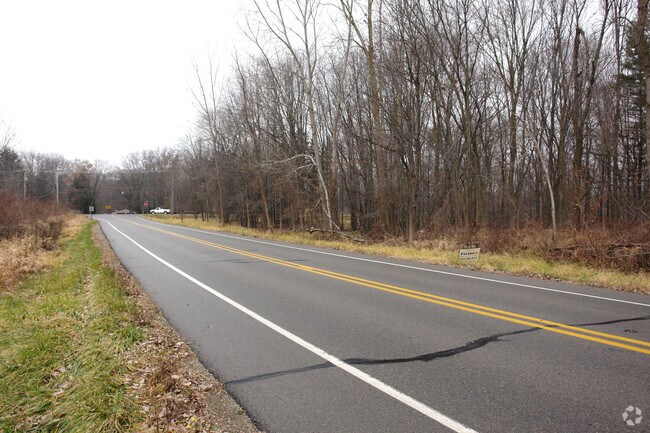
3951 W Herbison Rd
Lansing-East Lansing, MI
BEG 785.07 FT N OF THE W 1/4 COR SEC 18, T5NR2W, TH N 252.73 FT TO THE S'LY ROWLN OF HERBISON RD, TH N 73 DEG E ALONG SD ROW
050-018-200-021-60
CLINTON
Residentialacreage
Michigan
R6
86,66l
AE The base floodplain where base flood elevations are provided. AE Zones are now used on new format FIRMs instead of A1-A30 Zones.
6.40 AC
2024
Outlying Clinton County
2025
West Michigan
010105
NEARBY LISTINGS FOR SALE OR LEASE
DEMOGRAPHICS near 3951 W Herbison Rd
1 mile
3 mile
5 mile
2025 Total Population
3,764
17,208
34,561
2030 Population
3,785
17,412
34,824
Pop Growth 2025-2030
+ 0.56%
+ 1.19%
+ 0.76%
Average Age
42
41
42
2025 Total Households
1,392
6,489
13,651
HH Growth 2025-2030
+ 0.50%
+ 1.22%
+ 0.75%
Median Household Inc
$134,457
$124,397
$98,835
Avg Household Size
2.70
2.60
2.50
2025 Avg HH Vehicles
2.00
2.00
2.00
Median Home Value
$380,733
$358,159
$281,614
Median Year Built
1988
1991
1975
Nearby Places
Map Layers
Map Styles
 Street
 Aerial
Layers
 Traffic
 Biking
Places
Listings with unknown addresses are not visible on the map
- Restaurants
- Banks
- Shops
- Fitness
- Groceries
PUBLIC TRANSPORTATION
AIRPORT
Capital Region International
Drive
Walk
Distance
Capital Region International
10 min
5.1 mi
Freight Ports
Port of Toledo
Drive
Walk
Distance
Port of Toledo
158 min
124.6 mi
Nearby Properties
Address
Land Use
TOTAL SIZE
Lot Size
Zoning
Address
Land Use
TOTAL SIZE
Lot Size
Zoning
4,312 SF
30.47 AC
M3
Address
Land Use
TOTAL SIZE
Lot Size
Zoning
5,180 SF
16.94 AC
M2
Address
Land Use
TOTAL SIZE
Lot Size
Zoning
3,252 SF
10.16 AC
M3
Address
Land Use
TOTAL SIZE
Lot Size
Zoning
4,976 SF
6.23 AC
MF-N
Address
Land Use
TOTAL SIZE
Lot Size
Zoning
8,270 SF
13.15 AC
M3
Address
Land Use
TOTAL SIZE
Lot Size
Zoning
14,276 SF
6.42 AC
M3
Address
Land Use
TOTAL SIZE
Lot Size
Zoning
10,992 SF
10.43 AC
M3
Address
Land Use
TOTAL SIZE
Lot Size
Zoning
56,579 SF
8.48 AC
BSC
Address
Land Use
TOTAL SIZE
Lot Size
Zoning
4,464 SF
8.29 AC
MF
Address
Land Use
TOTAL SIZE
Lot Size
Zoning
39,372 SF
5.86 AC
BSC
Address
Land Use
TOTAL SIZE
Lot Size
Zoning
19,000 SF
CB
Address
Land Use
TOTAL SIZE
Lot Size
Zoning
8,247 SF
3.75 AC
BC
Address
Land Use
TOTAL SIZE
Lot Size
Zoning
26,110 SF
6.73 AC
OP
Address
Land Use
TOTAL SIZE
Lot Size
Zoning
15,576 SF
5.75 AC
M3
Address
Land Use
TOTAL SIZE
Lot Size
Zoning
17,490 SF
3.48 AC
BC
Address
Land Use
TOTAL SIZE
Lot Size
Zoning
22,413 SF
3.32 AC
M4
Address
Land Use
TOTAL SIZE
Lot Size
Zoning
5,536 SF
95.10 AC
PQ
Address
Land Use
TOTAL SIZE
Lot Size
Zoning
12,915 SF
0.95 AC
BL
Address
Land Use
TOTAL SIZE
Lot Size
Zoning
1,912 SF
6.61 AC
M3
Address
Land Use
TOTAL SIZE
Lot Size
Zoning
5,126 SF
1.59 AC
BSC
Address
Land Use
TOTAL SIZE
Lot Size
Zoning
89.93 AC
AG
Address
Land Use
TOTAL SIZE
Lot Size
Zoning
10,582 SF
1.43 AC
BC
Address
Land Use
TOTAL SIZE
Lot Size
Zoning
106 AC
POD
Address
Land Use
TOTAL SIZE
Lot Size
Zoning
4,655 SF
1.41 AC
BC
Address
Land Use
TOTAL SIZE
Lot Size
Zoning
20,520 SF
0.88 AC
CB
Address
Land Use
TOTAL SIZE
Lot Size
Zoning
4,831 SF
1.19 AC
BC
Address
Land Use
TOTAL SIZE
Lot Size
Zoning
8,640 SF
2.19 AC
MF
Address
Land Use
TOTAL SIZE
Lot Size
Zoning
15,340 SF
3.56 AC
M3
Address
Land Use
TOTAL SIZE
Lot Size
Zoning
5,642 SF
2.01 AC
BC
Address
Land Use
TOTAL SIZE
Lot Size
Zoning
11,649 SF
1.33 AC
BC
The World's #1 Commercial Real Estate Marketplace
Connect with us
© 2026 CoStar Group
The information above has been obtained from sources believed reliable. While we do not doubt its accuracy we have not verified it and make no guarantee, warranty or representation about it. It is your responsibility to independently confirm its accuracy and completeness. Any projections, opinions, assumptions, or estimates used are for example only and do not represent the current or future performance of the property. The value of this transaction to you depends on tax and other factors which should be evaluated by your tax, financial, and legal advisors. You and your advisors should conduct a careful, independent investigation of the property to determine to your satisfaction the suitability of the property for your needs.