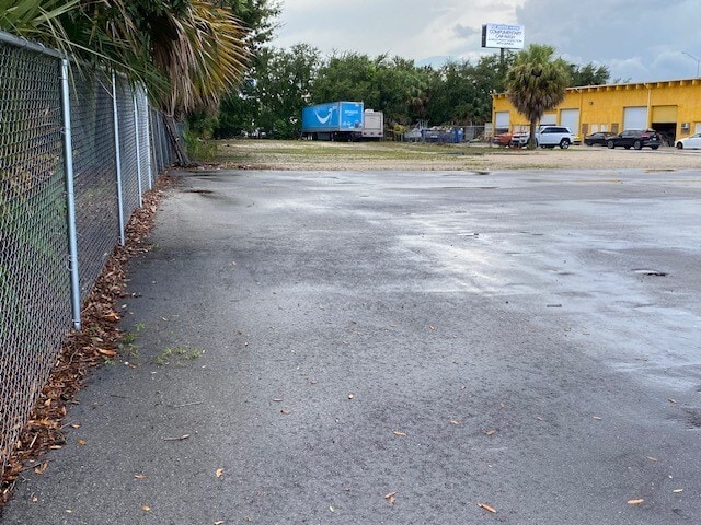
Property Record
3954 Byron Dr, Riviera Beach, FL 33404
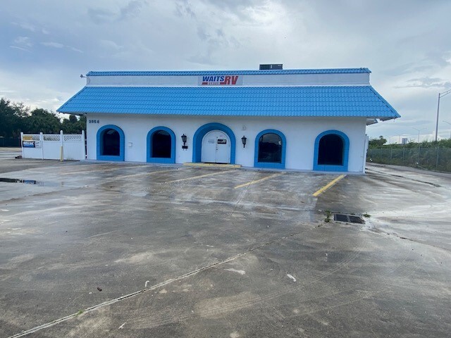


Property Detail
3954 Byron Dr
56-43-42-30-00-000-7140
30-42-43~ TH PT OF S 300 FT OFN 3217.7 FT OF WLY 260 FT LYG E OF I-95 R/W
Warehouse
Palm Beach
CG
Florida
B and X Area of moderate flood hazard, usually the area between the limits of the 100-year and 500-year floods.
1.61 AC
2024
Central Palm Bch Area
2025
South Florida
001004
West Palm Beach-Boca Raton-Delray Beach, FL
14,460 SF
NEARBY LISTINGS FOR SALE OR LEASE
-
-
-
-
-
-
-
-
-
-
No Photo
-
-
View all Riviera Beach listings for lease on LoopNet.com
DEMOGRAPHICS near 3954 Byron Dr
1 mile
3 mile
5 mile
2025 Total Population
13,275
94,604
221,925
2030 Population
14,279
100,791
238,102
Pop Growth 2025-2030
+ 7.56%
+ 6.54%
+ 7.29%
Average Age
39
39
43
2025 Total Households
4,850
34,955
93,749
HH Growth 2025-2030
+ 7.28%
+ 5.90%
+ 7.02%
Median Household Inc
$75,393
$74,586
$75,605
Avg Household Size
2.60
2.60
2.20
2025 Avg HH Vehicles
2.00
2.00
2.00
Median Home Value
$264,742
$390,846
$462,916
Median Year Built
1998
1984
1985
Nearby Places
Map Layers
Map Styles
 Street
 Aerial
Layers
 Traffic
 Biking
Places
Listings with unknown addresses are not visible on the map
- Restaurants
- Banks
- Shops
- Fitness
- Groceries
PUBLIC TRANSPORTATION
COMMUTER RAIL
Mangonia Park (Tri-County Commuter - South Florida Regional Transportation Authority (Tri-Rail))
Drive
Walk
Distance
Mangonia Park (Tri-County Commuter - South Florida Regional Transportation Authority (Tri-Rail))
9 min
3.8 mi
West Palm Beach (Tri-County Commuter - South Florida Regional Transportation Authority (Tri-Rail))
Drive
Walk
Distance
West Palm Beach (Tri-County Commuter - South Florida Regional Transportation Authority (Tri-Rail))
13 min
7.8 mi
AIRPORT
Palm Beach International
Drive
Walk
Distance
Palm Beach International
18 min
10.5 mi
Freight Ports
Port of Palm Beach
Drive
Walk
Distance
Port of Palm Beach
10 min
3.7 mi
SALE & LEASE HISTORY
LISTING DATE
SALE/LEASE

Jul 30, 2024
For Lease
Nearby Properties
Address
Land Use
TOTAL SIZE
Lot Size
Zoning
Address
Land Use
TOTAL SIZE
Lot Size
Zoning
1,778,741 SF
69.19 AC
CF
Address
Land Use
TOTAL SIZE
Lot Size
Zoning
770,163 SF
571.53 AC
CS
Address
Land Use
TOTAL SIZE
Lot Size
Zoning
650,167 SF
27.64 AC
PCD
Address
Land Use
TOTAL SIZE
Lot Size
Zoning
546,847 SF
19.50 AC
RPD
Address
Land Use
TOTAL SIZE
Lot Size
Zoning
390,319 SF
44.34 AC
PCD
Address
Land Use
TOTAL SIZE
Lot Size
Zoning
411,080 SF
7.59 AC
CPD
Address
Land Use
TOTAL SIZE
Lot Size
Zoning
292,706 SF
30.75 AC
RPD
Address
Land Use
TOTAL SIZE
Lot Size
Zoning
416,171 SF
19.24 AC
R-PUD
Address
Land Use
TOTAL SIZE
Lot Size
Zoning
368,320 SF
23.07 AC
CLIC
Address
Land Use
TOTAL SIZE
Lot Size
Zoning
224,212 SF
141.33 AC
CSPD
Address
Land Use
TOTAL SIZE
Lot Size
Zoning
406,434 SF
40.60 AC
P/I
Address
Land Use
TOTAL SIZE
Lot Size
Zoning
433,243 SF
40.26 AC
RM-15
Address
Land Use
TOTAL SIZE
Lot Size
Zoning
366,446 SF
67.91 AC
CPD
Address
Land Use
TOTAL SIZE
Lot Size
Zoning
307,554 SF
6.10 AC
CSPD
Address
Land Use
TOTAL SIZE
Lot Size
Zoning
252,544 SF
9.95 AC
R1AA
Address
Land Use
TOTAL SIZE
Lot Size
Zoning
314,993 SF
38.46 AC
CF
Address
Land Use
TOTAL SIZE
Lot Size
Zoning
416,165 SF
42.48 AC
CSPD
Address
Land Use
TOTAL SIZE
Lot Size
Zoning
108,077 SF
9.72 AC
IG
Address
Land Use
TOTAL SIZE
Lot Size
Zoning
215,592 SF
38.87 AC
RL3
Address
Land Use
TOTAL SIZE
Lot Size
Zoning
270,686 SF
56.14 AC
IG
Address
Land Use
TOTAL SIZE
Lot Size
Zoning
161,695 SF
22.81 AC
PCD
Address
Land Use
TOTAL SIZE
Lot Size
Zoning
185,238 SF
16.63 AC
CLIC
Address
Land Use
TOTAL SIZE
Lot Size
Zoning
299,161 SF
16.85 AC
CSPD
Address
Land Use
TOTAL SIZE
Lot Size
Zoning
323,628 SF
48.15 AC
IG
Address
Land Use
TOTAL SIZE
Lot Size
Zoning
236,554 SF
14.37 AC
IG
Address
Land Use
TOTAL SIZE
Lot Size
Zoning
216,255 SF
25.37 AC
CSPD
Address
Land Use
TOTAL SIZE
Lot Size
Zoning
290,846 SF
20.50 AC
IG
Address
Land Use
TOTAL SIZE
Lot Size
Zoning
259,070 SF
12.95 AC
IL
Address
Land Use
TOTAL SIZE
Lot Size
Zoning
252,320 SF
29.12 AC
IG
Address
Land Use
TOTAL SIZE
Lot Size
Zoning
156,102 SF
10.80 AC
RPD
The World's #1 Commercial Real Estate Marketplace
Connect with us
© 2026 CoStar Group
The information above has been obtained from sources believed reliable. While we do not doubt its accuracy we have not verified it and make no guarantee, warranty or representation about it. It is your responsibility to independently confirm its accuracy and completeness. Any projections, opinions, assumptions, or estimates used are for example only and do not represent the current or future performance of the property. The value of this transaction to you depends on tax and other factors which should be evaluated by your tax, financial, and legal advisors. You and your advisors should conduct a careful, independent investigation of the property to determine to your satisfaction the suitability of the property for your needs.