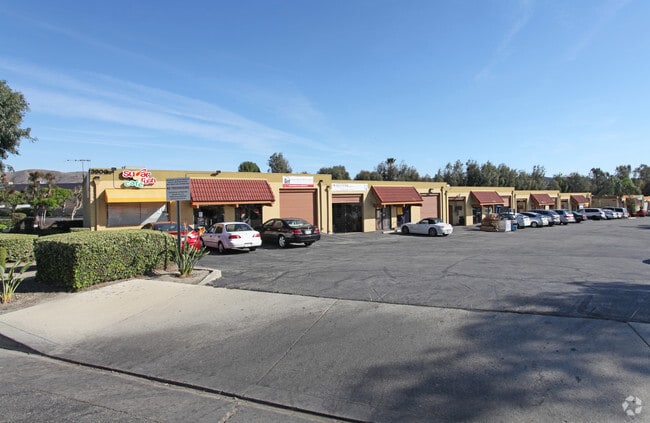
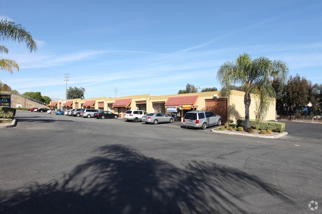
Property Record
3900 Valley Blvd, Walnut, CA 91789


Current Lease Availabilities
Property Detail
3900 Valley Blvd
8709-026-001
LOT COM N 65 30' E 2.11 FT AND N 32 28'58 E 243.62 FT AND N 57 31'02 W 25 FT AND N 32 28'58 E 35 FT AND S 57 31''02 E 25 FT AND N 32 28'58 E SEE ASSESSOR MAPBOOK FOR MISSING PORTIONNO 1 AND PART OF RANCHO LOS NOGALES
Warehouse
Los Angeles
POM2*
California
B and X Area of moderate flood hazard, usually the area between the limits of the 100-year and 500-year floods.
9.09 AC
2024
City of Industry
2025
Los Angeles
409000
Los Angeles-Long Beach-Glendale, CA
292,778 SF
NEARBY LISTINGS FOR SALE OR LEASE
DEMOGRAPHICS near 3900 Valley Blvd
1 mile
3 mile
5 mile
2025 Total Population
6,022
81,178
300,203
2030 Population
6,090
81,005
298,008
Pop Growth 2025-2030
+ 1.13%
(0.21%)
(0.73%)
Average Age
40
41
41
2025 Total Households
1,604
24,433
91,317
HH Growth 2025-2030
+ 1.06%
(0.38%)
(0.96%)
Median Household Inc
$111,151
$102,521
$98,484
Avg Household Size
3.20
3.10
3.20
2025 Avg HH Vehicles
2.00
2.00
2.00
Median Home Value
$755,067
$834,545
$783,308
Median Year Built
1980
1979
1975
Nearby Places
Map Layers
Map Styles
 Street
 Aerial
Transit
 Traffic
 Biking
Places
Listings with unknown addresses are not visible on the map
- Restaurants
- Banks
- Shops
- Fitness
- Groceries
PUBLIC TRANSPORTATION
COMMUTER RAIL
Industry (Riverside Line - Southern California Regional Rail Authority (Metrolink))
Drive
Walk
Distance
Industry (Riverside Line - Southern California Regional Rail Authority (Metrolink))
7 min
3.3 mi
Downtown Pomona (Riverside Line - Southern California Regional Rail Authority (Metrolink))
Drive
Walk
Distance
Downtown Pomona (Riverside Line - Southern California Regional Rail Authority (Metrolink))
9 min
5.0 mi
AIRPORT
Ontario International
Drive
Walk
Distance
Ontario International
25 min
16.6 mi
John Wayne/Orange County
Drive
Walk
Distance
John Wayne/Orange County
37 min
29.7 mi
Long Beach (Daugherty Field)
Drive
Walk
Distance
Long Beach (Daugherty Field)
49 min
35.4 mi
Freight Ports
Port of Long Beach
Drive
Walk
Distance
Port of Long Beach
55 min
38.7 mi
Nearby Properties
Address
Land Use
TOTAL SIZE
Lot Size
Zoning
Address
Land Use
TOTAL SIZE
Lot Size
Zoning
749,184 SF
32.26 AC
POM1
Address
Land Use
TOTAL SIZE
Lot Size
Zoning
221,018 SF
26.87 AC
IDM*
Address
Land Use
TOTAL SIZE
Lot Size
Zoning
183,668 SF
12.59 AC
RM
Address
Land Use
TOTAL SIZE
Lot Size
Zoning
146,466 SF
6.99 AC
IDM*
Address
Land Use
TOTAL SIZE
Lot Size
Zoning
1,092,435 SF
28.50 AC
Address
Land Use
TOTAL SIZE
Lot Size
Zoning
172,108 SF
7.77 AC
POR31500S*
Address
Land Use
TOTAL SIZE
Lot Size
Zoning
271,974 SF
7.33 AC
POM2*
Address
Land Use
TOTAL SIZE
Lot Size
Zoning
70,400 SF
11.04 AC
POM1*
Address
Land Use
TOTAL SIZE
Lot Size
Zoning
90,009 SF
6.22 AC
SDAP*
Address
Land Use
TOTAL SIZE
Lot Size
Zoning
595,025 SF
28.42 AC
IDM*
Address
Land Use
TOTAL SIZE
Lot Size
Zoning
378,980 SF
8.03 AC
POM2*
Address
Land Use
TOTAL SIZE
Lot Size
Zoning
950,576 SF
24.53 AC
IDM*
Address
Land Use
TOTAL SIZE
Lot Size
Zoning
799,910 SF
39.11 AC
IDM*
Address
Land Use
TOTAL SIZE
Lot Size
Zoning
140,956 SF
4.74 AC
WAC3*
Address
Land Use
TOTAL SIZE
Lot Size
Zoning
557,950 SF
12.45 AC
POM2
Address
Land Use
TOTAL SIZE
Lot Size
Zoning
466,575 SF
15.38 AC
IDM*
Address
Land Use
TOTAL SIZE
Lot Size
Zoning
130,850 SF
11.45 AC
LCC3
Address
Land Use
TOTAL SIZE
Lot Size
Zoning
201,940 SF
9.41 AC
POM2*
Address
Land Use
TOTAL SIZE
Lot Size
Zoning
99,456 SF
5.38 AC
LCA17000*
Address
Land Use
TOTAL SIZE
Lot Size
Zoning
650,025 SF
31.69 AC
IDM*
Address
Land Use
TOTAL SIZE
Lot Size
Zoning
68,313 SF
10.02 AC
LCR110000*
Address
Land Use
TOTAL SIZE
Lot Size
Zoning
238,268 SF
19.95 AC
POM1*
Address
Land Use
TOTAL SIZE
Lot Size
Zoning
350,936 SF
8.35 AC
WAC3*
Address
Land Use
TOTAL SIZE
Lot Size
Zoning
95,109 SF
7.24 AC
LCCPD*
Address
Land Use
TOTAL SIZE
Lot Size
Zoning
301,700 SF
14.78 AC
IDMA*
Address
Land Use
TOTAL SIZE
Lot Size
Zoning
158,405 SF
7.55 AC
IDM*
Address
Land Use
TOTAL SIZE
Lot Size
Zoning
83,446 SF
17.33 AC
LLC3
Address
Land Use
TOTAL SIZE
Lot Size
Zoning
73,052 SF
4.77 AC
WAM1*
Address
Land Use
TOTAL SIZE
Lot Size
Zoning
301,740 SF
14.72 AC
IDMA*
Address
Land Use
TOTAL SIZE
Lot Size
Zoning
37,538 SF
5.55 AC
WAM1*
The World's #1 Commercial Real Estate Marketplace
Connect with us
© 2026 CoStar Group
The information above has been obtained from sources believed reliable. While we do not doubt its accuracy we have not verified it and make no guarantee, warranty or representation about it. It is your responsibility to independently confirm its accuracy and completeness. Any projections, opinions, assumptions, or estimates used are for example only and do not represent the current or future performance of the property. The value of this transaction to you depends on tax and other factors which should be evaluated by your tax, financial, and legal advisors. You and your advisors should conduct a careful, independent investigation of the property to determine to your satisfaction the suitability of the property for your needs.