Property Record
3960 State Road 38 E, Lafayette, IN 47905
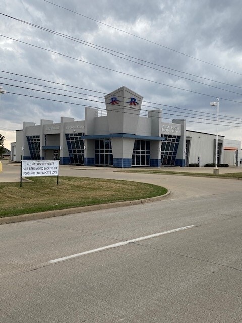


This Property Is For Sale
Property Detail
3960 State Road 38 E
Lafayette-West Lafayette, IN
PT N NE SEC 2 TWP 22 R4 3.315 A & PT NE SEC 2 TWP 22 R4 0.638 A
79-11-02-200-007.000-037
Tippecanoe
Vehiclerentalsvehiclesales
Indiana
B and X Area of moderate flood hazard, usually the area between the limits of the 100-year and 500-year floods.
1
2024
3.95 AC
2024
Lafayette/Kokomo
001701
Other Market Areas
7,200 SF
NEARBY LISTINGS FOR SALE OR LEASE
DEMOGRAPHICS near 3960 State Road 38 E
1 mile
3 mile
5 mile
2024 Total Population
4,440
44,098
110,552
2029 Population
4,528
44,149
112,630
Pop Growth 2024-2029
+ 1.98%
+ 0.12%
+ 1.88%
Average Age
35
38
36
2024 Total Households
1,956
18,451
45,347
HH Growth 2024-2029
+ 1.89%
+ 0.20%
+ 2.10%
Median Household Inc
$42,190
$64,661
$57,194
Avg Household Size
2.20
2.30
2.30
2024 Avg HH Vehicles
1.00
2.00
2.00
Median Home Value
$98,759
$210,333
$230,566
Median Year Built
1990
1979
1983
Nearby Places
Map Layers
Map Styles
 Street
 Aerial
Transit
 Traffic
 Biking
Places
Listings with unknown addresses are not visible on the map
- Restaurants
- Banks
- Shops
- Fitness
- Groceries
PUBLIC TRANSPORTATION
COMMUTER RAIL
Lafayette Amtrak Station (Cardinal - Amtrak)
Drive
Walk
Distance
Lafayette Amtrak Station (Cardinal - Amtrak)
8 min
4.8 mi
Freight Ports
Port Milwaukee
Drive
Walk
Distance
Port Milwaukee
252 min
209.8 mi
Nearby Properties
Address
Land Use
TOTAL SIZE
Lot Size
Zoning
Address
Land Use
TOTAL SIZE
Lot Size
Zoning
2,199,963 SF
0.06 AC
Address
Land Use
TOTAL SIZE
Lot Size
Zoning
68,943 SF
0.01 AC
Address
Land Use
TOTAL SIZE
Lot Size
Zoning
122,338 SF
0.01 AC
Address
Land Use
TOTAL SIZE
Lot Size
Zoning
507,320 SF
0.01 AC
Address
Land Use
TOTAL SIZE
Lot Size
Zoning
689,020 SF
0.01 AC
Address
Land Use
TOTAL SIZE
Lot Size
Zoning
117,351 SF
44 SF
Address
Land Use
TOTAL SIZE
Lot Size
Zoning
7,177 SF
19.58 AC
Address
Land Use
TOTAL SIZE
Lot Size
Zoning
300,876 SF
20.47 AC
Address
Land Use
TOTAL SIZE
Lot Size
Zoning
210,829 SF
87 SF
Address
Land Use
TOTAL SIZE
Lot Size
Zoning
298,050 SF
50.91 AC
Address
Land Use
TOTAL SIZE
Lot Size
Zoning
32.01 AC
Address
Land Use
TOTAL SIZE
Lot Size
Zoning
270,827 SF
34.90 AC
Address
Land Use
TOTAL SIZE
Lot Size
Zoning
1,449,360 SF
0.01 AC
Address
Land Use
TOTAL SIZE
Lot Size
Zoning
357,301 SF
45.62 AC
Address
Land Use
TOTAL SIZE
Lot Size
Zoning
77,226 SF
0.01 AC
Address
Land Use
TOTAL SIZE
Lot Size
Zoning
316,008 SF
27.04 AC
Address
Land Use
TOTAL SIZE
Lot Size
Zoning
518,808 SF
174 SF
Address
Land Use
TOTAL SIZE
Lot Size
Zoning
140,973 SF
131 SF
Address
Land Use
TOTAL SIZE
Lot Size
Zoning
263,826 SF
174 SF
Address
Land Use
TOTAL SIZE
Lot Size
Zoning
25,476 SF
131 SF
Address
Land Use
TOTAL SIZE
Lot Size
Zoning
340,790 SF
131 SF
Address
Land Use
TOTAL SIZE
Lot Size
Zoning
70,686 SF
25.67 AC
Address
Land Use
TOTAL SIZE
Lot Size
Zoning
500,000 SF
174 SF
Address
Land Use
TOTAL SIZE
Lot Size
Zoning
160,572 SF
19.25 AC
Address
Land Use
TOTAL SIZE
Lot Size
Zoning
1,409,410 SF
170.04 AC
Address
Land Use
TOTAL SIZE
Lot Size
Zoning
295,530 SF
23.01 AC
Address
Land Use
TOTAL SIZE
Lot Size
Zoning
154,040 SF
44 SF
Address
Land Use
TOTAL SIZE
Lot Size
Zoning
235,028 SF
131 SF
Address
Land Use
TOTAL SIZE
Lot Size
Zoning
70,889 SF
44 SF
Address
Land Use
TOTAL SIZE
Lot Size
Zoning
115,514 SF
44 SF
The World's #1 Commercial Real Estate Marketplace
Connect with us
© 2026 CoStar Group
The information above has been obtained from sources believed reliable. While we do not doubt its accuracy we have not verified it and make no guarantee, warranty or representation about it. It is your responsibility to independently confirm its accuracy and completeness. Any projections, opinions, assumptions, or estimates used are for example only and do not represent the current or future performance of the property. The value of this transaction to you depends on tax and other factors which should be evaluated by your tax, financial, and legal advisors. You and your advisors should conduct a careful, independent investigation of the property to determine to your satisfaction the suitability of the property for your needs.