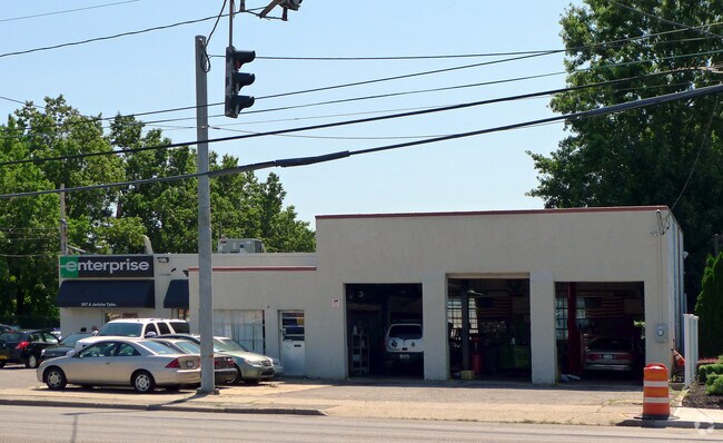
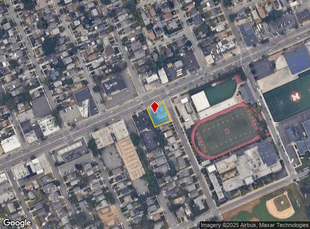
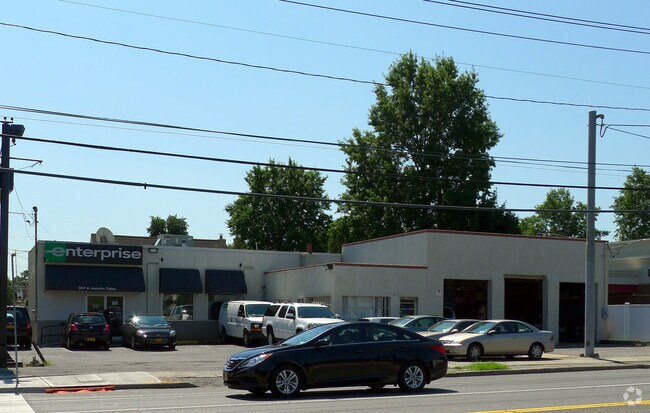
Property Record
397 Jericho Tpke, Mineola, NY 11501
NEARBY LISTINGS FOR SALE OR LEASE
Property Detail
397 Jericho Tpke
2223-09-021-00-0069-0
TOWN #2 SCH DIST 010
Autorepair
Nassau
X
New York
36059C0210G
69
2025
0.26 AC
2025
Central Nassau
303500
Long Island (New York)
4,056 SF
Nassau County-Suffolk County, NY
DEMOGRAPHICS near 397 Jericho Tpke
1 Mile
3 Mile
5 Mile
2024 Total Population
27,781
185,035
514,010
2029 Population
27,344
181,564
500,056
Pop Growth 2024-2029
(1.57%)
(1.88%)
(2.71%)
Average Age
42
42
42
2024 Total Households
10,277
61,430
163,927
HH Growth 2024-2029
(1.50%)
(1.90%)
(2.88%)
Median Household Inc
$123,294
$129,972
$118,486
Avg Household Size
2.70
2.90
3.00
2024 Avg HH Vehicles
2.00
2.00
2.00
Median Home Value
$717,742
$756,076
$704,638
Median Year Built
1952
1953
1953
Nearby Places
- Restaurants
- Banks
- Shops
- Fitness
- Groceries
PUBLIC TRANSPORTATION
COMMUTER RAIL
Mineola Station (Oyster Bay Branch - Long Island Rail Road, Port Jefferson Branch - Long Island Rail Road, Ronkonkoma Branch - Long Island Rail Road)
DRIVE
WALK
Distance
Mineola Station (Oyster Bay Branch - Long Island Rail Road, Port Jefferson Branch - Long Island Rail Road, Ronkonkoma Branch - Long Island Rail Road)
2 min
18 min
1.0 mi
Merillon Avenue Station (Port Jefferson Branch - Long Island Rail Road)
DRIVE
WALK
Distance
Merillon Avenue Station (Port Jefferson Branch - Long Island Rail Road)
2 min
1.1 mi
AIRPORT
John F Kennedy International
DRIVE
WALK
Distance
John F Kennedy International
23 min
13.4 mi
LaGuardia
DRIVE
WALK
Distance
LaGuardia
25 min
15.2 mi
Westchester County
DRIVE
WALK
Distance
Westchester County
54 min
36.4 mi
Freight Ports
NY - Red Hook Container Terminal
DRIVE
WALK
Distance
NY - Red Hook Container Terminal
36 min
23.3 mi
Nearby Properties
Address
Land Use
TOTAL SIZE
Lot Size
Zoning
Address
Land Use
TOTAL SIZE
Lot Size
Zoning
1,667,567 SF
30 AC
R3-2
Address
Land Use
TOTAL SIZE
Lot Size
Zoning
5,322,666 SF
86.10 AC
Address
Land Use
TOTAL SIZE
Lot Size
Zoning
1,197,283 SF
64.50 AC
Address
Land Use
TOTAL SIZE
Lot Size
Zoning
574,353 SF
65 AC
Address
Land Use
TOTAL SIZE
Lot Size
Zoning
556,575 SF
11.46 AC
Address
Land Use
TOTAL SIZE
Lot Size
Zoning
14,460 SF
0.54 AC
R2A
Address
Land Use
TOTAL SIZE
Lot Size
Zoning
7,740 SF
0.46 AC
R3-2
Address
Land Use
TOTAL SIZE
Lot Size
Zoning
11,554 SF
0.35 AC
R2A
Address
Land Use
TOTAL SIZE
Lot Size
Zoning
9,750 SF
0.64 AC
R2A
Address
Land Use
TOTAL SIZE
Lot Size
Zoning
13,695 SF
0.23 AC
R3-2
Address
Land Use
TOTAL SIZE
Lot Size
Zoning
352,730 SF
41.04 AC
Address
Land Use
TOTAL SIZE
Lot Size
Zoning
29,224 SF
1.33 AC
Address
Land Use
TOTAL SIZE
Lot Size
Zoning
152,926 SF
30 AC
Address
Land Use
TOTAL SIZE
Lot Size
Zoning
277,200 SF
21.03 AC
Address
Land Use
TOTAL SIZE
Lot Size
Zoning
130,720 SF
48.60 AC
Address
Land Use
TOTAL SIZE
Lot Size
Zoning
5,600 SF
0.09 AC
R3-2
Address
Land Use
TOTAL SIZE
Lot Size
Zoning
111,756 SF
21.24 AC
Address
Land Use
TOTAL SIZE
Lot Size
Zoning
63,600 SF
2 AC
Address
Land Use
TOTAL SIZE
Lot Size
Zoning
182,129 SF
1.51 AC
Address
Land Use
TOTAL SIZE
Lot Size
Zoning
152,783 SF
51.20 AC
Address
Land Use
TOTAL SIZE
Lot Size
Zoning
7,500 SF
0.28 AC
R2A
Address
Land Use
TOTAL SIZE
Lot Size
Zoning
2,700 SF
0.30 AC
R2A
Address
Land Use
TOTAL SIZE
Lot Size
Zoning
116,998 SF
26.35 AC
Address
Land Use
TOTAL SIZE
Lot Size
Zoning
399,955 SF
13.63 AC
Address
Land Use
TOTAL SIZE
Lot Size
Zoning
6,250 SF
0.23 AC
R3-2
Address
Land Use
TOTAL SIZE
Lot Size
Zoning
3,970 SF
0.26 AC
R2A
Address
Land Use
TOTAL SIZE
Lot Size
Zoning
0.51 AC
R2A
Address
Land Use
TOTAL SIZE
Lot Size
Zoning
23,148 SF
18.67 AC
Address
Land Use
TOTAL SIZE
Lot Size
Zoning
186,050 SF
8.64 AC
Address
Land Use
TOTAL SIZE
Lot Size
Zoning
252,032 SF
4.72 AC
The World's #1 Commercial Real Estate Marketplace
Connect with us
© 2025 CoStar Group
The information above has been obtained from sources believed reliable. While we do not doubt its accuracy we have not verified it and make no guarantee, warranty or representation about it. It is your responsibility to independently confirm its accuracy and completeness. Any projections, opinions, assumptions, or estimates used are for example only and do not represent the current or future performance of the property. The value of this transaction to you depends on tax and other factors which should be evaluated by your tax, financial, and legal advisors. You and your advisors should conduct a careful, independent investigation of the property to determine to your satisfaction the suitability of the property for your needs.