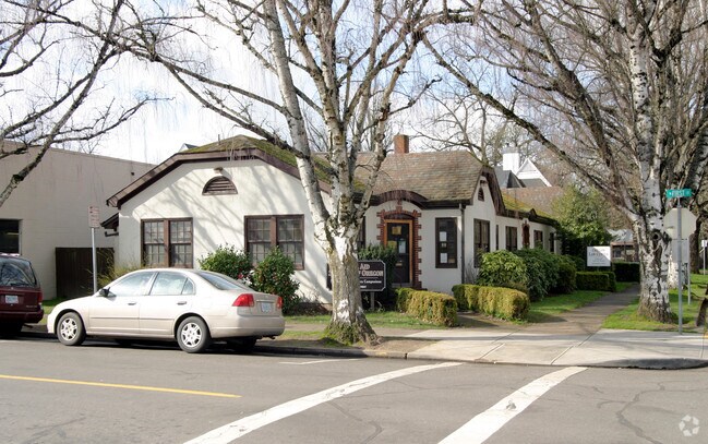
Property Record
397 N 1St St, Woodburn, OR 97071

Property Detail
397 N 1St St
105933
ADDITION A TO WOODBURN BLOCK 2 LOT 1 ACRES .11
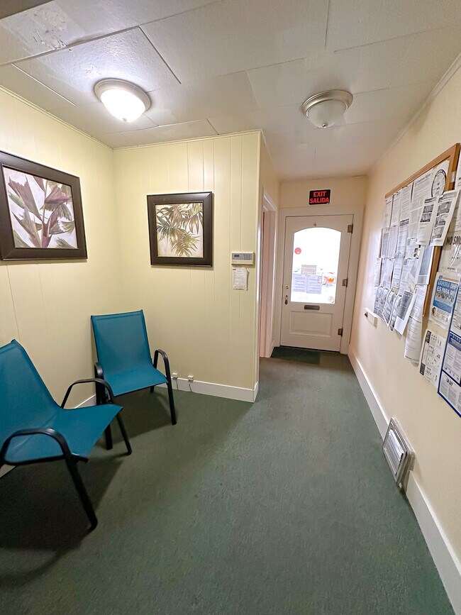
Officebuilding
Marion
DDC
Oregon
B and X Area of moderate flood hazard, usually the area between the limits of the 100-year and 500-year floods.
1
2024
0.11 AC
2025
Marion County
010309
Portland
5,194 SF
Salem, OR
NEARBY LISTINGS FOR SALE OR LEASE
DEMOGRAPHICS near 397 N 1St St
1 mile
3 mile
5 mile
2024 Total Population
19,332
33,159
41,395
2029 Population
19,738
34,012
42,360
Pop Growth 2024-2029
+ 2.10%
+ 2.57%
+ 2.33%
Average Age
37
38
38
2024 Total Households
5,783
10,263
12,735
HH Growth 2024-2029
+ 2.27%
+ 2.68%
+ 2.44%
Median Household Inc
$67,297
$69,242
$73,646
Avg Household Size
3.20
3.10
3.20
2024 Avg HH Vehicles
2.00
2.00
2.00
Median Home Value
$362,098
$367,267
$388,234
Median Year Built
1975
1978
1978
Nearby Places
Map Layers
Map Styles
 Street
 Aerial
Transit
 Traffic
 Biking
Places
Listings with unknown addresses are not visible on the map
- Restaurants
- Banks
- Shops
- Fitness
- Groceries
SALE & LEASE HISTORY
LISTING DATE
SALE/LEASE

Jan 27, 2023
For Sale
Nearby Properties
Address
Land Use
TOTAL SIZE
Lot Size
Zoning
Address
Land Use
TOTAL SIZE
Lot Size
Zoning
3,486,458 SF
82.43 AC
IL
Address
Land Use
TOTAL SIZE
Lot Size
Zoning
60,057 SF
37.80 AC
CG
Address
Land Use
TOTAL SIZE
Lot Size
Zoning
80.18 AC
IL
Address
Land Use
TOTAL SIZE
Lot Size
Zoning
26,283 SF
56.26 AC
P/SP
Address
Land Use
TOTAL SIZE
Lot Size
Zoning
Address
Land Use
TOTAL SIZE
Lot Size
Zoning
41.57 AC
IL
Address
Land Use
TOTAL SIZE
Lot Size
Zoning
10 SF
23.27 AC
RM; RS
Address
Land Use
TOTAL SIZE
Lot Size
Zoning
42,561 SF
9.01 AC
P/SP
Address
Land Use
TOTAL SIZE
Lot Size
Zoning
6,853 SF
75.96 AC
IH-LU; MUV
Address
Land Use
TOTAL SIZE
Lot Size
Zoning
234,131 SF
9.47 AC
CG
Address
Land Use
TOTAL SIZE
Lot Size
Zoning
198,139 SF
8.60 AC
CG
Address
Land Use
TOTAL SIZE
Lot Size
Zoning
391,539 SF
28.02 AC
IL
Address
Land Use
TOTAL SIZE
Lot Size
Zoning
82,150 SF
7.05 AC
CG
Address
Land Use
TOTAL SIZE
Lot Size
Zoning
246,258 SF
10.44 AC
RMN
Address
Land Use
TOTAL SIZE
Lot Size
Zoning
20 SF
100.66 AC
P
Address
Land Use
TOTAL SIZE
Lot Size
Zoning
170,895 SF
7.34 AC
RM
Address
Land Use
TOTAL SIZE
Lot Size
Zoning
72,935 SF
9.73 AC
CG
Address
Land Use
TOTAL SIZE
Lot Size
Zoning
219,424 SF
11.91 AC
CG
Address
Land Use
TOTAL SIZE
Lot Size
Zoning
129,578 SF
6.12 AC
RMN
Address
Land Use
TOTAL SIZE
Lot Size
Zoning
107,208 SF
5.81 AC
RMN
Address
Land Use
TOTAL SIZE
Lot Size
Zoning
100,645 SF
3.24 AC
CG
Address
Land Use
TOTAL SIZE
Lot Size
Zoning
20.51 AC
IL; EFU; I
Address
Land Use
TOTAL SIZE
Lot Size
Zoning
161,280 SF
11.39 AC
RM
Address
Land Use
TOTAL SIZE
Lot Size
Zoning
90,582 SF
3.39 AC
CG
Address
Land Use
TOTAL SIZE
Lot Size
Zoning
123,691 SF
3.94 AC
RM
Address
Land Use
TOTAL SIZE
Lot Size
Zoning
152,390 SF
20.40 AC
IP
Address
Land Use
TOTAL SIZE
Lot Size
Zoning
Address
Land Use
TOTAL SIZE
Lot Size
Zoning
27,204 SF
9.16 AC
P/SP
Address
Land Use
TOTAL SIZE
Lot Size
Zoning
99,924 SF
8.50 AC
CG
The World's #1 Commercial Real Estate Marketplace
Connect with us
© 2026 CoStar Group
The information above has been obtained from sources believed reliable. While we do not doubt its accuracy we have not verified it and make no guarantee, warranty or representation about it. It is your responsibility to independently confirm its accuracy and completeness. Any projections, opinions, assumptions, or estimates used are for example only and do not represent the current or future performance of the property. The value of this transaction to you depends on tax and other factors which should be evaluated by your tax, financial, and legal advisors. You and your advisors should conduct a careful, independent investigation of the property to determine to your satisfaction the suitability of the property for your needs.