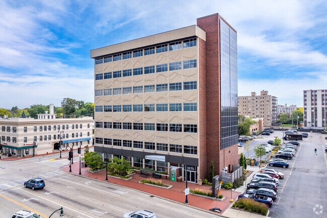
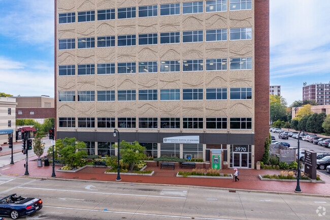
Property Record
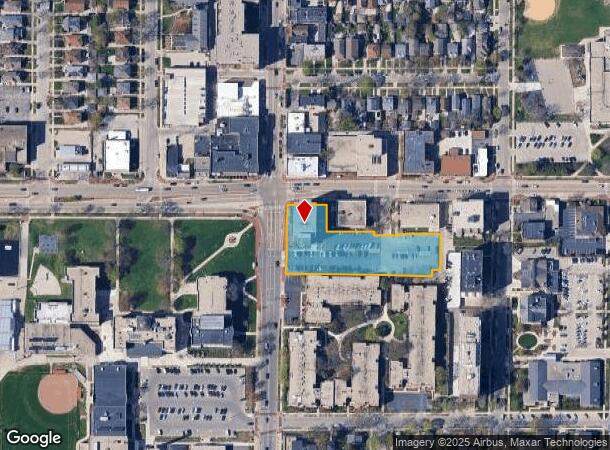
3970 N Oakland Ave, Milwaukee, WI 53211
Current Lease Availabilities
NEARBY LISTINGS FOR SALE OR LEASE
Property Detail
3970 N Oakland Ave
Milwaukee-Waukesha-West Allis, WI
Sav & Inv Assn Of Milwaukee Subd
276-0749-006
CERTIFIED SURVEY MAP 3488 PARCEL 4 EXC EASTERNMOST 5FT THEREOF FOR PUBLIC ALLEY ALSO LOT 36 THRU 40 BLK 2 SAV & INV ASSN OF MILWAUKEE SUBD #12
Commercialnec
Milwaukee
X
Wisconsin
55079C0084E
3
2024
0.10 AC
2024
Milwaukee East
080400
Milwaukee/Madison
46,416 SF
DEMOGRAPHICS near 3970 N Oakland Ave
1 Mile
3 Mile
5 Mile
2024 Total Population
20,351
125,598
274,652
2029 Population
19,674
123,646
271,381
Pop Growth 2024-2029
(3.33%)
(1.55%)
(1.19%)
Average Age
37
36
36
2024 Total Households
8,945
57,396
119,319
HH Growth 2024-2029
(3.32%)
(1.68%)
(1.25%)
Median Household Inc
$81,508
$52,266
$43,912
Avg Household Size
2.10
2.00
2.10
2024 Avg HH Vehicles
1.00
1.00
1.00
Median Home Value
$374,632
$272,348
$201,956
Median Year Built
1947
1948
1948
Nearby Places
- Restaurants
- Banks
- Shops
- Fitness
- Groceries
PUBLIC TRANSPORTATION
COMMUTER RAIL
Milwaukee (Empire Builder - Amtrak)
DRIVE
WALK
Distance
Milwaukee (Empire Builder - Amtrak)
14 min
6.5 mi
AIRPORT
General Mitchell International
DRIVE
WALK
Distance
General Mitchell International
24 min
13.1 mi
Freight Ports
Port Milwaukee
DRIVE
WALK
Distance
Port Milwaukee
17 min
8.9 mi
Nearby Properties
Address
Land Use
TOTAL SIZE
Lot Size
Zoning
Address
Land Use
TOTAL SIZE
Lot Size
Zoning
237,850 SF
5.02 AC
RM7
Address
Land Use
TOTAL SIZE
Lot Size
Zoning
26.11 AC
TL
Address
Land Use
TOTAL SIZE
Lot Size
Zoning
417,704 SF
0.81 AC
PD
Address
Land Use
TOTAL SIZE
Lot Size
Zoning
382,921 SF
2.81 AC
PD
Address
Land Use
TOTAL SIZE
Lot Size
Zoning
42.90 AC
TL
Address
Land Use
TOTAL SIZE
Lot Size
Zoning
508,168 SF
14.56 AC
C9G
Address
Land Use
TOTAL SIZE
Lot Size
Zoning
162,000 SF
0.83 AC
PD
Address
Land Use
TOTAL SIZE
Lot Size
Zoning
305,573 SF
3.20 AC
Address
Land Use
TOTAL SIZE
Lot Size
Zoning
66,245 SF
10.21 AC
Address
Land Use
TOTAL SIZE
Lot Size
Zoning
0.09 AC
LB2
Address
Land Use
TOTAL SIZE
Lot Size
Zoning
12.97 AC
TL
Address
Land Use
TOTAL SIZE
Lot Size
Zoning
85,000 SF
1.13 AC
Address
Land Use
TOTAL SIZE
Lot Size
Zoning
247,344 SF
1.44 AC
RED
Address
Land Use
TOTAL SIZE
Lot Size
Zoning
685,390 SF
26.20 AC
Address
Land Use
TOTAL SIZE
Lot Size
Zoning
1 SF
5.12 AC
PD
Address
Land Use
TOTAL SIZE
Lot Size
Zoning
152,640 SF
10.50 AC
Address
Land Use
TOTAL SIZE
Lot Size
Zoning
171,170 SF
25.88 AC
Address
Land Use
TOTAL SIZE
Lot Size
Zoning
12.74 AC
TL
Address
Land Use
TOTAL SIZE
Lot Size
Zoning
230,828 SF
0.87 AC
RM7
Address
Land Use
TOTAL SIZE
Lot Size
Zoning
193,988 SF
1.28 AC
C9G
Address
Land Use
TOTAL SIZE
Lot Size
Zoning
214,461 SF
0.49 AC
PD
Address
Land Use
TOTAL SIZE
Lot Size
Zoning
224,756 SF
12 AC
RESIDENTIA
Address
Land Use
TOTAL SIZE
Lot Size
Zoning
145,605 SF
2.64 AC
Address
Land Use
TOTAL SIZE
Lot Size
Zoning
241,520 SF
6.60 AC
Address
Land Use
TOTAL SIZE
Lot Size
Zoning
110,011 SF
0.59 AC
PD
Address
Land Use
TOTAL SIZE
Lot Size
Zoning
27.05 AC
PK
Address
Land Use
TOTAL SIZE
Lot Size
Zoning
160,414 SF
1 AC
PD
Address
Land Use
TOTAL SIZE
Lot Size
Zoning
165,296 SF
1.04 AC
Address
Land Use
TOTAL SIZE
Lot Size
Zoning
294,553 SF
6.19 AC
Address
Land Use
TOTAL SIZE
Lot Size
Zoning
113,542 SF
2.31 AC
The World's #1 Commercial Real Estate Marketplace
Connect with us
© 2025 CoStar Group
The information above has been obtained from sources believed reliable. While we do not doubt its accuracy we have not verified it and make no guarantee, warranty or representation about it. It is your responsibility to independently confirm its accuracy and completeness. Any projections, opinions, assumptions, or estimates used are for example only and do not represent the current or future performance of the property. The value of this transaction to you depends on tax and other factors which should be evaluated by your tax, financial, and legal advisors. You and your advisors should conduct a careful, independent investigation of the property to determine to your satisfaction the suitability of the property for your needs.