Property Record
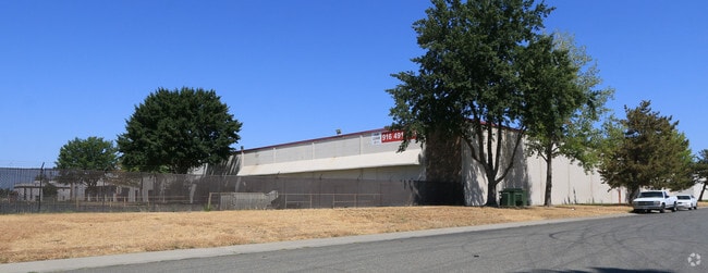
3970 Pell Cir, Sacramento, CA 95838


NEARBY LISTINGS FOR SALE OR LEASE
Property Detail
3970 Pell Cir
Sacramento--Roseville--Arden-Arcade, CA
Parcel Map
237-0400-012
PARCEL MAP, LOT 2B
Shipyard
Sacramento
X
California
06067C0064J
2b
2024
5.51 AC
2025
Natomas/Northgate
006703
Sacramento
108,480 SF
DEMOGRAPHICS near 3970 Pell Cir
1 Mile
3 Mile
5 Mile
2024 Total Population
13,054
129,861
301,837
2029 Population
13,112
131,054
304,869
Pop Growth 2024-2029
+ 0.44%
+ 0.92%
+ 1.00%
Average Age
35
36
37
2024 Total Households
3,661
41,851
109,300
HH Growth 2024-2029
+ 0.38%
+ 0.93%
+ 1.10%
Median Household Inc
$55,170
$68,839
$72,173
Avg Household Size
3.40
3.00
2.60
2024 Avg HH Vehicles
2.00
2.00
2.00
Median Home Value
$359,317
$389,336
$447,585
Median Year Built
1983
1984
1982
Nearby Places
Map Layers
Map Styles
 Street
 Aerial
- Restaurants
- Banks
- Shops
- Fitness
- Groceries
PUBLIC TRANSPORTATION
COMMUTER RAIL
Sacramento (Capitol Corridor - Capitol Corridor Joint Powers Authority)
DRIVE
WALK
Distance
Sacramento (Capitol Corridor - Capitol Corridor Joint Powers Authority)
17 min
8.5 mi
AIRPORT
Sacramento International
DRIVE
WALK
Distance
Sacramento International
19 min
9.8 mi
Freight Ports
Port of Stockton
DRIVE
WALK
Distance
Port of Stockton
68 min
54.4 mi
Nearby Properties
Address
Land Use
TOTAL SIZE
Lot Size
Zoning
Address
Land Use
TOTAL SIZE
Lot Size
Zoning
363,761 SF
10.34 AC
SC-PUD
Address
Land Use
TOTAL SIZE
Lot Size
Zoning
522,025 SF
65.80 AC
SC-PUD EC-
Address
Land Use
TOTAL SIZE
Lot Size
Zoning
9.74 AC
EC-50-PUD
Address
Land Use
TOTAL SIZE
Lot Size
Zoning
43,200 SF
38.55 AC
SPA
Address
Land Use
TOTAL SIZE
Lot Size
Zoning
153,090 SF
7.77 AC
MP
Address
Land Use
TOTAL SIZE
Lot Size
Zoning
343,500 SF
12.68 AC
R-2B-R-PUD
Address
Land Use
TOTAL SIZE
Lot Size
Zoning
100.41 AC
C-2-PUD
Address
Land Use
TOTAL SIZE
Lot Size
Zoning
241,321 SF
14.43 AC
R-3-PUD
Address
Land Use
TOTAL SIZE
Lot Size
Zoning
429,346 SF
18.88 AC
R-2B-PUD E
Address
Land Use
TOTAL SIZE
Lot Size
Zoning
298,493 SF
18.56 AC
EC-40-PUD
Address
Land Use
TOTAL SIZE
Lot Size
Zoning
34,993 SF
9.06 AC
R-2B-PUD
Address
Land Use
TOTAL SIZE
Lot Size
Zoning
195,928 SF
8.62 AC
EC-40-PUD
Address
Land Use
TOTAL SIZE
Lot Size
Zoning
164,061 SF
8.15 AC
R-3-PUD
Address
Land Use
TOTAL SIZE
Lot Size
Zoning
327,278 SF
20.63 AC
R-2A
Address
Land Use
TOTAL SIZE
Lot Size
Zoning
218,732 SF
9.45 AC
R-2B-PUD
Address
Land Use
TOTAL SIZE
Lot Size
Zoning
9.01 AC
EC-80-PUD
Address
Land Use
TOTAL SIZE
Lot Size
Zoning
207,273 SF
11.44 AC
R-2B-R-PUD
Address
Land Use
TOTAL SIZE
Lot Size
Zoning
217,682 SF
9.57 AC
R-3-PUD
Address
Land Use
TOTAL SIZE
Lot Size
Zoning
92,240 SF
5.59 AC
MP
Address
Land Use
TOTAL SIZE
Lot Size
Zoning
209,376 SF
9.14 AC
MP M-1
Address
Land Use
TOTAL SIZE
Lot Size
Zoning
13.90 AC
SC-PUD
Address
Land Use
TOTAL SIZE
Lot Size
Zoning
179,126 SF
9.48 AC
R-3A
Address
Land Use
TOTAL SIZE
Lot Size
Zoning
Address
Land Use
TOTAL SIZE
Lot Size
Zoning
1,784 SF
15.07 AC
M-1
Address
Land Use
TOTAL SIZE
Lot Size
Zoning
222,792 SF
12.50 AC
MP
Address
Land Use
TOTAL SIZE
Lot Size
Zoning
343,355 SF
19.10 AC
MP M-1
Address
Land Use
TOTAL SIZE
Lot Size
Zoning
164,780 SF
7.98 AC
R-2B-PUD
Address
Land Use
TOTAL SIZE
Lot Size
Zoning
15.83 AC
MRD-SPD
Address
Land Use
TOTAL SIZE
Lot Size
Zoning
82,774 SF
2.29 AC
EC-50-PUD
Address
Land Use
TOTAL SIZE
Lot Size
Zoning
182,688 SF
10.88 AC
R-3
The World's #1 Commercial Real Estate Marketplace
Connect with us
© 2025 CoStar Group
The information above has been obtained from sources believed reliable. While we do not doubt its accuracy we have not verified it and make no guarantee, warranty or representation about it. It is your responsibility to independently confirm its accuracy and completeness. Any projections, opinions, assumptions, or estimates used are for example only and do not represent the current or future performance of the property. The value of this transaction to you depends on tax and other factors which should be evaluated by your tax, financial, and legal advisors. You and your advisors should conduct a careful, independent investigation of the property to determine to your satisfaction the suitability of the property for your needs.