Property Record
3971 Highway 378, Leesville, SC 29070


Property Detail
3971 Highway 378
003000-05-014
PO TRACT B
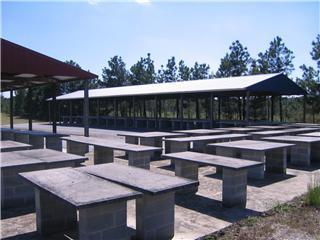
Officebuilding
LEXINGTON
ID
South Carolina
B and X Area of moderate flood hazard, usually the area between the limits of the 100-year and 500-year floods.
1.51 AC
2025
Outlying Lexington County
2024
Columbia
021404
Columbia, SC
768 SF
NEARBY LISTINGS FOR SALE OR LEASE
-
-
View all Leesville listings for sale on LoopNet.com
DEMOGRAPHICS near 3971 Highway 378
1 mile
3 mile
5 mile
2025 Total Population
224
3,554
9,411
2030 Population
240
3,766
10,005
Pop Growth 2025-2030
+ 7.14%
+ 5.97%
+ 6.31%
Average Age
50
50
49
2025 Total Households
99
1,576
4,148
HH Growth 2025-2030
+ 7.07%
+ 6.28%
+ 6.53%
Median Household Inc
$97,499
$97,359
$98,461
Avg Household Size
2.20
2.20
2.20
2025 Avg HH Vehicles
2.00
2.00
2.00
Median Home Value
$416,667
$400,187
$410,201
Median Year Built
1993
1994
1995
Nearby Places
Map Layers
Map Styles
 Street
 Aerial
Layers
 Traffic
 Biking
Places
Listings with unknown addresses are not visible on the map
- Restaurants
- Banks
- Shops
- Fitness
- Groceries
PUBLIC TRANSPORTATION
AIRPORT
Columbia Metro
Drive
Walk
Distance
Columbia Metro
48 min
26.5 mi
Freight Ports
North Charleston Terminal
Drive
Walk
Distance
North Charleston Terminal
149 min
124.4 mi
Nearby Properties
Address
Land Use
TOTAL SIZE
Lot Size
Zoning
Address
Land Use
TOTAL SIZE
Lot Size
Zoning
1,674 SF
9.30 AC
Address
Land Use
TOTAL SIZE
Lot Size
Zoning
Address
Land Use
TOTAL SIZE
Lot Size
Zoning
Address
Land Use
TOTAL SIZE
Lot Size
Zoning
2,271 SF
0.34 AC
Address
Land Use
TOTAL SIZE
Lot Size
Zoning
2,072 SF
2.60 AC
Address
Land Use
TOTAL SIZE
Lot Size
Zoning
6,400 SF
6.20 AC
Address
Land Use
TOTAL SIZE
Lot Size
Zoning
1,120 SF
0.28 AC
Address
Land Use
TOTAL SIZE
Lot Size
Zoning
1,816 SF
1 AC
Address
Land Use
TOTAL SIZE
Lot Size
Zoning
1,080 SF
1 AC
Address
Land Use
TOTAL SIZE
Lot Size
Zoning
750 SF
1.59 AC
LR
Address
Land Use
TOTAL SIZE
Lot Size
Zoning
1.10 AC
Address
Land Use
TOTAL SIZE
Lot Size
Zoning
7,960 SF
2.71 AC
ID
Address
Land Use
TOTAL SIZE
Lot Size
Zoning
2,905 SF
0.40 AC
Address
Land Use
TOTAL SIZE
Lot Size
Zoning
19,336 SF
1.31 AC
ID
Address
Land Use
TOTAL SIZE
Lot Size
Zoning
11,615 SF
1.11 AC
ID
Address
Land Use
TOTAL SIZE
Lot Size
Zoning
960 SF
3.17 AC
ID
Address
Land Use
TOTAL SIZE
Lot Size
Zoning
1,026 SF
2 AC
Address
Land Use
TOTAL SIZE
Lot Size
Zoning
672 SF
19.07 AC
RD
Address
Land Use
TOTAL SIZE
Lot Size
Zoning
5,050 SF
0.38 AC
RD
Address
Land Use
TOTAL SIZE
Lot Size
Zoning
3,007 SF
0.38 AC
RD
Address
Land Use
TOTAL SIZE
Lot Size
Zoning
2,252 SF
3.33 AC
LR
Address
Land Use
TOTAL SIZE
Lot Size
Zoning
1,680 SF
2.60 AC
Address
Land Use
TOTAL SIZE
Lot Size
Zoning
3,057 SF
0.33 AC
RD
Address
Land Use
TOTAL SIZE
Lot Size
Zoning
1.60 AC
ID
Address
Land Use
TOTAL SIZE
Lot Size
Zoning
2.78 AC
RD
Address
Land Use
TOTAL SIZE
Lot Size
Zoning
1,680 SF
15.58 AC
ID
Address
Land Use
TOTAL SIZE
Lot Size
Zoning
Address
Land Use
TOTAL SIZE
Lot Size
Zoning
0.56 AC
RD
Address
Land Use
TOTAL SIZE
Lot Size
Zoning
560 SF
RD
Address
Land Use
TOTAL SIZE
Lot Size
Zoning
0.50 AC
The World's #1 Commercial Real Estate Marketplace
Connect with us
© 2026 CoStar Group
The information above has been obtained from sources believed reliable. While we do not doubt its accuracy we have not verified it and make no guarantee, warranty or representation about it. It is your responsibility to independently confirm its accuracy and completeness. Any projections, opinions, assumptions, or estimates used are for example only and do not represent the current or future performance of the property. The value of this transaction to you depends on tax and other factors which should be evaluated by your tax, financial, and legal advisors. You and your advisors should conduct a careful, independent investigation of the property to determine to your satisfaction the suitability of the property for your needs.