Property Record
3971 N Northeast Loop 323, Tyler, TX 75708
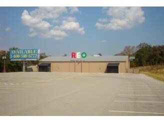

Property Detail
3971 N Northeast Loop 323
1-00000-1062-00-011030
ABST A1062 H WALLTRACT 11C
Warehouse
SMITH
B and X Area of moderate flood hazard, usually the area between the limits of the 100-year and 500-year floods.
Texas
2025
4.92 AC
2025
Tyler
001701
Other Market Areas
10,395 SF
Tyler, TX
NEARBY LISTINGS FOR SALE OR LEASE
DEMOGRAPHICS near 3971 N Northeast Loop 323
1 mile
3 mile
5 mile
2025 Total Population
1,346
20,463
64,559
2030 Population
1,428
21,684
68,190
Pop Growth 2025-2030
+ 6.09%
+ 5.97%
+ 5.62%
Average Age
35
35
36
2025 Total Households
432
6,675
22,268
HH Growth 2025-2030
+ 5.79%
+ 5.54%
+ 5.25%
Median Household Inc
$77,262
$53,568
$54,923
Avg Household Size
3.00
2.90
2.60
2025 Avg HH Vehicles
2.00
2.00
2.00
Median Home Value
$93,708
$89,470
$138,927
Median Year Built
1970
1972
1966
Nearby Places
Map Layers
Map Styles
 Street
 Aerial
Transit
 Traffic
 Biking
Places
Listings with unknown addresses are not visible on the map
- Restaurants
- Banks
- Shops
- Fitness
- Groceries
Nearby Properties
Address
Land Use
TOTAL SIZE
Lot Size
Zoning
Address
Land Use
TOTAL SIZE
Lot Size
Zoning
14,000 SF
144.13 AC
M2
Address
Land Use
TOTAL SIZE
Lot Size
Zoning
Address
Land Use
TOTAL SIZE
Lot Size
Zoning
Address
Land Use
TOTAL SIZE
Lot Size
Zoning
Address
Land Use
TOTAL SIZE
Lot Size
Zoning
111,750 SF
26 AC
Address
Land Use
TOTAL SIZE
Lot Size
Zoning
Address
Land Use
TOTAL SIZE
Lot Size
Zoning
25.54 AC
INT
Address
Land Use
TOTAL SIZE
Lot Size
Zoning
Address
Land Use
TOTAL SIZE
Lot Size
Zoning
520,081 SF
24.62 AC
M2
Address
Land Use
TOTAL SIZE
Lot Size
Zoning
3,222 SF
7.43 AC
RMF
Address
Land Use
TOTAL SIZE
Lot Size
Zoning
16,800 SF
12.99 AC
RMF
Address
Land Use
TOTAL SIZE
Lot Size
Zoning
91.33 AC
M2
Address
Land Use
TOTAL SIZE
Lot Size
Zoning
1,375 SF
8.50 AC
RMF
Address
Land Use
TOTAL SIZE
Lot Size
Zoning
2,514 SF
10.58 AC
Address
Land Use
TOTAL SIZE
Lot Size
Zoning
Address
Land Use
TOTAL SIZE
Lot Size
Zoning
72,000 SF
24.16 AC
Address
Land Use
TOTAL SIZE
Lot Size
Zoning
2,454 SF
12.93 AC
M2
Address
Land Use
TOTAL SIZE
Lot Size
Zoning
3,319 SF
18 AC
Address
Land Use
TOTAL SIZE
Lot Size
Zoning
Address
Land Use
TOTAL SIZE
Lot Size
Zoning
28,771 SF
4.47 AC
Address
Land Use
TOTAL SIZE
Lot Size
Zoning
14,588 SF
22.07 AC
Address
Land Use
TOTAL SIZE
Lot Size
Zoning
27,006 SF
12.54 AC
Address
Land Use
TOTAL SIZE
Lot Size
Zoning
25.81 AC
R1B
Address
Land Use
TOTAL SIZE
Lot Size
Zoning
Address
Land Use
TOTAL SIZE
Lot Size
Zoning
59,269 SF
8.73 AC
Address
Land Use
TOTAL SIZE
Lot Size
Zoning
9,729 SF
2.73 AC
R2
Address
Land Use
TOTAL SIZE
Lot Size
Zoning
15,364 SF
43.24 AC
Address
Land Use
TOTAL SIZE
Lot Size
Zoning
2,400 SF
9.48 AC
Address
Land Use
TOTAL SIZE
Lot Size
Zoning
9,973 SF
8.24 AC
Address
Land Use
TOTAL SIZE
Lot Size
Zoning
10,900 SF
1.89 AC
M1
The World's #1 Commercial Real Estate Marketplace
Connect with us
© 2026 CoStar Group
The information above has been obtained from sources believed reliable. While we do not doubt its accuracy we have not verified it and make no guarantee, warranty or representation about it. It is your responsibility to independently confirm its accuracy and completeness. Any projections, opinions, assumptions, or estimates used are for example only and do not represent the current or future performance of the property. The value of this transaction to you depends on tax and other factors which should be evaluated by your tax, financial, and legal advisors. You and your advisors should conduct a careful, independent investigation of the property to determine to your satisfaction the suitability of the property for your needs.